When I was a child and into my youth growing up in the 1980s and 1990s (can’t really remember the 70s) - a Scandinavian high pressure and easterly flow normally meant snow living in Kent (and generally for the east of Britain at least). Of all the easterlies I remember, even in the milder winters of the late 1980s and early 1990s, they generally came with snow of varying amounts, which stuck around for a few days at least.
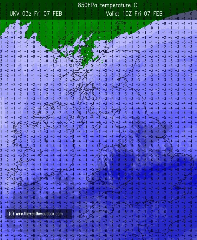
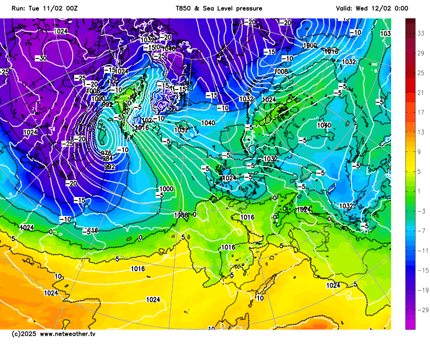
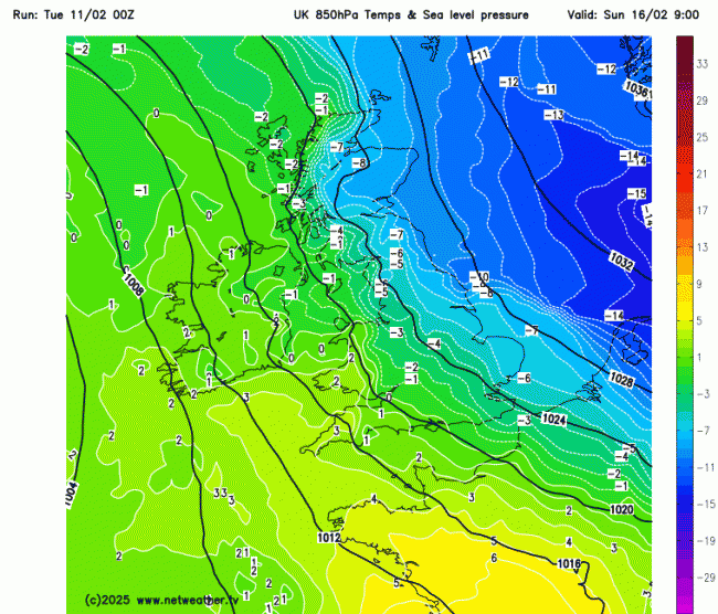
However, in more recent years, we have seen high pressure to the northeast and easterlies fail or struggle to bring snow. The current easterly, though cold, has only brought rain or sleet away from high ground of Wales, northern England and eastern Scotland above 200/300 metres. The upper air temperatures, at 850 hPa have been conducive for snow. Last Friday saw -8C at this level across southern England, however, the surface air was too warm for snow to reach the ground, not helped by the cold air aloft not mixing down to the surface. The source of the surface air over the near continent was not particularly cold for an easterly flow, despite the air aloft being cold enough.
Last Friday morning's 850 hPa tempeatures and surface temperatures
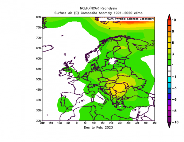
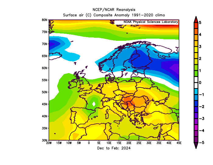
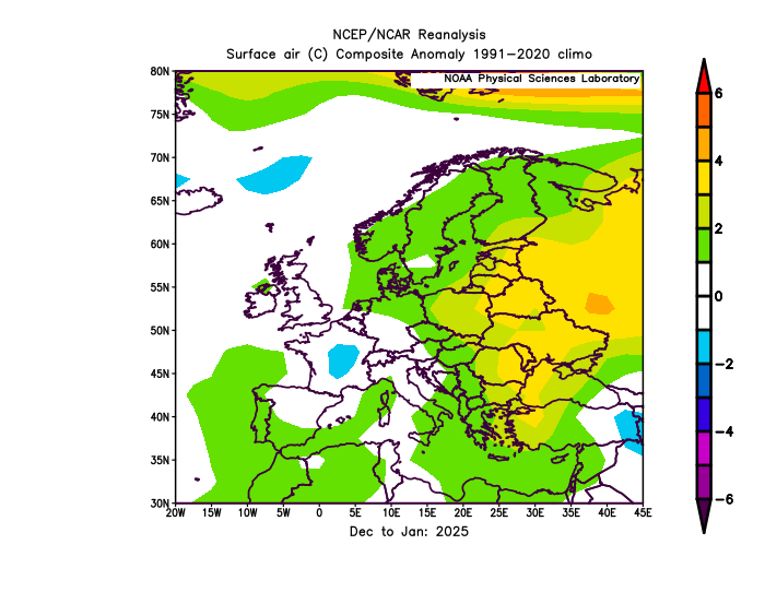
The reason for this is a lack of antecedent cold building up over eastern Europe by early February. This is not to say milder winters in the past weren’t absent of cold air over eastern Europe. But it does seem apparent that recent winters have been abnormally mild over eastern Europe - as the anomaly charts for the last few winters have shown:
December 2022 to February 2023
December 2024 to February 2024
December 2024 to January 2025
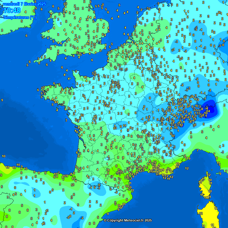
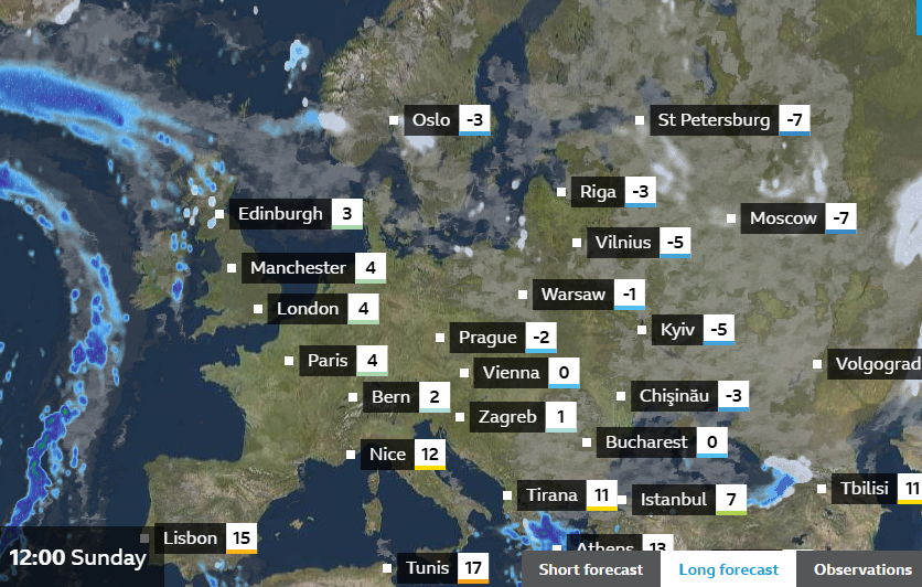
The lack of deep cold to our east over eastern Europe looks set to change though, as very cold arctic air over the Barents and Kara Seas to the north of Northwest Russia spreads southwest across Scandinavia and eastern Europe later this week and over the weekend. Temperatures at noon on Sunday -3C in Oslo, -2C in Prague, -1C in Warsaw, 0C in Vienna.
This deep cold air does spread across the North Sea on Sunday, but does stop short of spreading across the UK before retreating early next week. The -10C 850 hPa temperature line kissing the North Yorkshire coast near Whitby on Sunday morning on GFS, but that could be as close as we get to deep cold before it retreats, so tantalisingly close, could bring some snow showers to NE England on Sunday.
But generally, the outlook is dry & chilly for many through to the middle of next week at least, with high pressure close to the northeast or east and low pressure held back way to the west. The flow looks to veer from the cloudy and damp easterly to a drier and clearer southeasterly from later this week, bringing drier but still chilly continental air, so becoming sunnier for many. But with clear skies, widespread frost will develop overnight. Many in England and Wales that have suffered gloomy skies and rain over recent days will be glad of the promise of sunshine. Temperatures by day look to be a little below average though, so it will be chilly, particularly in the mornings after the overnight frosts, but it should feel pleasant in the sun, now the sun has a little more strength than it does in December or January.
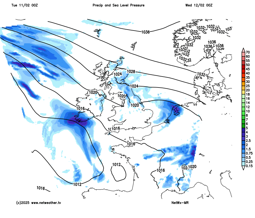
Atlantic low pressure looks be kept at bay by blocking high pressure nearby through to the middle of next week at least, though frontal systems could bring rain across Ireland at times.
Loading recent activity...