There is growing confidence based on weather model output over recent days for colder weather to develop from the east next weekend following a brief return of milder weather early this coming new week. For many it will be a mostly dry week, bar a few weakening Atlantic fronts trying to move east early on, with high pressure building in during the second half of the week. By next weekend, high pressure looks to migrate northeast and then establish over Scandinavia. This will allow a cold easterly flow to develop from Sunday and through early the following week, initially dry, but some wintry showers may develop off the North Sea with time.
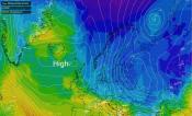
00z EPS mean indicates good support for a high over Scandinavia and cold easterly flow to develop in a week's time:
Before then, Atlantic frontal systems will try and make inroads across the UK from the west early in the coming new week, bringing spells of rain in the west, but only bringing small amounts by the time they reach eastern areas of England. It will turn milder for a time too on Monday and Tuesday, as southwesterly flow develops and less cold maritime air spreads east, with temperatures recovering into double figures across the south and west.

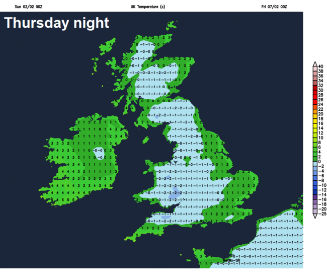
A weakening band of showery rain moving east across western areas will fizzle out today, with most areas having a dry and bright Sunday. More rain returns to NW Scotland on Monday ahead of a frontal system moving east with another band of rain moving in across northern and western areas Tuesday morning, the rain band weakening as it reaches SE England and East Anglia later in the day.
These rain bands moving in off the Atlantic weakening as high pressure builds in from the southwest by mid-week. This is thanks to the jet stream shifting north from the UK to be over Iceland later in the week. So most places will become dry and settled through the second half of the week. With a polar maritime flow moving in mid-week prior to the high building, fortunately, this time, it looks to be a sunnier high than previous ones this winter. But this does mean that clear skies at night will lead to widespread frost.
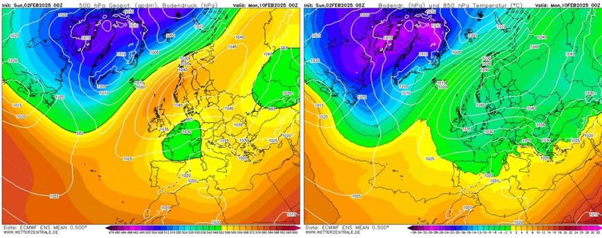
By next weekend, some uncertainty develops over detail, as high pressure weakens a little to allow an Atlantic frontal system to move in from the west, but how far east it gets remains uncertain. Some rain and hill snow may reach the north and west, but could progress towards the east on Saturday too, which could be a cloudier day and on the cold side. On Sunday, most models agree that high pressure will rebuild across the north and to the northeast, with winds turning easterly and colder, drier continental flow establishing into early next week.
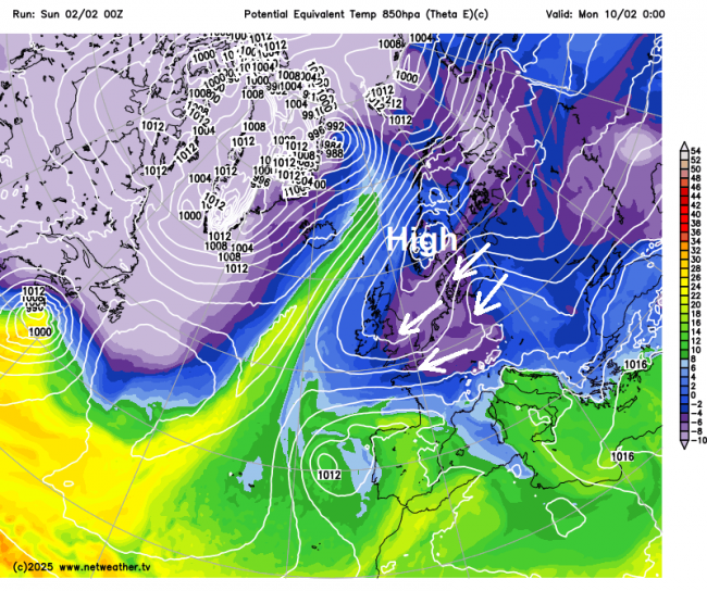
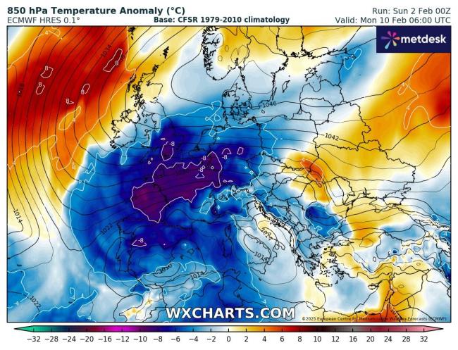
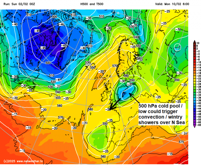
So a cold easterly flow looks to develop from Sunday on most models, initially dry, but early the following week, models suggest a 500 hPa cold pool / upper low moving west over continental Europe could generate enough shallow convection over the North Sea, as cold air aloft from the upper low crosses it, to bring thicker cloud and some snow flurries or showers across southern and eastern areas of England.
It is still far enough away next weekend and early next week for there to be uncertainty, but for now, there is cross model consensus, with ensemble support, for a cold easterly flow to develop from next weekend, likely from Sunday, but perhaps earlier. How cold is uncertain and lower confidence over whether there will be any snow, due to orientation of high pressure, direction of flow and how cold the air is. Eastern areas most favoured for any snow, mostly from showers off the North Sea.
Further ahead, blocking high pressure looks to persist in some shape or form to the northeast in the vicinity of Scandinavia and northwest Russia in week 2 of February, so a cold theme continuing, with flow most likely from the east. Potential that Atlantic systems may try and make inroads later in week 2, but that’s too far out to discuss with any certainty.
I talked yesterday about the possibility of stratospheric polar vortex (SPV) split which could lead to a sudden stratospheric warming (SSW), driven by the typical precursor for a SSW of high pressure block over Scandinavia and Alaska driving waves polewards and upwards weakening the SPV. Models have backed off this idea of a split for now, but there are still signs of the record strong SPV weakening considerably towards mid-month, but whether it will be enough for a reversal of westerly to easterly winds in the stratosphere for a technical remains very uncertain.
But if a SSW does occur, it could lead to a continuation of high latitude blocking and prolong cold weather for the rest of the month. But, equally, it may have no effect or the reverse, depending on any split evolves. We’ll keep you updated.
Loading recent activity...