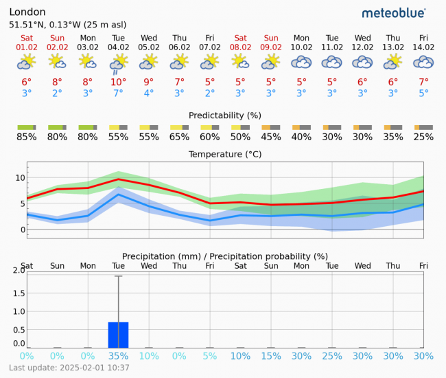
Following a rather disturbed period of weather over the last week or so, with Storm Eowyn just over a week ago bringing record-breaking strong winds, then Storm Herminia following with lots of rain, the weather looks to dry out as we head through early February.
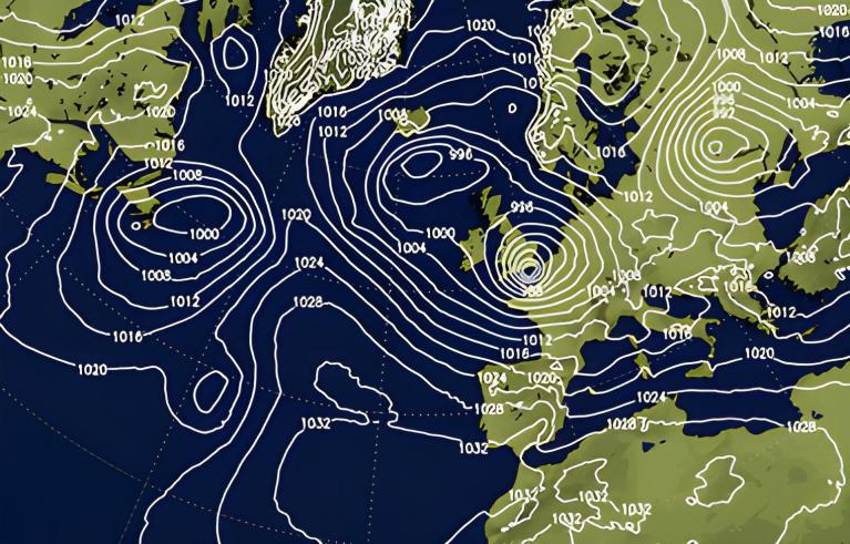
What’s bringing about the flip from unsettled to settled conditions is a change in the jet stream track – diverting low pressure systems away from the UK and Ireland and corresponding build of high pressure.
The jet stream, which will be close to the west this weekend and drifts east across the UK early next week, looks to shift north away from the UK from the middle of next week. This will allow high pressure to build northeast from the Azores and merge with high pressure over northwest Russia extending west. This looks likely to form a blocking area of high pressure to the northeast over Scandinavia, which will divert Atlantic storm track further north than usual, with Atlantic depressions passing over Iceland rather than close to northern Britain.
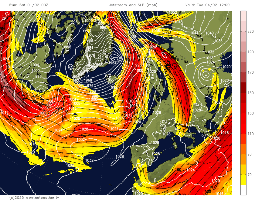
These blocking highs can be rather stubborn and persist for a week or two. The position of the high pressure block in the means to the northeast and east from most model guidance will likely pull in a colder but dry continental flow later next week. So temperatures will likely fall below average, with chilly days and potential for frosty nights where skies clear.
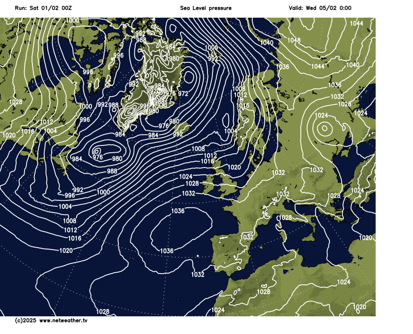
There is some uncertainty next weekend over the possibility of Atlantic trough disruption over the UK. Where this occurs is uncertain, but the slowing frontal system arriving across the UK from the west, as the trough disrupts, could bring some snow in places – if the air is cold enough by then.
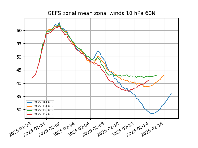
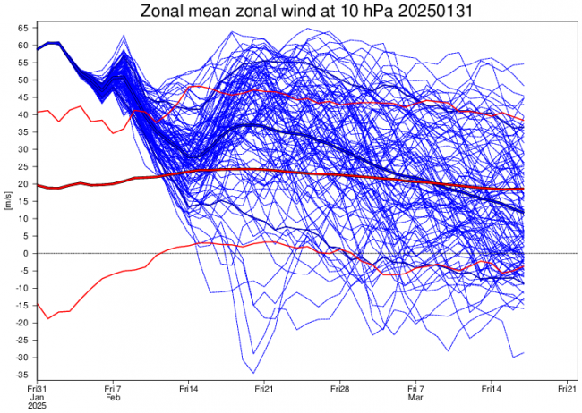
Looking further ahead, consecutive GFS runs have been stretching the stratospheric polar vortex (SPV) over the next week or two, then splitting it towards mid-month. There is growing support from GFS and ECMWF ensembles for a weakening of the record strong SPV (the other day saw strongest 10 hPa winds at 60N for that date).
The weakening looks to be the result of the combination of Greenland tropospheric Polar vortex and Scandinavian blocking high propagating waves poleward and upward resulting in a warming and weakening the stratospheric vortex and also warming on the other side of the arctic from east Siberian trough and Alaskan ridge driving waves poleward.
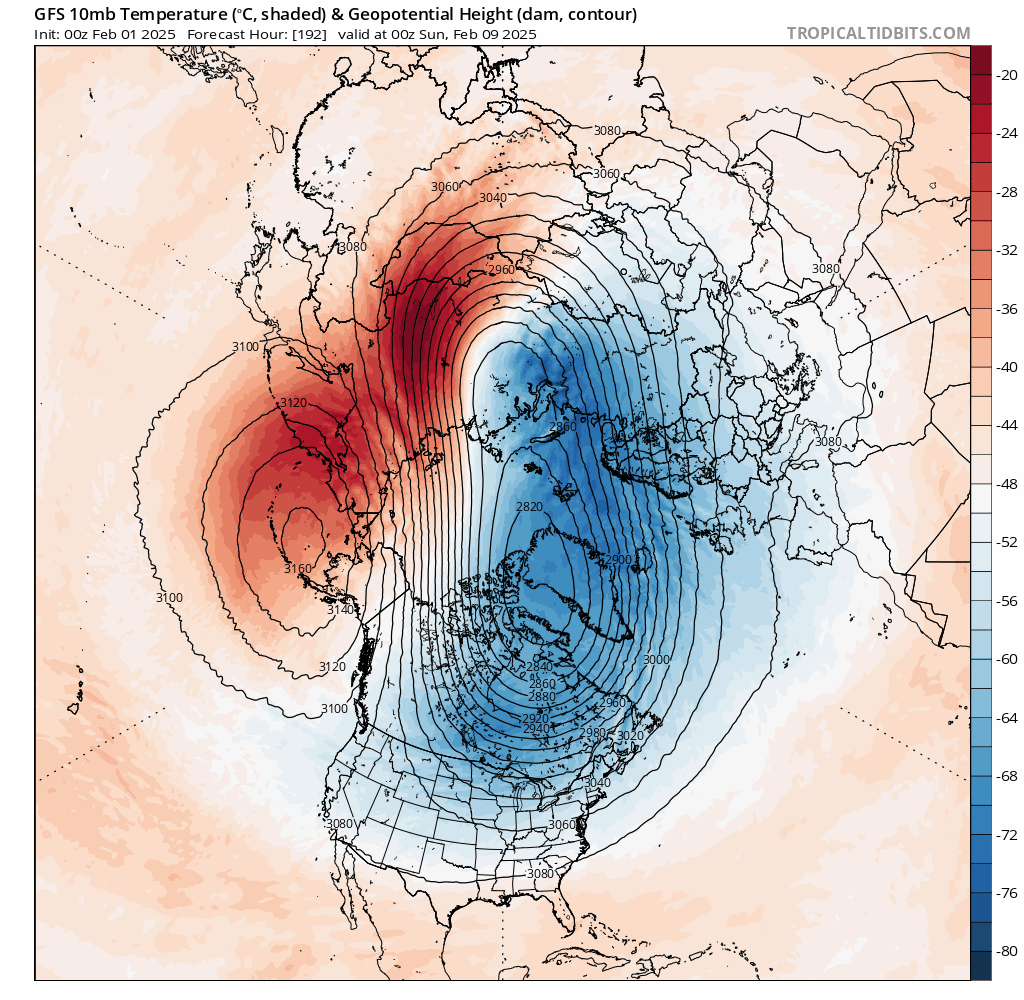
If the split occurs later this month, and the daughter vortices forced equatorward position favourably and connect with the troposphere (where our weather patterns occur) – then there is potential for high latitude blocking to persist and deep cold to push down from the arctic and spread across parts of Europe, including the UK later this month or into the start of March, depending on how quickly the troposphere responds to the stratospheric warming.
There is uncanny similarities to the evolution of the stratosphere and timing to that that led to the SSW in February 2018 – which was followed a few weeks later by the Beast from the East late that month and early March. However, we are a long way off firming up on whether there will be a SSW and, even if there is, whether it will being cold and wintry weather to the UK. Each SSW is different and not all lead to cold and snow, sometimes, like in early 2019, they can lead to mild weather instead.
But in the meantime, early February weather patterns are looking blocked, with increasingly settled, dry and chilly weather looking likely.
Loading recent activity...