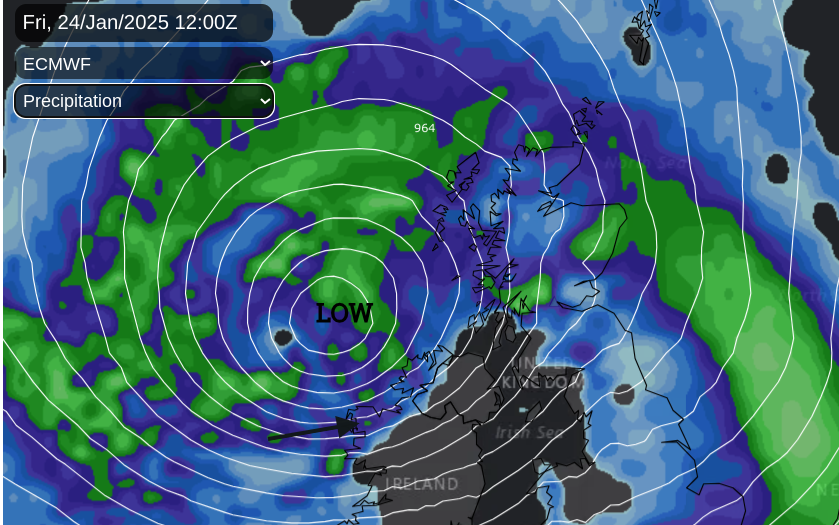
It’s only Monday and already the first weather warnings have appeared for Friday. “A deep area of low pressure [which] will bring very strong winds and disruption” later this week into the weekend. A significant low pressure has been showing on forecast charts, rapidly deepening and moving from the north Atlantic towards Scotland on Friday. Some of the weather models are showing terrifying wind strengths for the Western Isles and NW Highlands.
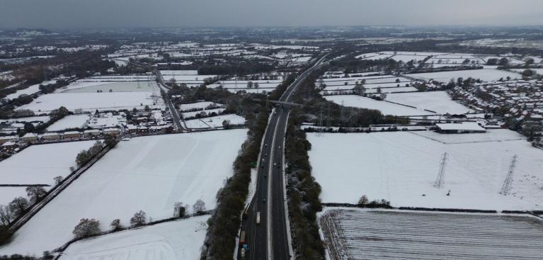
There will be bands of rain moving through with strong gusty winds across the UK and snow This initial yellow wind warning should be treated as an early heads-up to what could be a significant event. Disruption to travel looks likely in the region and options are limited in exposed parts. Already people should be factoring this information into any plans and preparing or thinking about alternatives.
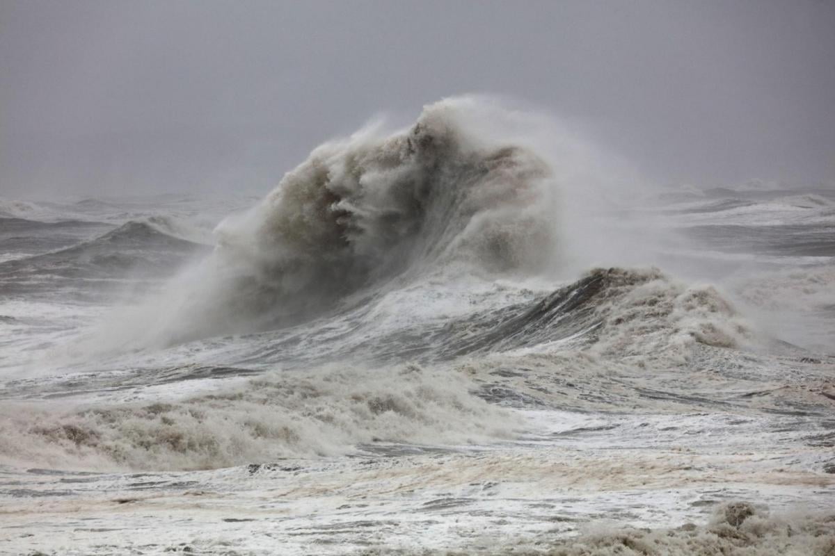
There could be damage to buildings particularly roofs, power cuts, large waves and in these parts most likely will be “Road, rail, air and ferry services may be affected, with longer journey times and cancellations possible. Some roads and bridges may close.” MO
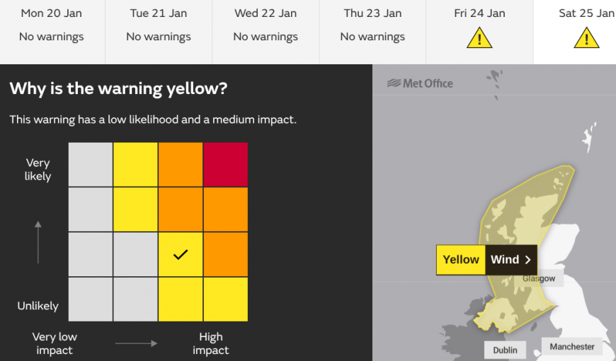
The early heads-up wind warning covers northwestern parts of the UK; Northern Ireland, western mainland Scotland, the Western Isles and Orkney. These will be updated and changed, maybe expanded or moved to Amber as the time frame decreases. This low pressure has a lot to go through before it impacts parts of the UK.
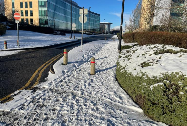
The UK looks set for wet and windy weather with snow for northern hills on Friday, with strong winds into Saturday. A sequence of low pressures will follow into next week. This shift away from settled, grey weather comes as the jetstream fires up thanks to a stark temperature contrast near North America. The bitter cold Arctic air impacting the presidential inauguration on Monday 20th will surge southeastwards and meet warmer tropical air over the Caribbean. Our Friday surface low gets caught in a region of development from this very strong jet way up in the atmosphere.
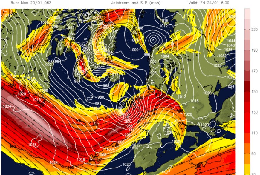
The exact track, the timing of its rapid deepening, a shift in path north or south would all alter when and where the main core of intense surface winds and gusts will be. It might be out over the Atlantic and the UK could miss the worst of this event. Or shift slightly, ending up impacting more populated areas (such as the Central Belt and Northern Ireland) but not with such an intense core. It is certainly something to keep an eye on.
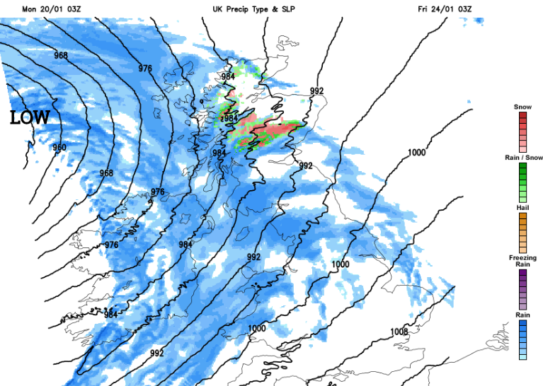
The wet and windy weather will arrive over Ireland on Thursday night. Met Eireann Weather Advisory “On Thursday night and during Friday, a deepening Low-Pressure system is forecast to track close to Ireland. Very strong winds are likely across the country with the potential for damaging wind gusts and disruption in places. High seas and spells of heavy rain are expected also.” Large waves look likely for the west and SW of Ireland
The next name on the Storm list is Éowyn. Even though this low will impact Ireland first usually it is the country forecast to see the highest impacts which would name a storm. However, the storm naming conventions are very fluid and sometimes hard to fathom.
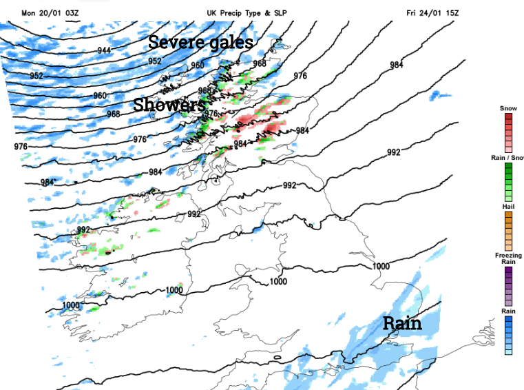
Severe gales even storm-force winds are possible for exposed parts in this event. Snow is possible for the high ground of Northern Ireland and northern England with several cms of lying snow over the Scottish mountains for the start of the weekend. The strong winds will continue in the far north into Saturday as the low centre moves towards the Norwegian Sea.
More discussion and chat in the Netweather community forum
Loading recent activity...