A vigorous polar maritime system is bringing strong winds , showers and even some wintry conditions, before a marked change in air mass ushers in notably milder conditions for the Christmas period.
We still have a yellow Met Office warning for strong winds across Scotland, Northern Ireland, Wales and the West, before winds begin to decrease tonight. Gusts of wind up to 70mph in exposed western areas and 45 to 55mph in some of the heavier, more squally showers elsewhere may cause further travel problems this Sunday afternoon, mainly on high-level roads where you may encounter some snow, in exposed areas and also due to fallen trees.
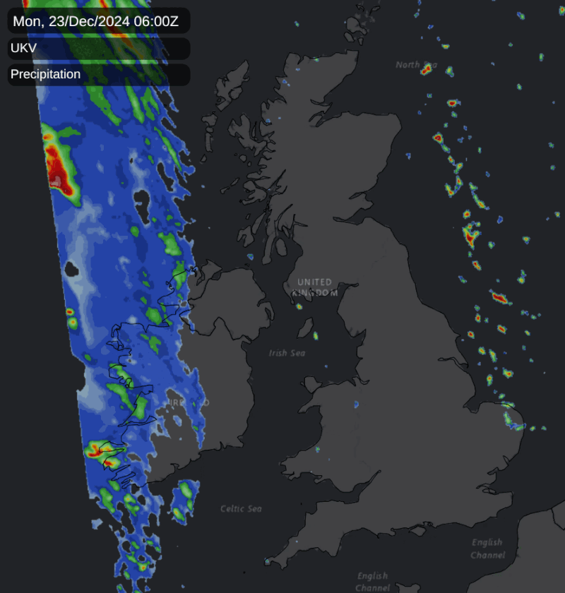
You'll certainly notice the current chill, with winds of polar maritime origin bringing modified Arctic air from the Iceland/Greenland area. As a result, it'll be cold enough on Sunday afternoon for blustery showers to continue to fall as snow on hills, mainly in the north. We've also seen sleet, hail and snow temporarily falling at lower levels in a few of the heavier, more squally showers. Some places will see lots of them, while others 'fare' better and enjoy the best of the sunny intervals on offer.
As winds steadily decrease after dark, the blustery showers, still wintry in places giving mostly hill snow, begin to fade. By Monday morning, they'll largely be confined to the north and east of Scotland and coasts of Norfolk, with a few probably continuing to affect parts of Cheshire, Merseyside and the West Midlands. As skies clear, there'll be a frost where you have shelter, perhaps leading to a few icy patches by dawn, as temperatures fall to around or just below freezing in the coldest spots.
It'll still be blustery towards the east coast at first on Monday but as Christmas week gets underway, things quieten down a little as a transient ridge moves in from the west. This'll give some winter sunshine while you're picking up those final stocking fillers, but an advancing warm front will be bringing rain to Northern Ireland by the afternoon. Cloud will also increase in the west to give patchy rain here by nightfall.
Somewhat lighter winds will turn into the South West through the day, bringing milder air to Northern Ireland by evening. But elsewhere, and particularly further east, it'll be another chilly day, with temperatures generally getting no higher than 6 to 8C.
It may turn cold enough briefly for a touch of ground frost in some eastern areas after dark, but temperatures will be rising overnight as that warm front eventually spreads to all parts. This'll bring some rain, but in the south much of it will probably be light and patchy. A South West wind will be freshening again, with renewed gales expected in the north and west.
Christmas Eve will be noticeably milder everywhere, with temperatures quite widely by the afternoon up to 10 to 14C. Most places keep a lot of cloud, with mainly the North and West seeing further rain or drizzle at times. Elsewhere any rain should be mostly light and patchy, with perhaps a few bright or sunny intervals coming through in the east and south before dusk. But a South West wind will remain quite fresh, with gales continuing in the north and west.
Loading recent activity...