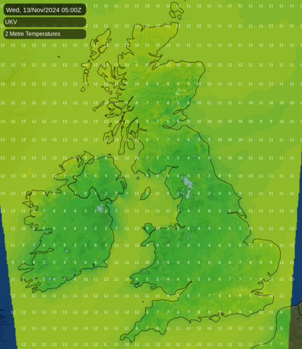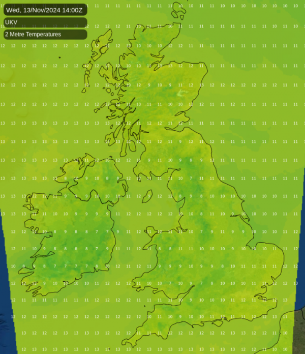
The sunshine on Monday and sunny spells for most today have cheered things up a little, allowing some of us at least to top up our levels of Vitamin D. However, anticyclones at this time of year don't necessarily bring fine weather, as we saw over large parts of the country last week.
This is because the sun's strength is weakened by its lower elevation, making it more difficult for morning mist, fog and cloud to clear. With light winds later in the week, the gloom is set to return to much of England and Wales ahead of much colder air moving down from the North next weekend.
Most parts see sunny spells on Tuesday afternoon, with temperatures ranging from 8 to 13C from North to South. A northerly breeze is bringing cloud to some eastern areas, giving a few showers towards the South East and across the Channel Islands, while the far North West sees increasing cloud bringing some light rain or drizzle before dusk.
Patchy fog and frost return to Northern Ireland and the North West overnight. The southern half of Scotland could also see patchy fog and perhaps a touch of frost for a while before it probably turns cloudy from the North, bringing mistiness and a little drizzle. Meanwhile, the South East and the Channel Islands continue to see a few showers. Lowest temperatures range from -1 to +2C where skies stay clear, and 5 to 7C where cloud persists.

Wednesday could see patchy fog lingering well into the morning before eventually clearing to leave most parts dry again with sunny spells in light winds. The showers across the South East and the Channel Islands should also fade, but a North or North-easterly breeze may continue to bring patchy cloud to some eastern areas, particularly towards the coast. Cloud over Scotland may well spread into parts of northern England through the day, making it gloomy and misty here, with perhaps a little drizzle in places. Temperatures should mostly range from 8 to 11C but will be colder where fog lingers.

Patchy fog and frost return overnight to Wales, parts of the Midlands and the West Country. Scotland and perhaps the North East may also see a touch of frost as skies clear from the North. Meanwhile, Northern Ireland and the North of England will probably keep considerable cloud and mistiness that could give a little drizzle here and there in an otherwise dry night for most. Lowest temperatures range from -2 to +2C, but around 4 to 6C where cloud persists.
Apart from subtle changes, it's much the same on Thursday and Friday, before it begins to turn clearer but much colder from the North over the weekend.
Loading recent activity...