It's been a chilly start, with a ground frost in places first thing. Some of the lowest temperatures were recorded in rural parts close to the Scottish border and in the Welsh marshes, with the thermometer falling as low as -2C at Shap, Eskdalemuir, and Redesdale Camp. But the colder snap is on its way out now, and as an anticyclone becomes established across the South, much of England and Wales will be dry today and slowly become warmer over the weekend.
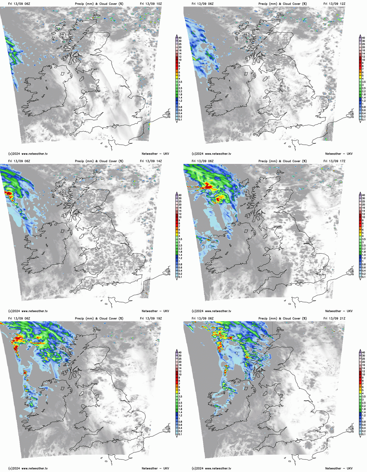
The North Norfolk coast sees the odd shower to begin with, but these'll move away as the chilly North wind here at first decreases. The North and West of Scotland also see a few showers for a time, but for much of the country, it's a mainly dry prospect as pressure continues to rise. After a fine, sunny start for many, some cloud will 'bubble up', but any showers that do develop, most likely in the East, will be isolated. The exception will be Northern Ireland, where the afternoon sees increasing amounts of cloud, perhaps bringing some rain towards Donegal before evening.

Elsewhere, after the chilly start, light breezes will make it feel quite pleasant in the still quite strong September sunshine, although top temperatures of 12 to 14C for the North and around 16 or 17C further South will still be a little disappointing for the time of year. But across Northern Ireland and later the Western Isles, a South Westerly wind will be freshening through the day.
Cumbria may see cloud bringing some rain later in the night, but for much of England and Wales, it stays dry after dark with clear spells in mostly light winds. This may allow mist to form towards dawn in a few rural parts of the East and South where it'll turn a little chilly again. But it won't be as cold as on recent nights, with lowest temperatures mostly in the range 4 to 7C.
Across Northern Ireland, there'll be some rain after dark as a warm front moves in from the West. This'll spread to the North and West of Scotland overnight, but further East and South, the rain should be lighter and patchy after a dry evening. But across much of the North and West, it'll be milder, with temperatures falling no lower than 8 to 11C in a South Westerly that'll become quite fresh and gusty.
On Saturday, a cold front works its way through Scotland and Northern Ireland, bringing further rain, followed by clearer skies and lighter breezes, making Sunday here the best day of the weekend. By then, our cold front, by now a weak feature, will be ensconced across northern England, giving a band of cloud and some light patchy rain. But further South, it should stay dry, fine, and steadily become warmer, as temperatures return to the low twenties Celsius early next week in warm September sunshine.
Loading recent activity...