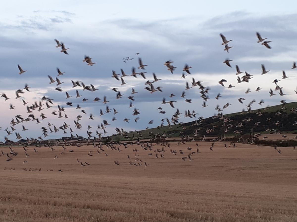
As we pass the middle of October, it won’t be long before the clocks go back (26th October). The mornings are already getting darker and this ongoing gloomy greyness in the day isn’t helping. Teachers and parents will be thinking about half-term holidays. It’s been a settled but cloudy week for those in Scotland who have had this week off. The sunshine is reserved for the tops of the highest mountains across Britain with the thick blanket of stratocumulus continuing to deaden our skies. Loud interruptions come from geese honking in their skeins underneath the cloud cover. The Greylag and Pink-footed geese arriving, to winter in Britain and Ireland.
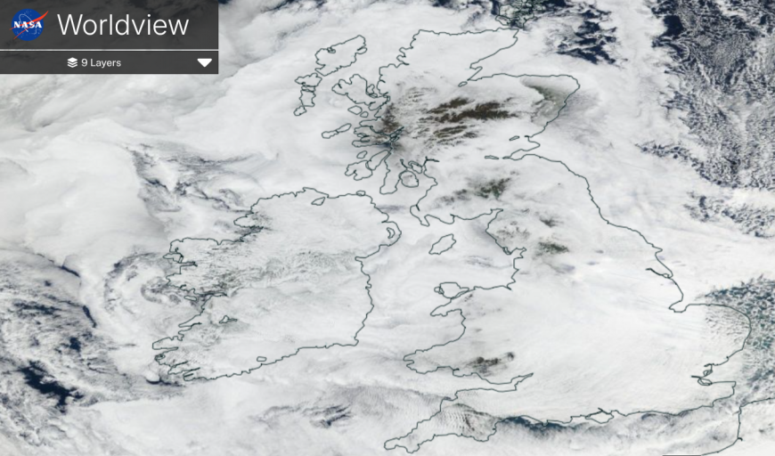
NASA satellite image 14th Oct showing mountain tops (dark) peaking through the cloud cover (white).
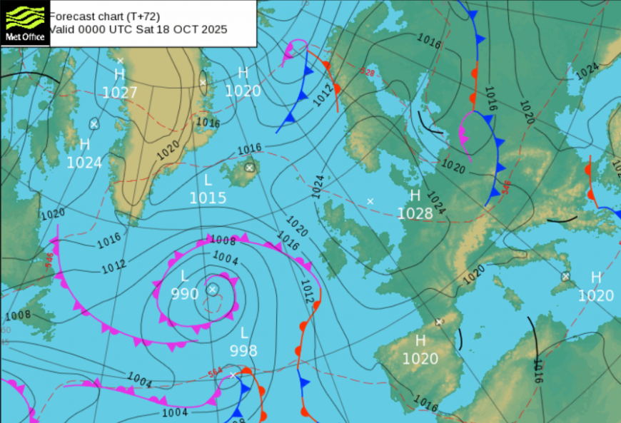
A change in our UK weather is on the way, which means that next week looks more unsettled and mixed. As frontal rain finally arrives from the west during Sunday 19th it opens the doors to a flow from the Atlantic. The cloak of grey cloud will be disrupted and there will be bouts of wet and windy weather throughout next week. There will be brighter skies and even sunny spells in between, particularly for eastern Britain, but by the start of the following week (26th) there might be a brief colder northerly flow.
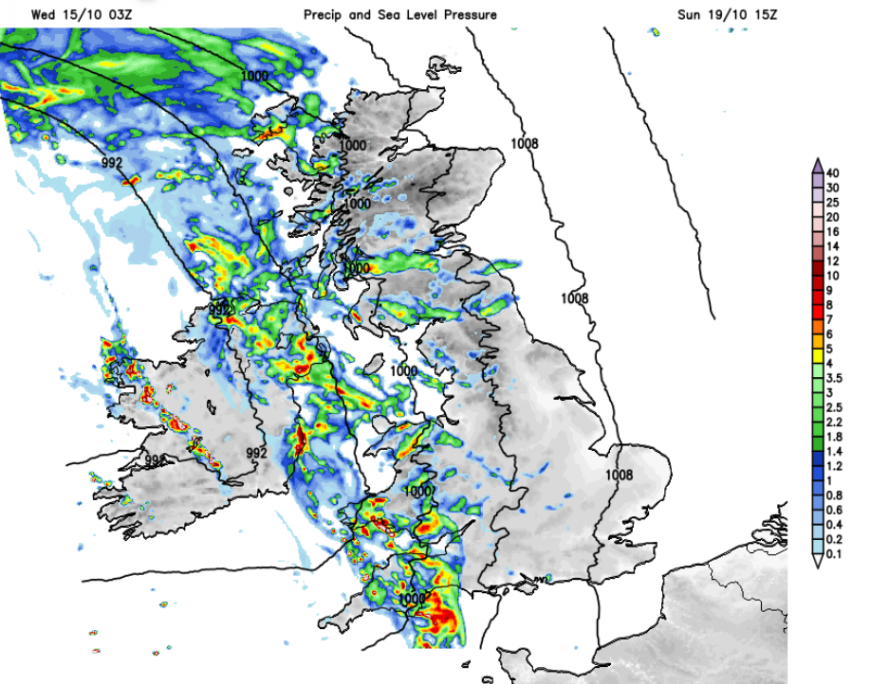
Often, with an incoming Atlantic front to break a steady anticyclonic setup, there can be a slowing down, a delay in the change. The high pressure will be reluctant to shift. There is rain on the way at the weekend but eastern England, even the Midlands and northeastern Scotland, will probably stay dry for much of Sunday. All these regions are waiting for autumn rain to begin replenishing water supplies.
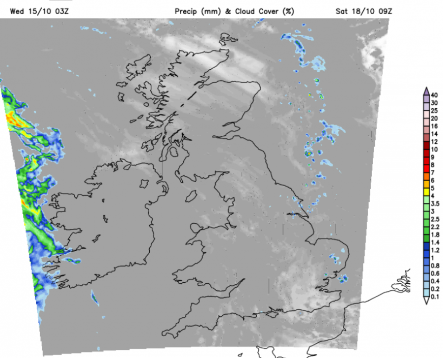
By Saturday, the high pressure that has been over the UK all week will have drifted eastwards over Denmark. Wrapped around the high pressure will be a line of showers, over the North Sea but brushing the far north/northeast of Scotland on Thursday and Friday and this line could pester East Anglia on Friday night and Saturday morning. Just something to remember if you are expecting another completely dry day.
There will be a nippy start for some areas that have seen clear spells during Friday night. It will be mild for Northern Ireland, SW Wales and Devon and Cornwall with a moderate southwesterly wind and more cloud. There will be a lot of dry and often cloudy weather with some bright spells. If sunshine does appear it will feel pleasant as there will be light winds over Britain.
Temperatures on Saturday will be around 13 to 16C, so aroung average with a slight S/SE wind picking up during the afternoon. This will be more noticeable for western counties of Britain with a moderate wind for Northern Ireland.
The focus is in the west as the first frontal band reaches western Ireland and should move over County Fermanagh later on Saturday. During Saturday night, there will be heavier frontal rain for Northern Ireland and it will be blustery, for Northern Ireland and Irish Sea coasts.
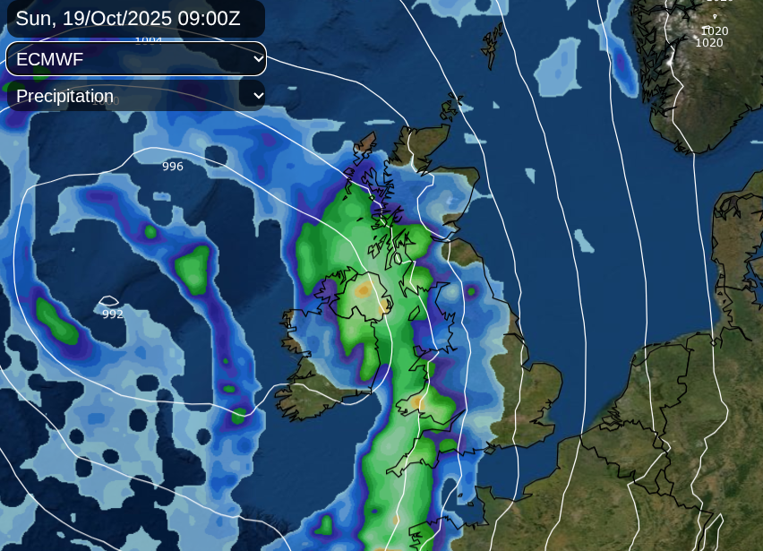
Sunday morning will start with a lot of cloud over Britain. The front is oriented north-south and there will be pulses of heavy rain moving along it. Depending on the progress of this frontal band up against the high pressure it should be a windy start for Northern Ireland and western shores of Britain. There could be some brighter breaks over England where temperatures will have fallen away overnight, with light winds. Gradually on Sunday morning, this band of rain will spread over the Irish Sea into western Scotland, over Wales (particularly western counties) and southwest England. Temperatures will be similar to Saturday but feeling cooler in the wind and rain.
The winds will be fresh for northern and western parts of the UK, so a windy Sunday here with gusts around 60mph over the mountain tops. As the cloud increases over Britain, there will be outbreaks of rain during Sunday afternoon, reaching northwest England, the Midlands, more of Scotland and later central southern England.
By Sunday evening, there will be a clearance for southwest England and gradually for Northern Ireland. The cold front could bring some hefty downpours and strong gusty winds even gales, through the Irish Sea to end the weekend, and strong SE winds for the west coast and far north of Scotland.
Monday morning will start with a low pressure rotating over the UK, so quite a change from this week.
Loading recent activity...