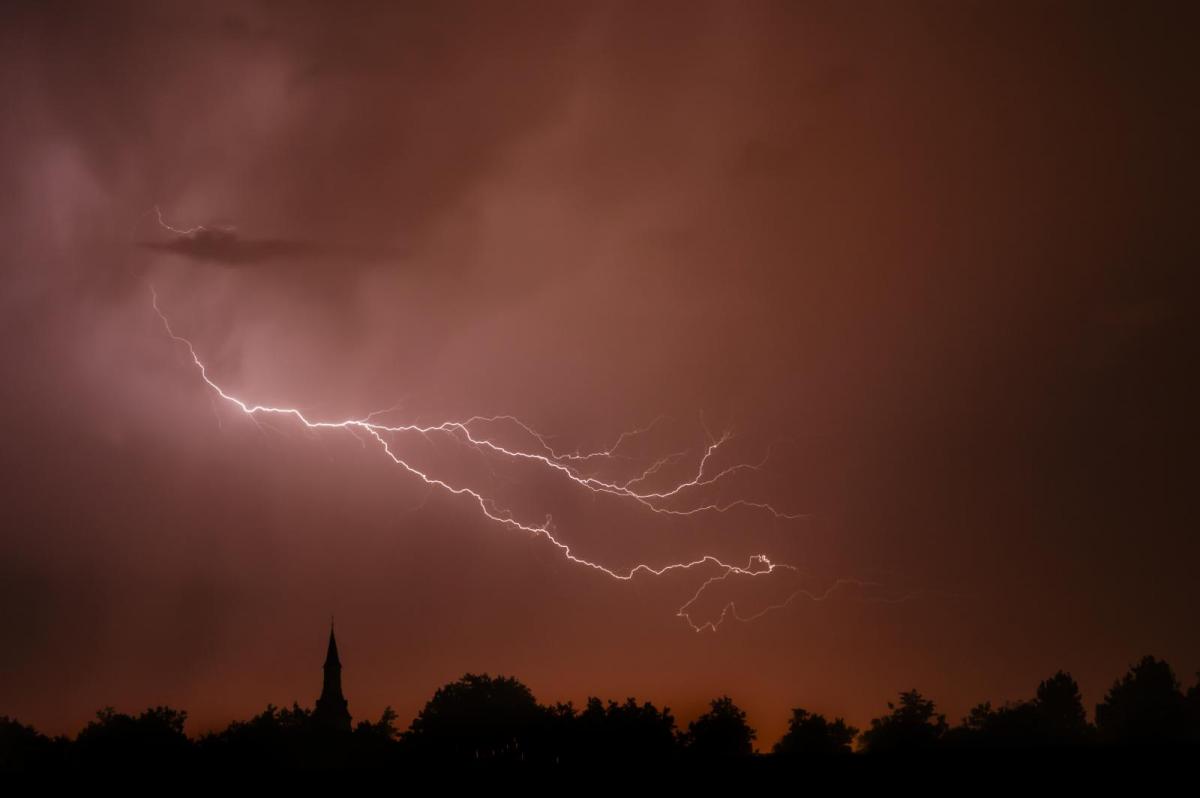
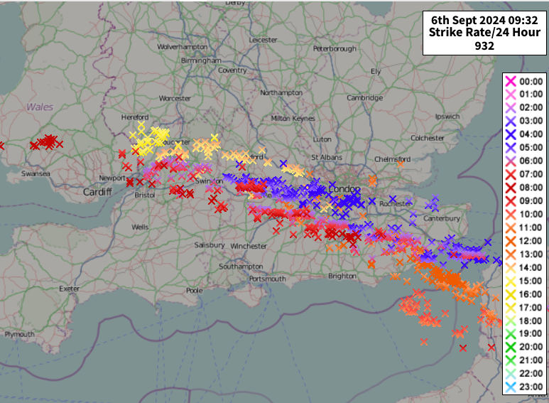
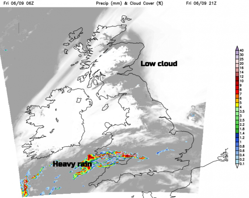
There have been dramatic thunderstorms and heavy downpours overnight into Friday. The lightning strikes stretched from Kent and Sussex, across south London along the M4 to the Severn Bridges into south Wales with an ongoing heavy rain warning from the Met Office today.
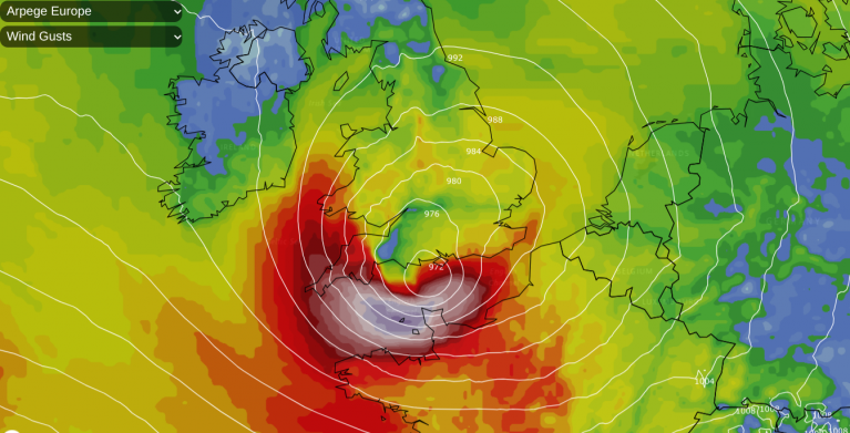
A low pressure in the Bay of Biscay is throwing off bands of rain and clusters of heavy showers. It is also dragging warm and humid air across the North Sea from northern Europe. There has been cloaking low cloud with a grey dampness and poor visibility but as that clings to some northern and eastern coasts of Scotland or over the Pennines, other areas are in glorious sunshine.
The temperatures are responding in these regions and could reach the mid to high 20s Celsius. From the Forth down to The Wash there will be a moderate NE breeze, reaching far inland. Where the low cloud, haar and seafret linger the temperatures will stay in the mid to high teens so not cold but damp. This air is warm and muggy so in any sunny spells, it will feel close today.
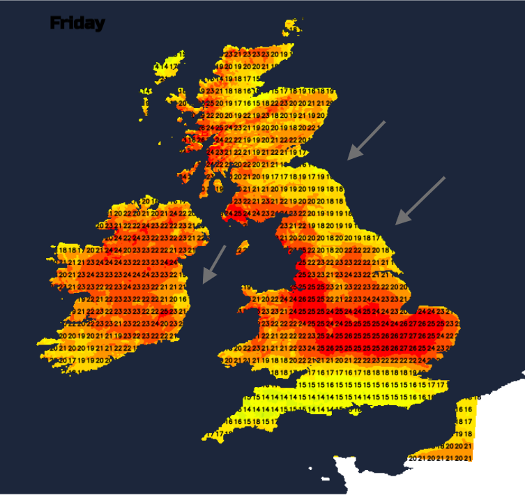
For southern Britain, it will feel different where it rains. Temperatures could stay at 17 to 21C or leap up in pockets of sunshine to 27C. There will be very light winds but with outbreaks of rain sweeping westwards. The overall band will sink southwards away from south Wales and London with new pulses edging in from southeast England across other southern counties and brushing Cardiff. By Friday evening there could be intense downpours around the Bristol Channel and again into south Wales perhaps torrential rain for north Devon, Somerset and Exmoor. This brings the risk of localised flooding.
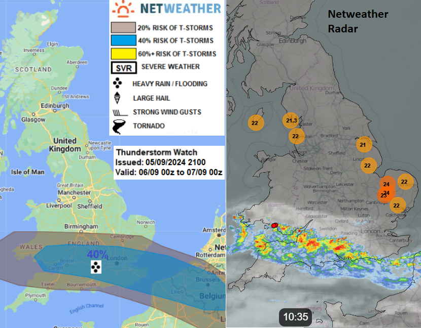
“…These storms are likely to produce very heavy rainfall…we cannot discount isolated supercell structures producing isolated large hail, flash-flooding and isolated damaging wind gusts. Also, frequent lightning will be possible locally.” Convective Forecast
Later in the evening, most areas will be clear of the downpours except southern Wales and southwest England. The warm, muggy air will remain over the UK during Friday night.
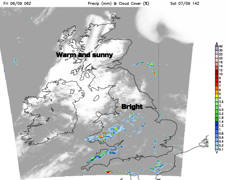
Saturday starts off with glorious warm sunshine in the northwest, the low cloud and haar once more in the northeast. There will be lighter winds for central Britain with a good deal of fine warm weather. The east coast might see the odd early shower. By day temperatures will be in the high teens to mid-20s Celsius. For southern Britain, it’s going to be hard to pin down any details but a scattering of showers will start up by lunchtime and really get going through the day. Again there could be heavy, even thundery downpours with intense rainfall whilst other areas miss all the convective action. Further clusters will swing in from the southeast, moving westwards over southern Britain into Saturday night.
These downpours will still be around on Sunday for parts of England and Wales again with the risk of thunderstorms.
Loading recent activity...