
It’s looking to turn drier and much warmer for the rest of the week across much of England and Wales. This is thanks to the jet stream shifting further north to be just to the north of Scotland by Friday, something that’s not happened very often this summer so far, as the map of winds at jet stream level show since the start of June.
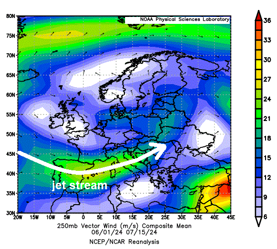
The jet stream has been mostly south of the UK over Spain or southern France since the beginning of summer, with the UK on the cool side of the jet stream and, recently, often near low pressure, as lows tend to be on the north side of the jet stream. Hence the often-cool conditions so far this summer, with the first halves of June and July experiencing below average temperatures. Although June was dry for many, it has been wet during the first half of July, with areas of low pressure crossing the UK.
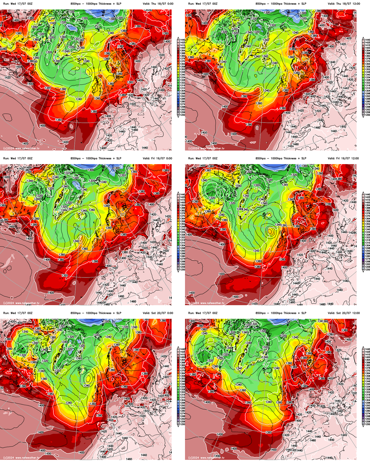
The next few days, though, will see jet stream lift to the north of the UK, which combined with a deepening low moving northeast to the northwest of Britain, will allow very warm air to be sucked north from Iberia and NW Africa by the end of the week. The highest temperatures will be across southern, central and eastern England and look to peak on Friday, with 30-31C forecast in SE England.
Jet stream lifting north over the UK next few days ...
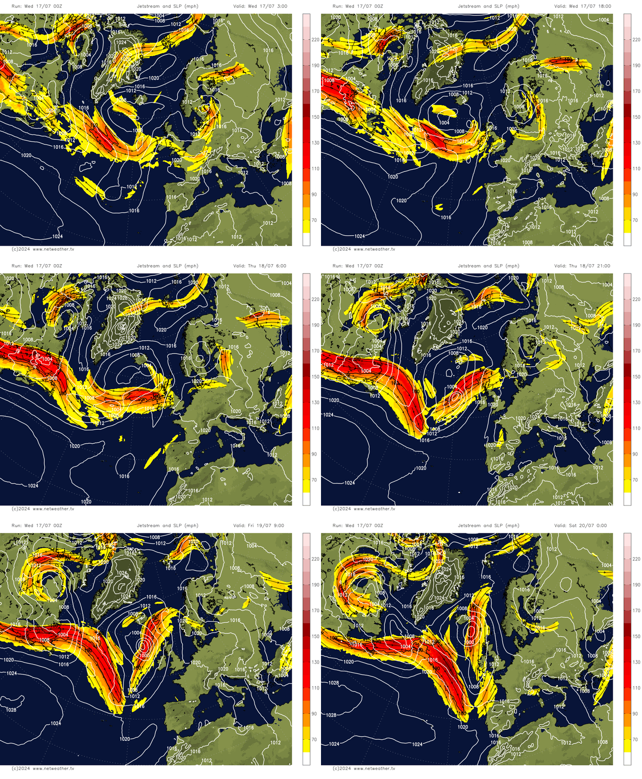
... which will allow very air to be pulled north to southeastern Britain
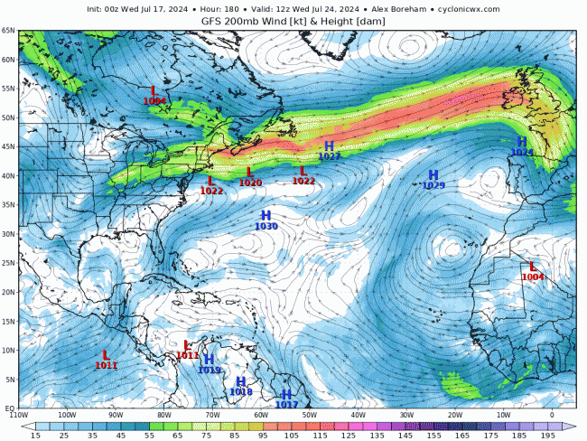
However, for those hoping that summer is arriving and will be here to stay for the school holidays, which are starting for many in England and Wales next week, unfortunately the jet stream looks to move back south again over the weekend, bringing a breakdown of the heat across southern areas. A strong zonal jet streak looks to emerge from eastern Canada early next week, which then transfers east across the North Atlantic, with a strong jet stream running west to east across the UK from mid-week. As a result, lows and frontal systems look to move east across most parts at times, with spells of rain or showers – with temperatures slightly below average for late July with the flow from the west.
Strong jet stream aimed at the UK next week
So, the position of the jet stream is quite import with regards to regulating the temperatures and rainfall we get here and elsewhere, as it directly impacts surface weather patterns. The jet acts to steer mid-latitude weather systems, so it can control which regions are wet and dry. The jet stream is a fast, narrow current of air flowing generally west to east, but sometimes meandering, that encircles the globe but is not to be confused with the Gulf Stream which is instead an ocean current of drifting seawater.
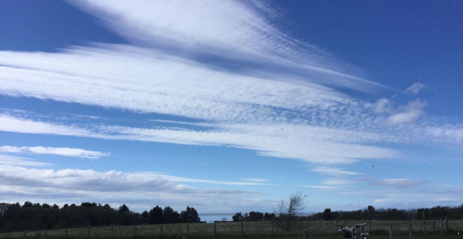 What is the Jet Stream & how does it affect our weather The position of the jet stream is not used anywhere near enough in the daily TV weather forecasts in the UK, and I think this is a shame, because they are crucial for understanding why we may be stuck under spells of disturbed and unsettled weather, why it it’s so wet, cool, cold or so warm and dry with high pressure. Netweather
 Although the fastest winds of the jet stream are far above the surface, weaker winds often extend all the way down to the surface. So, if the jet stream is above or nearby, its winds will often be blowing the same direction at the surface. Next week the jet stream is forecast to be blowing west to east above the UK, so westerly winds will prevail at the surface too.
The jet stream is stronger when there is a sharp boundary between contrasting air masses, so as we have seen through much of the summer so far and will see next week, heat over the near continent and cooler polar air over NW Europe will help sharpen the boundary and strengthen the jet.
2 years back, in July 2022, we were a few days away from experiencing the hottest day since records began, with 40.3C reached in Lincolnshire on the 19th. The extreme heat that reached the UK was attributed to the configuration of the jet stream. At the time, a stagnant jet stream pattern over Europe was in place, the polar jet stream was mostly north of the UK, so it was very warm or hot. But what was more unique and unusual, that made the heat more extreme for a few days, was a cut-off upper low that formed further south over the North Atlantic as wave breaking of the polar jet stream against an omega blocking high and heat dome over Europe disrupted to form the cut off jet circulation / upper low west of Iberia. This almost stationary upper low west of Iberia acted as an extra heat pump, which drew extreme heat out of an unusually hot NW Africa and Iberia north to the UK. If this upper low wasn’t there and the UK and much of western Europe wasn’t so dry, it probably wouldn’t have got so hot.
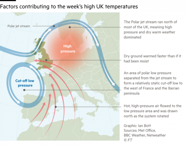 Image from Inside Climate News article
But this summer so far and likely to the end of this month, the jet stream looks to spend most of its time near or south of the UK, so prolonged heat such as we saw 2 years ago, looks very unlikely.
Loading recent activity...