The position of the jet stream is not used anywhere near enough in the daily TV weather forecasts in the UK, and I think this is a shame, because they are crucial for understanding why we may be stuck under spells of disturbed and unsettled weather, why it it’s so wet, cool, cold or so warm and dry with high pressure.
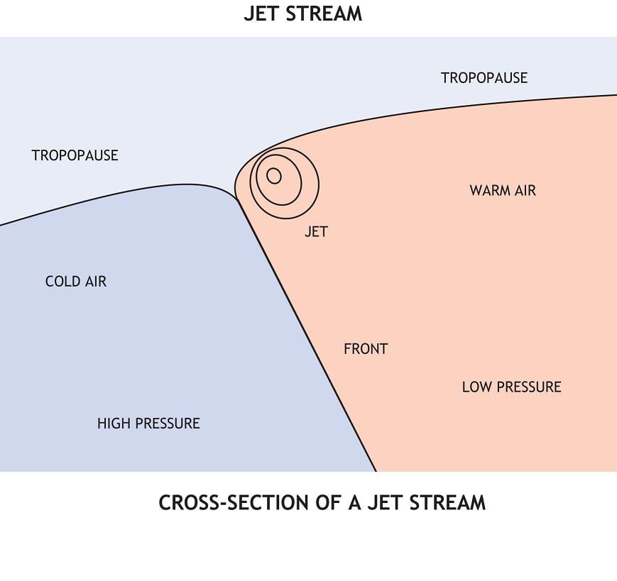
Although the jet stream is 5 to 7 miles high in the atmosphere in the mid to upper troposphere, it often controls much of the weather we experience on the ground, even if it’s not nearby. The jet stream acts to steer mid-latitude weather systems, so it can control which regions will see wet weather and which regions stay dry. The jet stream also acts as a sharp boundary between contrasting air masses, with relatively warm, tropical air to the south and much colder air on the northern, poleward side. The location of the jet, and hence also the boundary, has a strong influence on temperatures down at ground level.
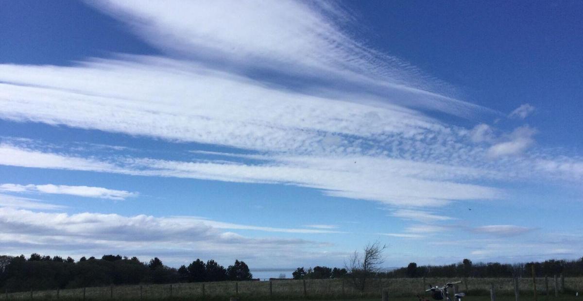
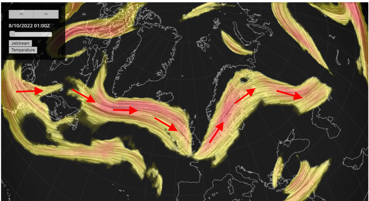
Jet stream this morning over the Atlantic and Europe:
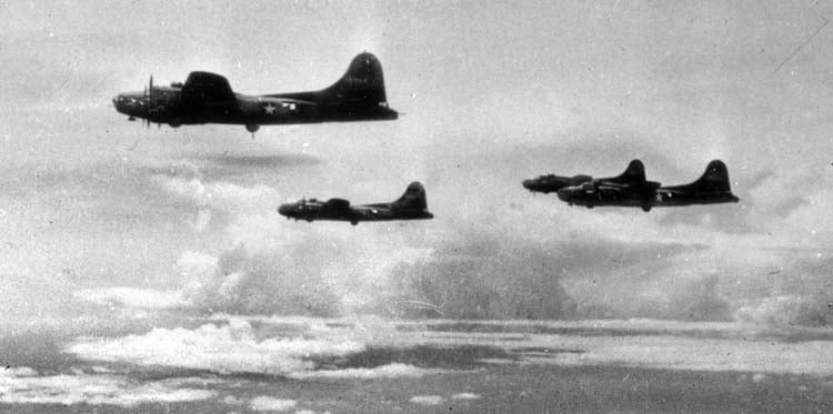
The jet first became widely known when American forces were caught off-guard during World War II, when their high-altitude bombers often encountered 230mph headwinds over the Pacific as they headed towards Japan on bombing raids. The strong winds caused bombs to miss targets and, as headwinds, required bombers to use far more fuel than expected—so much more that they sometimes ran out on the return trip. Meanwhile, the Japanese Fu-Go campaign used the jet to carry balloon-bombs downwind across the Pacific to America, albeit with little success because most of the bombs dropped too early, landing in the ocean.
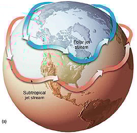
There are two jet streams in each hemisphere, the polar front jet stream in the mid-latitudes and a relatively weaker, subtropical jet stream at lower latitudes. The polar-front jet stream encircles the globe in both the northern and southern hemisphere in segments thousands of miles long, hundreds of miles wide, and several miles thick. It is strongest in winter when the temperature gradient across Polar and mid latitude regions is greatest, with core wind speeds sometimes reaching 250mph. And it’s the polar front Jetstream that will be referred to in this article as it controls the weather in the UK.

The temperature gradient that drives the polar front jet stream is caused by air from polar regions and tropical regions moving towards each other, creating differences in air pressure. Since warm air is lighter than cold air which is denser, the warm air rises and cold air will push against it to replace the warm air. This creates a change in air pressure and temperature over a distance, called a gradient. Air will flow down this gradient from areas that have high pressure to areas that have lower pressure, creating a current or wind. As the Earth rotates, the route in which the air moves from high to low pressure also changes. This is caused by the Coriolis force, where air deflects in each hemisphere. In the Northern Hemisphere, the air is deflected to the right, leading to the west to east direction of air flow, and the left in the Southern Hemisphere.
Typically winds associated with the jetstream blow from west to east in both hemispheres, but the position can vary from week to week. These changes in location of the jetstream are associated with changes in the seasons, so in the summer the polar jet is weaker and further north than in winter on average, due to the absence of the polar vortex - which creates a stronger temperature gradient in winter between polar and mid-latitudes. But the location of the jet stream is also influenced by other factors in the climate system, and ENSO (El Nino, La Nina) is the prime example of this. An El Niño event can affect the jet stream by warming the tropics and amplifying the temperature contrast between lower and higher latitudes and also triggering regional patterns associated with Rossby waves. A La Nina also affect the jet stream, but in different ways to El Nino. La Niña can often lead to the jet stream meandering more, leading to an increases chance of blocking high pressure in both winter and summer.


The North Atlantic Oscillation (NAO) is a measure of differences in the surface pressure patterns over the North Atlantic and so can give us a clue to the position of the polar front jet stream over the North Atlantic, which can have a strong impact on the weather in UK and across Europe. The NAO is an index of fluctuations in the difference of atmospheric pressure at sea level between the Icelandic Low and the Azores High. Through fluctuations in the strength of the Icelandic Low and the Azores High, the phasse of the NAO can relate to the strength and direction of westerly winds and location of storm tracks across the North Atlantic. The Positive NAO index phase shows a stronger than usual subtropical high pressure centre and a deeper than normal Icelandic low. The increased pressure difference results in more and stronger winter storms crossing the Atlantic Ocean on a more northerly track. This results in warm and wet winters in Europe. However, during a negative NAO event, pressure is when the jet stream shifts further south, the maritime influence is lost leading to bitterly cold winters, such as the winter 2009/10.
The jetstream flow doesn’t always move west to east and can meander north to south in a wavelike pattern - known as planetary, or Rossby, waves. When the jetstream meanders north and south, two distinct weather patterns are formed. As the air mass moves north it starts to spin clockwise forming ridges creating high pressure systems which are associated with settled weather. When air moves south it spins anti-clockwise forming a trough with low pressure systems bringing unsettled conditions. These weather systems can become stuck over different regions. So in winter the UK may see dry and settled weather with cold frosty and foggy nights and sometimes bitterly cold weather if the high positions to draw winds from the north or east. In the summer, stubborn high pressure may bring heatwaves. Conversely, the UK may be stuck under a trough with low pressure dominating, bringing unsettled wet conditions.
Rising global temperatures from global warming are affecting the jet stream and, in turn, the weather. Because the Earth's polar regions are warming more quickly than the rest of the world, the temperature contrast that drives jet streams has decreased. Slower, weaker jet streams have been linked to melting in Greenland and a potential rise in extreme weather events because they can lock weather systems into place, stalling them over regions. Certainly, we have seen increasing occurrences in summer of these stalling high pressure systems, bringing weeks of dry and settled weather but also very hot weather.
The jet stream played a crucial role in leading to last year's extreme heat in the Pacific northwest of North America and flooding in central Europe
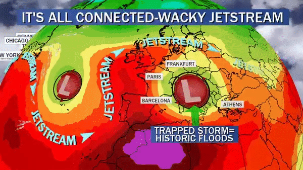
Source: CBS News (USA)
Weather events like this summer’s several heatwaves in Europe, the extreme heatwave in the Pacific Northwest and the floods in Europe last year are some recent examples of how the jet stream affects weather patterns based on its intensity or location in the short term.
Netweather has an interactive global jet stream forecast map, click on the link below. You can drag the map around to move it, the mouse wheel will zoom in and out (pinch to zoom on mobile and tablet). The maps update four times a day - and are an initial small feature using this new mapping technology - keep your eye out for further additions soon.
Loading recent activity...