After what has been quite a dull March so far across many areas, for England – the 10th dullest so far this month since records began, some welcome sunshine appeared across southern areas yesterday – lifting temperatures to warm 18.8C in Charlwood, Surrey. This is not the UK’s warmest day of the year so far though, that was back in January, would you believe it, when an incredible 19.9C was recorded at Achfary in Scotland, thanks to the foehn effect.
Turning colder into the weekend
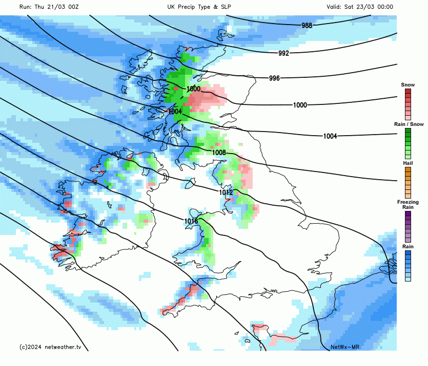
Temperatures in the high teens in late March are still well-above the average for SE England, the average high on the 21st for London is 12C. Today will be another warm spring day for late March across southern Britain, thanks to sunshine and a gentle mild southwesterly breeze. However, a different story for central and northern Britain – where it will be wet and windy today. Rain will clear south from northern areas tonight before clearing southern Britain tomorrow morning. Cooler, clearer but windy conditions following on Friday, with showers across the west, which will turn increasingly wintry over northern hills. A colder weekend follows, as winds turn northwesterly. Showery on Saturday, with sleet and snow over northern and western hills, cold start Sunday but a drier day with winds easing.
For today, a north-south split, cloudy skies and outbreaks of rain will slowly drift southwards through the day across Scotland, N. Ireland, northern England, north Wales and down into the Midlands. Windy across Scotland, especially around coasts and over high ground, with gusts of 50-60mph possible in the north of Scotland. A different story for south Wales, southern England and East Anglia – which will enjoy some warm hazy sunshine for much of the day. Temperatures reaching 16-18C in the sunny southeast, 12-15C elsewhere.
Through this evening and overnight, a cold front sinks southeast across Britain, taking an area of cloud and outbreaks of rain with it across England and Wales. Dry, mild but increasingly cloudy ahead of the rain across the far south, turning cooler and clearer to the north of the cold front, but with frequent blustery showers moving in across the northwest – which will turn wintry over high ground. Cold with risk of frost across northern Scotland where skies stay clear.
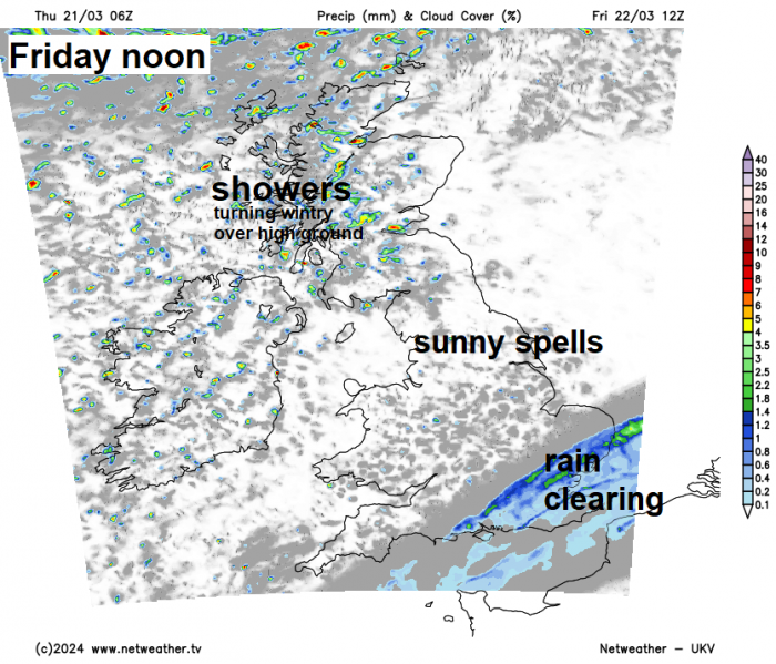
We start Friday with cloudy skies and patchy rain across southern England and East Anglia before this slowly clears away southeast through the morning, perhaps not clearing the far southeast until mid-afternoon. Brighter skies following but increasingly windy, with a good deal of sunshine and staying mostly dry away from western Scotland, N. Ireland, NW England and west Wales – which will see frequent blustery showers, wintry over high ground in the northwest. Temperatures reaching 8-11C in the north, 11-12C in the south, gales across the far north taking the edge of temperatures.
Colder and windier for all as we head into the weekend, with winds turning northwesterly making it feel noticeably colder, especially in the strong wind. Saturday is looking like a day of sunshine and showers, blown through most areas on the strong northwesterly wind, showers falling as sleet and snow over high ground in the north and west, also a risk of hail and thunder almost anywhere. Temperatures will struggle to around 8-10C at best as a result. Feeling colder in the wind than these temperatures suggest.
Then on Sunday, after a cold start, with a slight frost in northern areas, it will be a sunnier day with fewer showers and winds easing too away from the east coast, as a ridge of high pressure builds. Some showers to start towards North Sea coasts, but most staying dry, though cloud and rain looks to move in from the west across Wales and SW England through the evening. Temperatures reaching 9-12C.
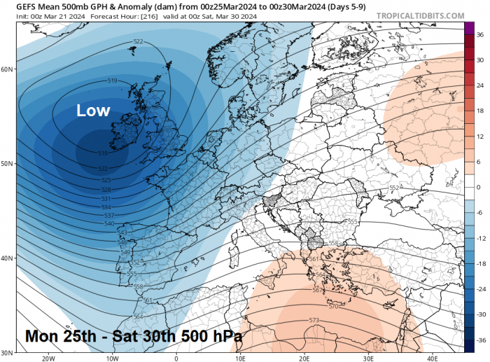
Looking ahead into next week and unfortunately it’s looking like turning increasingly unsettled and windy at times, as areas of low pressure move in close to the west or southwest and become slow-moving. Monday is looking cloudy and wet for many. Tuesday seeing further spells of rain spreading north across many areas. The rest of the week seeing spells of rain or showers affecting most areas, windy at times too, temperatures probably around average for late March.
Loading recent activity...