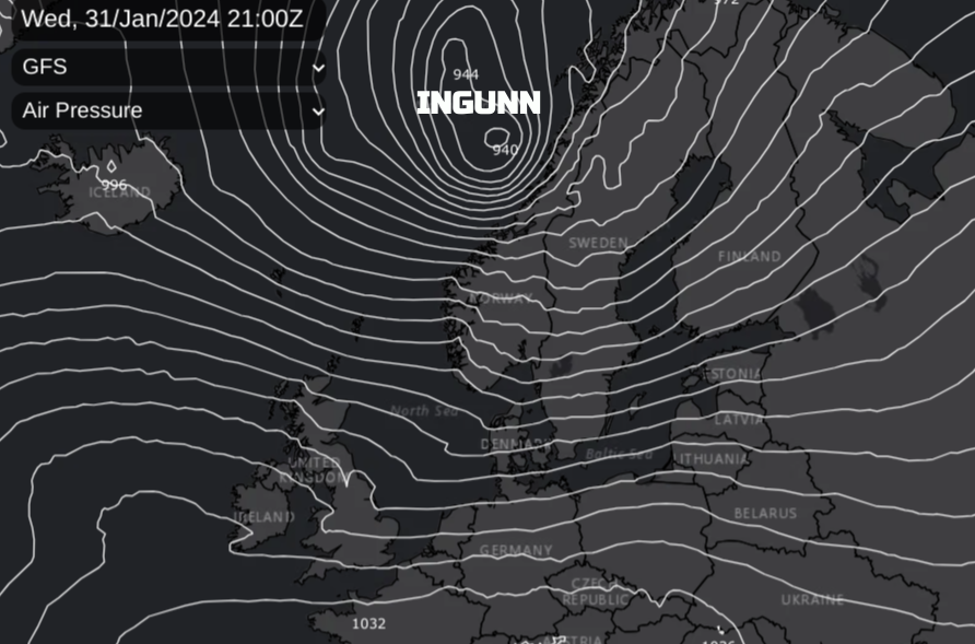
Norway has named Storm 'Ingunn'. This significant low pressure will bring strong winds to northern parts of the UK on Wednesday hitting the west coast of Norway on Wednesday night. There are sea area warnings for Storm Force winds and coastal flooding with high tides, the low pressure and a push from winds. The weather has been horrendous in northern Norway during this past week with driving rain, widespread ice and gales along the coast into the Arctic Circle.
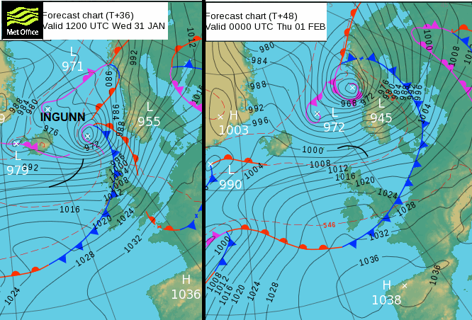
DWD ‘Core pressure will probably fall by 40 to 50 hPa in 24 hours by tomorrow evening!’
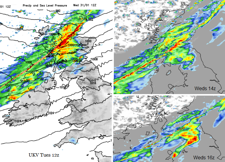
The centre of deepening low pressure will move between Iceland and Scotland on Wednesday morning and continue to deepen as it moves across the Norwegian Sea. The selection of warnings on the YR.no site is varied: gale, snow, avalanche, debris and slush slides, severe icing on ships, Hurricane force winds and extremely strong wind gusts. Widespread disruption is very likely as signalled by the red wind warning, with damage to forests and infrastructure possible.
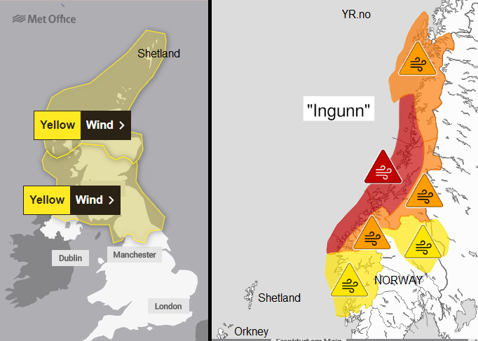
For the UK, there are two yellow wind warnings although they have differences in the matrix detail.
“Strong winds are likely to cause some disruption to travel on Wednesday.” MO
Through central and southern Scotland including the central Belt, also just into Northern Ireland and the far north of England, it is very likely in this region there will be some low impacts. For northern mainland Scotland and the Western Isles, Orkney, Fair Isle and Shetland there is a different yellow warning which mentions a very low likelihood of medium impacts and gusts of 75 to 85mph in exposure.
Inshore waters for Shetland - WIND Southwest 5 or 6, increasing 7 or gale 8, then severe gale 9 or storm 10 later, perhaps violent storm 11 later. SEA STATE Rough or very rough, becoming very rough or high, then very high later in west.
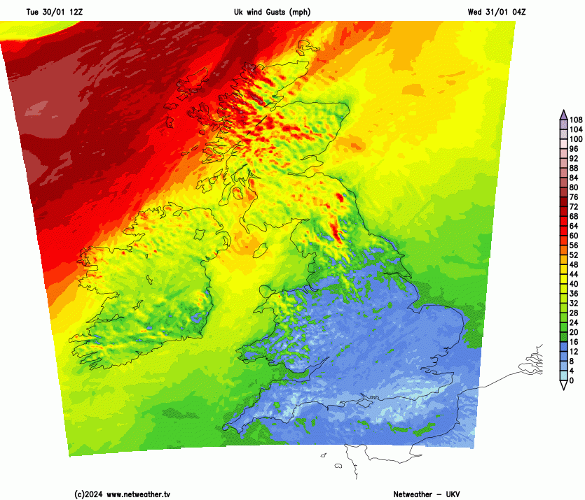
After a fine settled day on Tuesday, the change will be very obvious for NW Scotland early on Wednesday. With SW gales and driving rain to start the day. It will be windy for Scotland, N.Irelalnd, through the Irish Sea and for northern England into Gwynedd. The active cold front will bring heavy rain down over Scotland, Northern Ireland with the winds veering to a westerly in the clear, bright skies behind. The heavy frontal rainband will include line convection as it crosses the borders around teatime, followed by lively showers. By Wednesday evening there could be hail and thunder for the Northern Isles in the unstable colder air. The westerly winds will continue to be strong. Ingunn then arrives in Norway.
'A red warning of extremely strong gusts of wind has been issued for parts of Nordfjord, Møre and Romsdal, Trøndelag and Helgeland. From Wednesday afternoon to Thursday morning, a hurricane [force F12 73+mph] is expected on the coast and wind gusts of 35-50 m/s. (78- 112mph) The strongest gusts are expected in outer regions from Stad to Helgeland.' YR.no
There will also be snow showers in northern Norway 'possibility of 20-50 cm of snow during Thursday together with the strong wind.'
Norway is part of the northern storm naming group with Denmark and Sweden. It is just a coincidence that this name begins with 'I', following our J for Jocelyn. Their last named storm was Pia in December 2023, named by the Danish Met Service for a low that brought disruption up through the Baltic Sea and Finland. They do not publish a list of storm names like us in the Western naming group or the Southwestern group.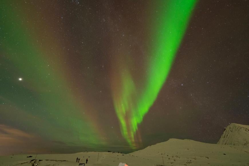
January 2024 photo Paul Botten
At this time of year, many tourists head to the Arctic Circle hoping to see the Aurora in the winter darkness. This kind of weather is not welcome. The recent Weather Holidays trip to northern Norway was lucky enough to have incredible clear skies and amazing views of the Northern Lights. Hopefully, the February trip will have similar luck, if the jetstream shifts and these lively low pressures stop feeding their gales, cloud and precipitation towards northern Norway.
More discussion in the Storm thread about Ingunn Netweather community forum
Loading recent activity...