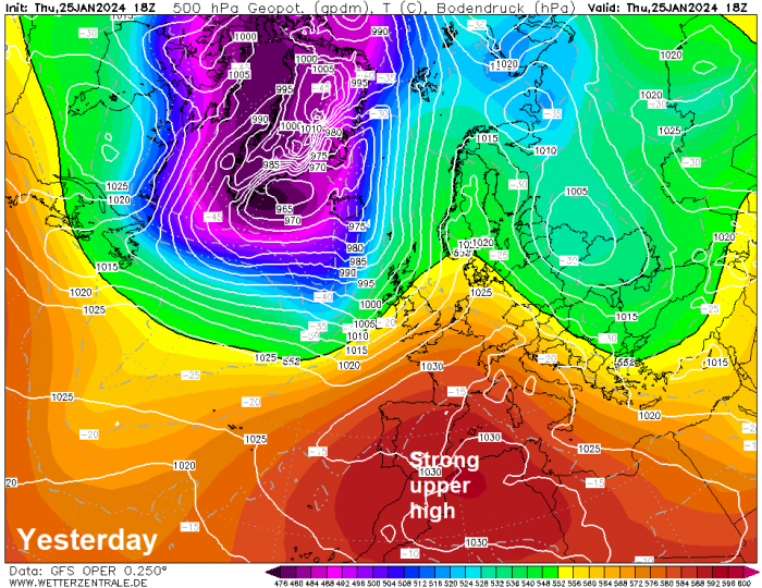
Following a few weeks of cold weather, with snow in places, which began around the 5th January, the weather has turned much milder but stormier since last weekend, with two named-storms in that time. What we have seen is a strong polar vortex re-organise over Greenland after it was displaced towards NE Europe during the colder weather. The very cold air wrapped up in the polar vortex and vertically stacked through the atmosphere over Greenland is helping to drive a steep temperature gradient over the far North Atlantic which in turn has driven a strong jet stream towards the U.K. – bringing the storms.
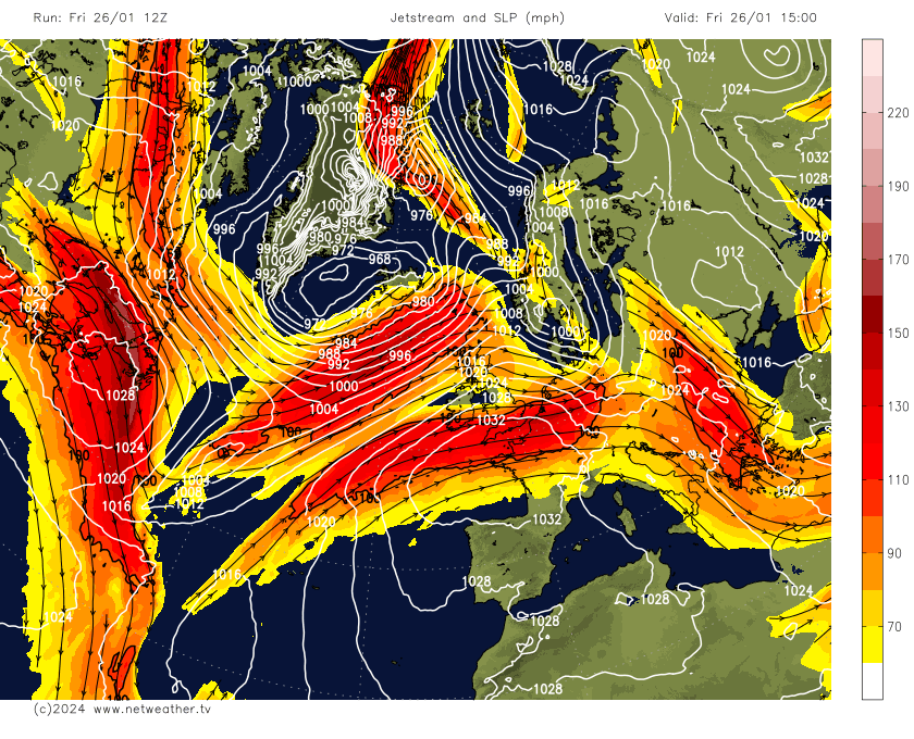
The jet stream is weakening and buckling this weekend, with an upper trough extending south towards the Azores while the jet stream that’s south of the UK today lifts north of the British Isles through the weekend. This will be in tandem with an upper-level ridge building north over Iberia and the western Mediterranean. A summer-like pattern looks to build north across western Europe by Sunday, with warm air aloft spreading north ahead of the trough to the west.
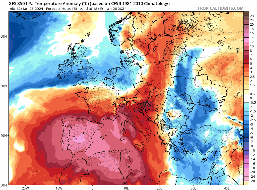
Temperatures rose into the high 20s Celsius across eastern Spain yesterday, Gavarda in eastern Spain recorded 30.7C – which would be a new European highest temperature record for January. Though this temperature has not been officially confirmed. However, yesterday still appears to be have been Spain's warmest January day since records began in 1950, the nationwide mean maximum temperature reaching 19.8C. The average maximum temperature for Spain in January is 10.6°C.
The high temperatures were thanks to an unusually strong ridge of high pressure causing air subsidence which in turn causes air to warm at the surface and added warm air moving up from North Africa. 500 hPa height at Murcia yesterday, on the noon radiosonde ascent, was at 5950m or 595dam (528dam or below generally required for snow), with a freezing level of over 2500m, which is very high for January.
Temperatures will continue to be noticeably above normal over the weekend and into the beginning of next week across not just Iberia but much of western Europe including the UK, thanks to a strong ridge of high pressure. with temperatures more typical of the month of March.
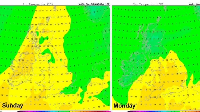
Anomalously warm air spreads north across western Europe, including the UK later this weekend before retreatiing east early next week
Here in the UK, Sunday looks to see temperatures reaching the low to mid-teens in the north and west, as stronger southerly wind here ahead of a cold front moving in from the west drags up warm air from way to the south. Similar temperatures further south across southern and eastern areas on Monday, while the cold front moves east introducing cooler air further north and west.
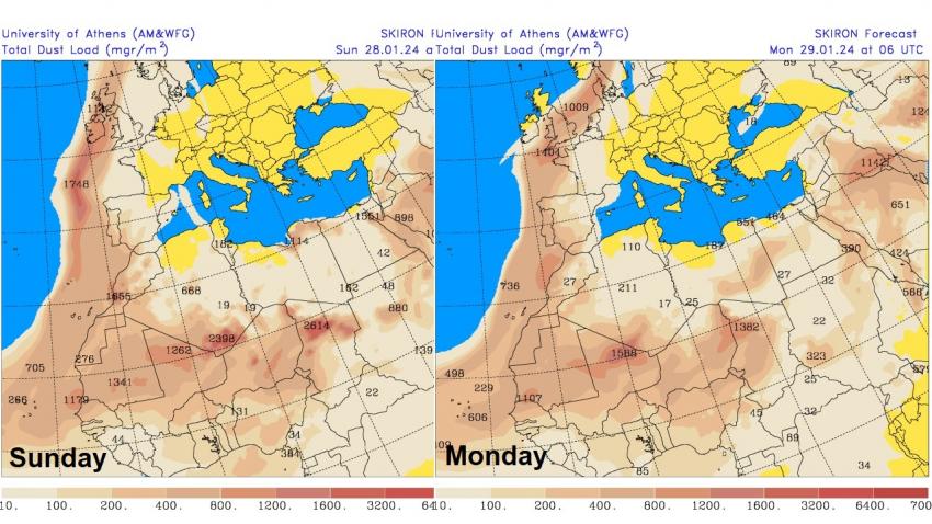
The strengthening southerly wind on Sunday ahead of the cold front moving in from the west will also pull north Sahara dust that’s been spilling out of west Africa out across the Atlantic today. The dust load greatest across northern and western areas on Sunday – where southerly wind will be strongest, before the greatest dust load shifts further south and east on Monday. Some of this dust will fall on to surfaces on the ground, such as cars, more particularly where rain is expected with an area of low pressure moving northeast along the waving frontal boundary across western and central areas of the UK on Monday. Though there is some uncertainty over the path of this rain across England and Wales for now. But there could be some colouful sunrises or sunsets while the dust is in the atmosphere.
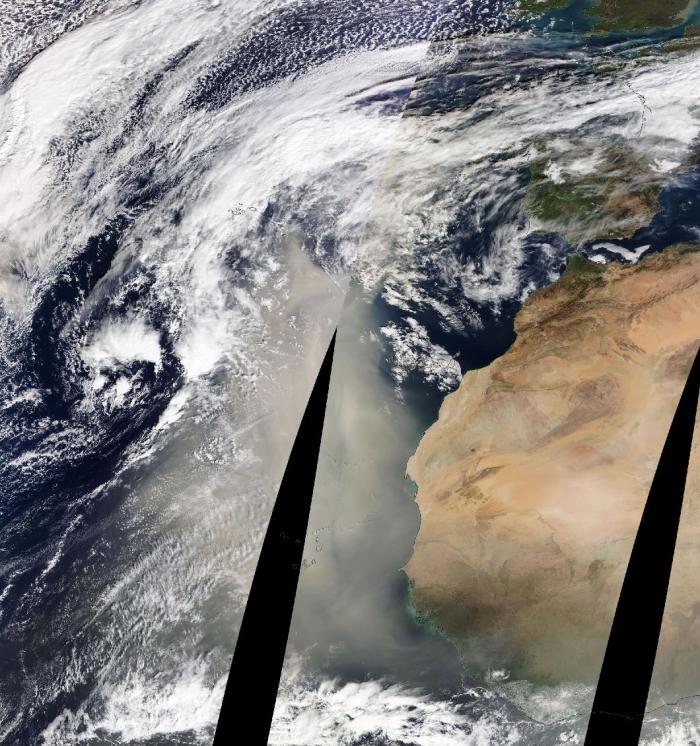
Sahara dust can be seen spreading west from Africa out over the Atlantic today ...
... the dust then looks to spread north to the UK over the weekend, dust load greatest in the north and west on Sunday, south and east on Monday:
The buckles or waves in the jet stream look to straighten out next week though, with the jet stream returning to a more zonal (westerly) flow like the past week. The jet stream becoming stronger again too, but as it will be close to Scotland, northern areas look to be unsettled and windy with rain at times, while southern areas look to remain dry and milder throughout next week, thanks to high pressure centred over France keeping the weather settled.
Loading recent activity...