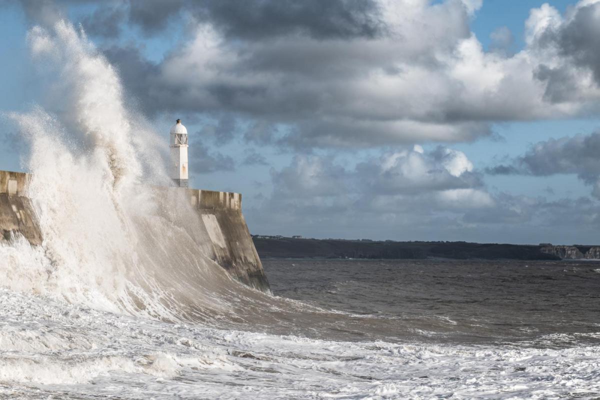
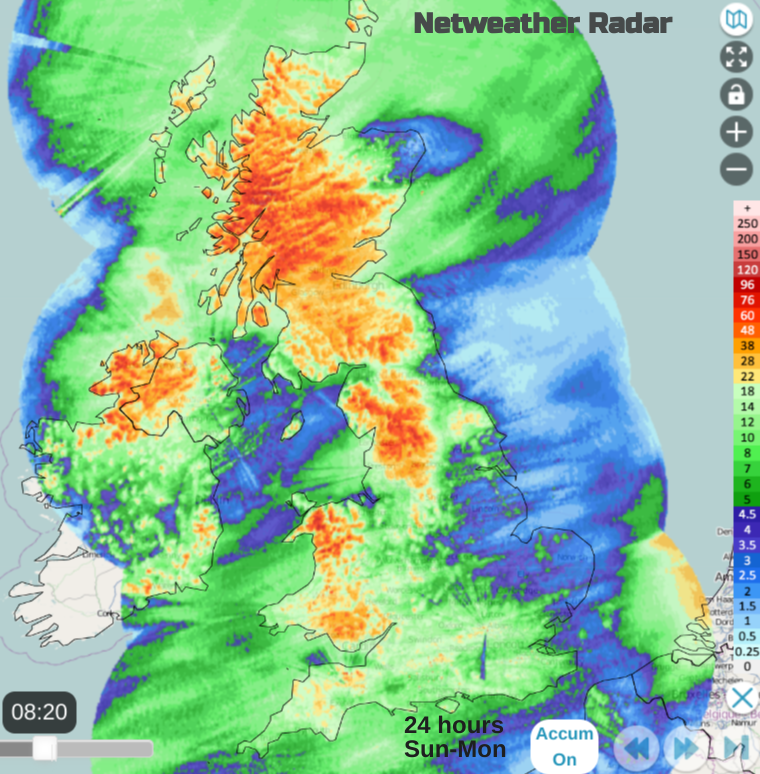
Storm Isha brought this weekend to a wild end for parts of the UK and Ireland. There was a lively cold front sweeping across all parts with heavy rain, squally gusts and strong winds giving a lively-sounding evening with additional flooding issues.
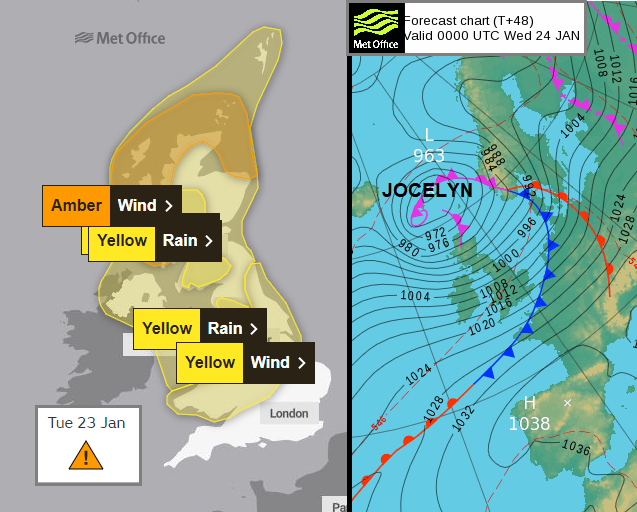
Warnings for Storm Jocelyn
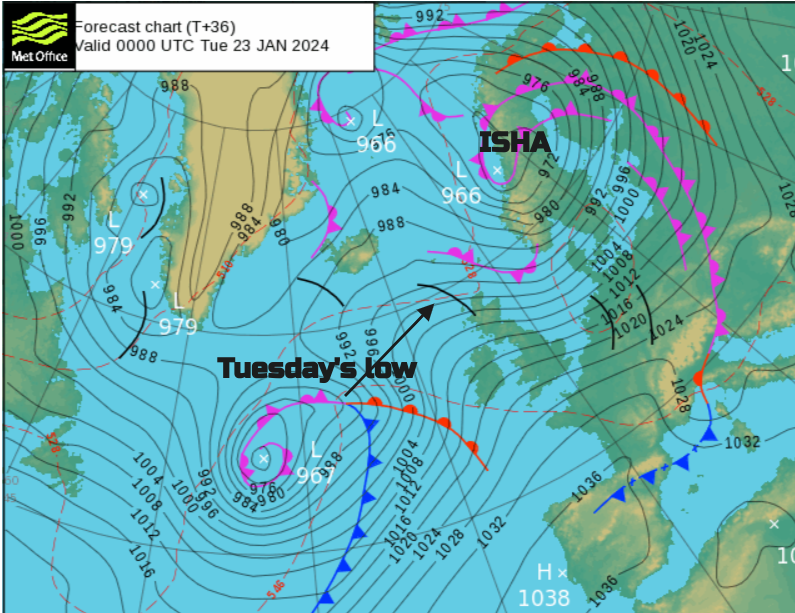
For northern and western areas, there were gales, severe gales, and gusts close to 100mph. By the small hours of Monday, the Met Office had issued a rare red warning for High likelihood of High impacts from winds for northeastern Scotland. Many were aware, earlier, of the evening and overnight Amber wind warnings. Hopefully, plans were adapted in time as the storm set in. All trains in Scotland finished by 7pm on Sunday and have not resumed for the Monday morning commute period whilst the lines are checked for debris, damage and flooding. Today will be blustery, tonight will feel colder as the wind eases but another Atlantic low (now named Storm Jocelyn by Met Eireann) will soon be arriving ready for more rain on Tuesday and strengthening winds later in the day. It won’t be as widespread as Isha but the westerly gales still look impactful for Tuesday night in the north.
Storm Isha will pull away northeastwards from Shetland this morning with its trailing fronts crossing the North Sea. The Shetland inshore waters forecast mentions High seas and “West severe gale 9 to violent storm 11” and Monday remains blustery with sudden gusts for much of the UK in the westerly flow.
This westerly flow will draw in colder air. Not the cold of a week ago from the Arctic but a change from the mild air of this weekend when temperatures reached 14.3C in north Wales. A rash of blustery showers will affect Northern Ireland and Scotland today, slowly spreading into Wales and England from the northwest. The northern half of the UK will be windy with lesser gusts and more showers, the southern half will be blustery but drier. Coastal areas will still be windy, for Wales and SW England. There are still flood warnings, for groundwater levels and river levels after the weekend rain. The thaw of hill snow and ice has added to the issues in northern England and there are Local coastal and tidal flooding concerns for Norfolk and Suffolk this week. SEPA mentions coastal wave overtopping in the west again for Monday and “delayed response from the rivers and continuing snowmelt from the hilltops could cause further significant impacts” inland.
“Winds gradually ease as storm Isha moves northeastwards through Monday before strengthening again on Tuesday as another Atlantic low approaches the United Kingdom.” Met Office
Before the next low pressure moves in, there is a ridge of high pressure and the winds ease off for a short time on Monday night. With colder air, temperatures will dip well down into single figures with a touch of frost in some areas. It won’t last long as southerly winds soon pick up on Tuesday morning over Ireland and cloud and rain arrive from the west.
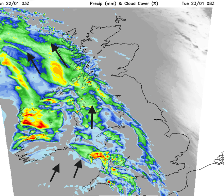
The next yellow wind warning is from Tuesday late afternoon through until Wednesday morning “with disruption to travel and utilities possible”. The day doesn’t look great with a band of heavy rain and freshening southerly winds veering to the southwest behind the front. In the unstable showery flow, later in the day, the winds strengthen and that is when the warning kicks in. The UKV shows high gusts and gales, even severe gales battering the Western Isles and west coast of Scotland by 3am on Wednesday and this main focus, transferring across to northeast Scotland but, affecting other parts of northeastern Britain but 6am. Further disruption is likely to road and rail journeys for Wednesday morning.
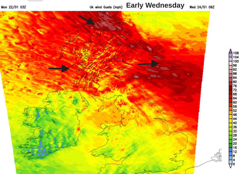
So Storm Isha is pulling away but Monday remains blustery with ongoing disruption in the north. The next low will bring heavy rain by day on Tuesday adding to the flooding concerns but it will be during Tuesday night when the winds will really ramp up. The main core of westerly gales looks to affect Scotland and then northeastern Britain by Wednesday morning.
Storm Isha chat in the Netweather Community
The next Low chat for Tuesday/Wednesday
Matrix and Met Office weather warnings blog
Loading recent activity...