The recent cold spell is coming to an end this morning, cold air is still hanging on across eastern areas of England with temperatures around freezing at dawn in SE England. But further north and west a strengthening southwesterly flow is bringing in milder air, with temperatures reaching 7-8C across the far west of mainland UK, 10C across western Ireland. The milder conditions spreading across all parts through today.
But with the change in wind direction and airmass will be increasingly unsettled and windy conditions through the weekend, as a series of low pressure systems track northeast close to NW Scotland over the weekend and into early next week.
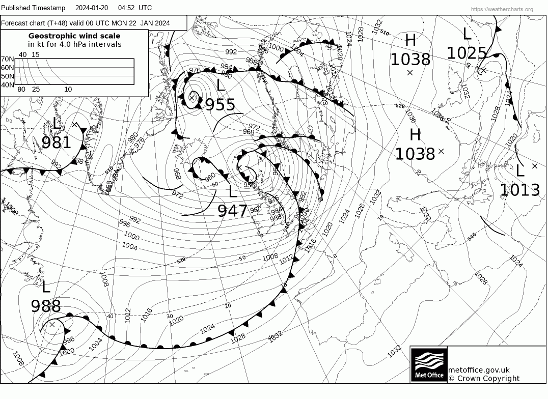
One of these lows is forecast to be particularly deep as it continues to deepen on approach to NW Scotland Sunday night. It was named Storm Isha by the Met Office yesterday morning, with two Amber Wind Warnings issued and valid for later on Sunday through into Monday. One amber warning for southern Scotland, North & southwest England, N. Ireland and Wales – which is valid between 6pm Sunday to 9am Monday. The other amber warning for the far SE of England and valid between midnight Sunday night to 9am Monday.
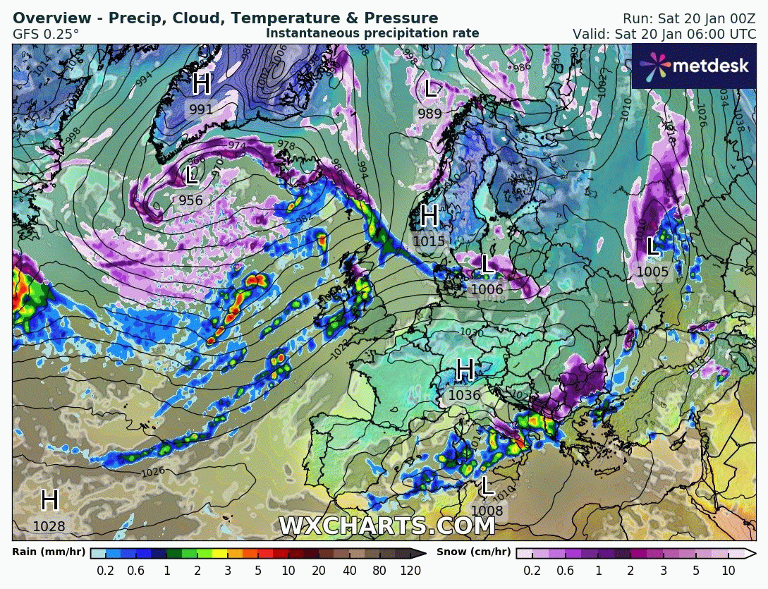
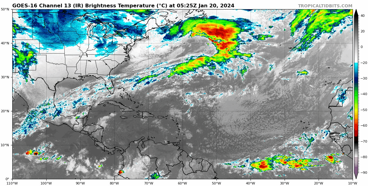
The sudden change from fairly benign, sunny but cold conditions for many this week, away from the far north and coasts that have seen snow showers, to milder and increasingly windy and wet weather through the weekend is thanks a powerful jet stream arriving from the west bringing areas of low pressure towards NW Europe, sucking up mild air from the southwest. The strong 200mph+ jet stream crossing the Atlantic is being ‘fuelled’ by a steep temperature gradient across southern USA between very cold arctic air over much of central and eastern USA and warm air from the Gulf of Mexico.
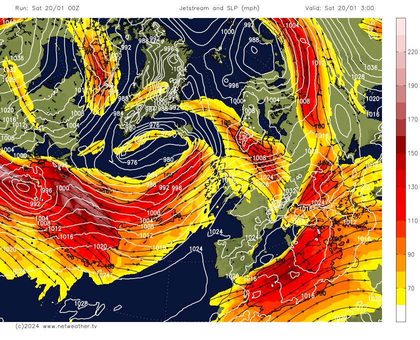
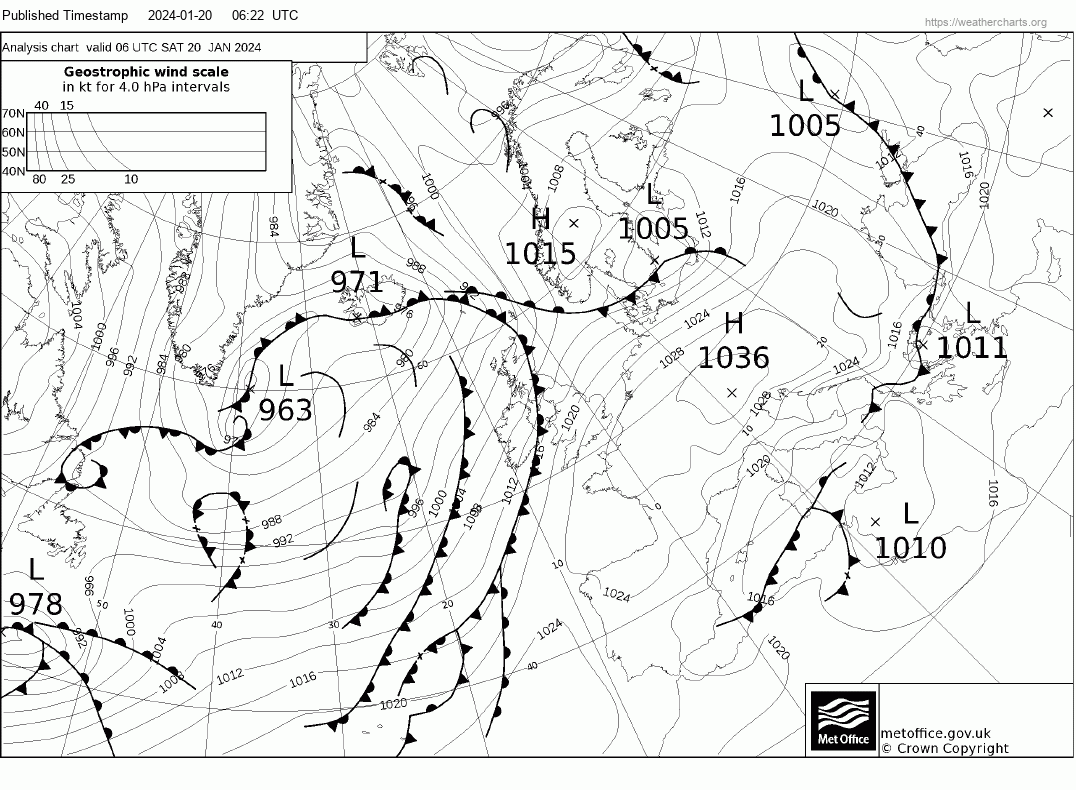
Storm Isha formed off the eastern seaboard of USA yesterday, the low is now moving rapidly northeast across the Atlantic carried by the strong jet stream. The low was a few 100 miles south of New Foundland on the 06z Saturday fax chart with a central pressure of 978 hPa.
The low then continues northeast across the Atlantic, moving on the cold northern side of the jet stream this afternoon and into the left exit of the jet stream – the combination of which will lead the low to undergo deepening. The left exit of a strong jet stream is a highly developmental area for low pressure to undergo rapid deepening. This is because there is strong divergence aloft in the exit of the jet stream – which causes a void or vacuum which needs to be filled, this causes air at the surface to converge and rise – causing pressure to lower towards the surface. So an area of low pressure moving into this area sees its pressure fall more rapidly. The central pressure of the low is expected to fall to 967 hPa at midnight tonight then further deepening bringing central pressure in the low down to around 947 hPa as the low arrives close to the northwest of Scotland at midnight Sunday night.
Storm Isha is currently to the south of New Foundland in the top middle
The weather models are now in generally good agreement with regards to the track of Storm Isha passing close to NW Ireland then close to or across the far northwest of Scotland. A look at the fax chart for midnight Sunday night (00z Monday) shows a wide tight pressure gradient south of the low which indicates a widespread strong wind field covering the UK Sunday evening through into Monday morning.
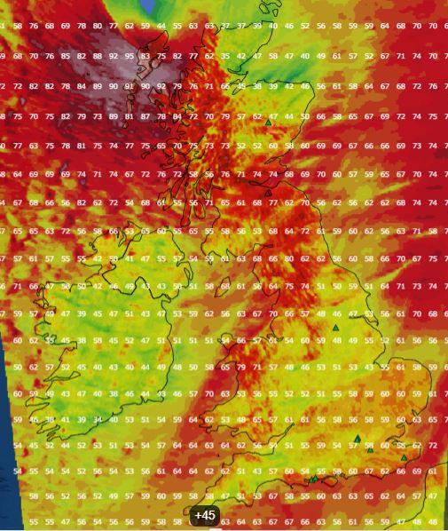
There is variation between weather models this morning on predicted gusts across the UK. UKV and ECMWF are generally forecasting 60-70mph gusts quite widely inland across Ireland, N. Ireland, Scotland, Wales and northern England Sunday evening and night, 70-80mph wind gusts around northern and western coasts and hills, perhaps 80-95mph to the north of Ireland and far west of Scotland. Across central, southern and eastern England – gusts of 50-60mph inland, perhaps up to 70mph along English Channel coasts.
UKV gusts midnight Sunday
GFS gusts midnight Sunday
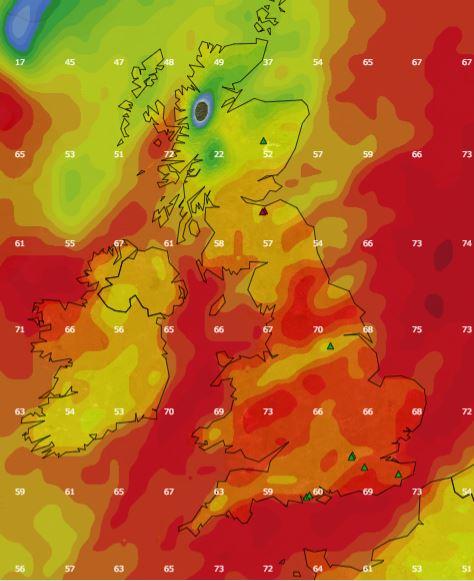
However, GFS is forecasting stronger wind gusts across southern Britain Sunday night – with gusts of 60-70mph inland. This could be to do with how the model differs with the shape of the depression moving past the far north and where the tightest pressure gradient is. GFS has a tighter gradient over England and Wales Sunday night, hence stronger gusts. UKV and ECMWF have an exceptionally tight gradient on the SW flank of the low centre to the north of Ireland approaching western Scotland – which packs the violent wind gusts it forecast up to 95mph. Could be possible signs of a ‘sting jet’ in this area too, where typically a dry air intrusion brings very strong winds aloft toward the surface.
So we may see the Amber warning extended further south and east – given the potential for stronger gusts inland across southern England.
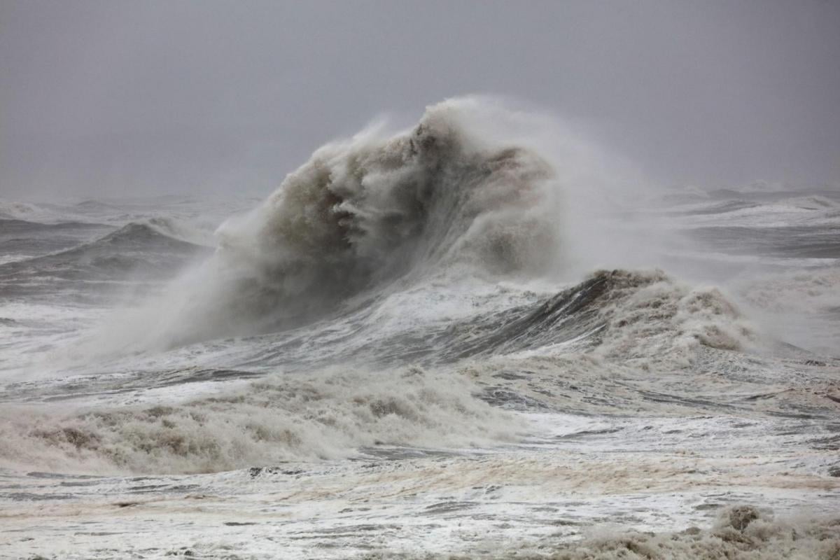
Such strong winds, although fortunately peaking overnight Sunday, when most will be indoors, will still bring a risk of damage from falling branches and trees, power cuts, delays to flight arriving late in the evening and also late train services and also disruption to travel Monday morning from any trees falling and blocking railway lines or roads overnight. Also seas are likely to be very rough, so delays to ferries will be inevitable and carrying on through Monday until seas calm down.
Another to-be-named deep low on Tuesday?
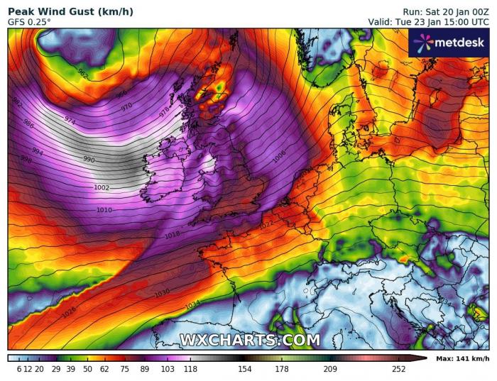
However, it will remain very windy in the north, with gales over coasts and hills and unfortunately it looks like another deep low looks to pass the north of Scotland on Tuesday, bringing further gales across the UK, perhaps severe gales across the west. This second deep low may be named too.
Follow the latest discussions around Isha on the Netweather community.
Edited at 1032 Saturday 20th Jan to add additional Met Office warning tweet.
Loading recent activity...