With disruptive snow in places and temperatures falling well below freezing overnight and struggling above freezing by day, some will be glad to hear that this cold spell will come to an end over the weekend. The change comes as the UK swaps northerly winds direct from the arctic with much milder southwesterly winds bringing air from the sub-tropical North Atlantic. Temperatures have been struggling to get any higher than low single figures this week, some places no higher than freezing. But temperatures will rise into double figures over the weekend and early next week they could reach as high 15C in the south.
Turning milder over the weekend and into early next week

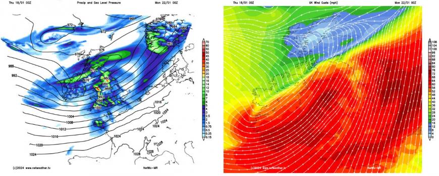
But with the milder air will be the arrival of stronger winds and also outbreaks of rain over the weekend. Sunday will see the arrival of a very strong jet streak across the North Atlantic, fuelled by the temperature contrast across southern USA between extreme cold to the north and tropical air to the south. An area of low pressure will deepen rapidly in the developmental left exit of the jet stream and looks to track across Scotland Sunday night, bringing gales or severe gales across parts of Britain. Unsettled and windy conditions continuing early next week and becoming very mild for a time.
Potential for stormy weather Sunday night
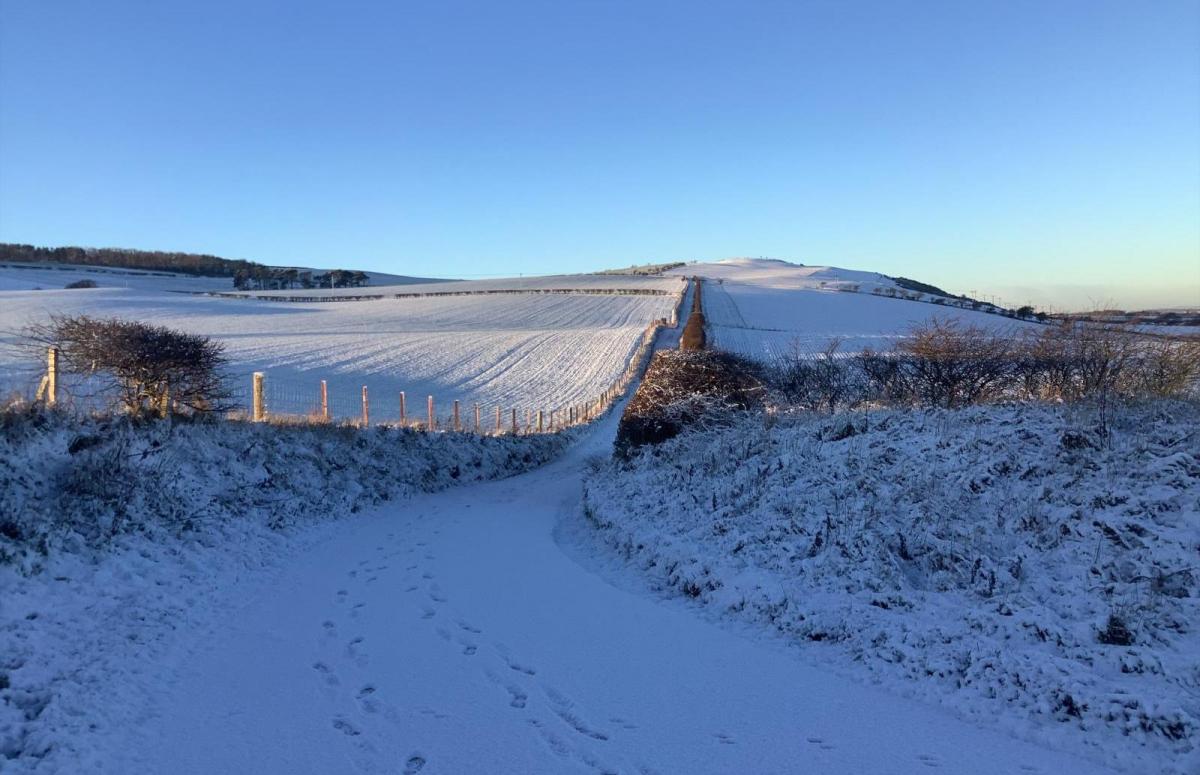
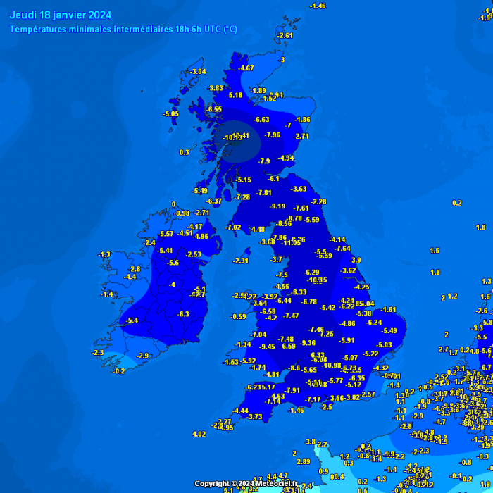
For now, a very wintry picture across the UK to start the day. Under clear skies and cold flow from the arctic, temperatures have fallen below freezing across pretty much most of the UK away from coasts. Coldest spot overnight was Tulloch Bridge in the Scottish Highlands which fell to -13.6C. Here there is snow on the ground, but in England - Benson in Oxfordshire fell to -11C with no snow on the ground. This shows just how cold the airmass is, but it could've been even colder with with snow cover in the south.
As well as widespread hard frost overnight, a strong and unstable arctic flow across the far north has brought and continues to bring frequent heavy snow showers across the far north of Scotland and the Northern Isles. Altnaharra in the northern Highlands has seen 37cm of snow, Wick on northern coast of northern Scotland has seen 27cm. A Met Office Amber warning for snow is in force until 6pm today, as further frequent snow showers continue across the far north of Scotland, their wording is:
Further frequent, occasionally heavy, snow showers will affect the Northern Isles and northwest Scotland through Wednesday evening and Thursday with an additional 5-10 cm of snow likely, and the potential for a further 15-20 cm of snow in a few locations. In addition strengthening northerly then northwesterly winds will cause lying snow to drift.
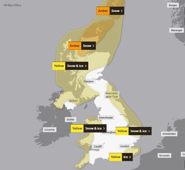
Yellow warnings for snow and ice are also in force until 11am for northern and western Scotland, N. Ireland, north and west Wales, Cornwall and west Devon and also coastal eastern England as far south as Suffolk. Here will see snow showers through the day spreading in from where they are generated over sea to the north. A few centimetres of snow overnight in places in these warning area which have seen snow showers could bring some icy conditions this morning.
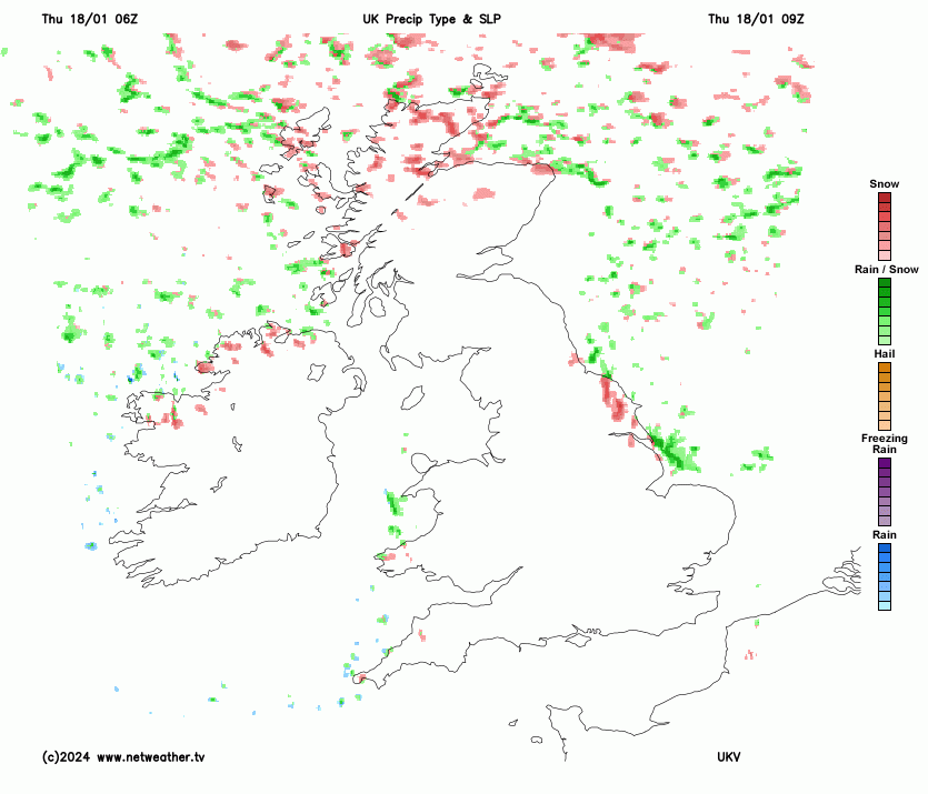
Snow showers will continue in these areas currently under yellow warnings for much of the day, an additional 5-10cm accumulating across N. Ireland, 5-15cm across the far north of Scotland and Northern Isles. This will bring some travel disruption in these areas. But elsewhere, it will be a largely dry day with mostly clear skies and sunshine. Despite the sunshine, it will be a rather cold day, temperatures reaching 2-3C at best, some places in northern Scotland staying around freezing.
Then this evening, with the wind backing more towards the northwest, snow showers will spread inland across North Wales and through the Cheshire Gap across southern NW England and towards the Midlands, giving a covering in places overnight. Winds turning westerly further north over Scotland, which will feed heavy wintry showers inland across western Scotland and the Highlands, falling as snow inland but rain or sleet towards western coasts as less cold air arrives. Wintry showers continuing towards the north coast of N. Ireland too, but the rest of England and south Wales will have a dry night with clear skies leading to another widespread hard frost.
Friday will continue to see plenty of showers packing in across northern Scotland on a brisk westerly wind, but with less cold air from the west, falling as snow over higher ground and rain or sleet at lower levels. Southern Scotland, England and Wales, mostly dry and sunny under a ridge of high pressure, though some showers off the Irish Sea along western coasts can’t be ruled out. Temperatures reaching 4-6C.
Then a big change in our weather pattern as we head through the weekend, as low pressure moves in off the Atlantic and winds turn southwesterly and strengthen, bringing milder air from way to the southwest. Bands of rain and showers will work their way eastwards across many parts on Saturday accompanied by a gusty southwest wind too, western areas wettest, eastern areas drier but seeing some showers arrive. A rapid thaw of lying snow in the north, as temperatures reach 6-9C, which could bring some localised flooding.
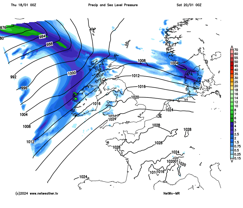
Sunday is looking very windy for all, SE England staying mostly dry until after dark, but northern and western areas seeing areas of rain, heavy at times, spreading northeast. A deepening depression arriving across Scotland in the evening will bring gales or perhaps severe gales, with gusts of up to 70mph in the west, during the evening and overnight. A yellow warning for wind is in force across Scotland and the west further south, but maybe extended to other areas.
Loading recent activity...