
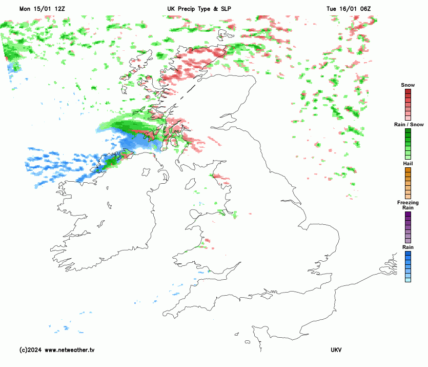
The Arctic air has arrived and the wind feels raw if you are not properly clad. For many parts of the UK, Monday has been cold, and dry, but sunny. The risk of ice will be widespread and frost will form where there is little wind. In the north-to-northwesterly flow, there have been sleet and snow showers. Depending on the flow, these hit northern Scotland first and filter down the west coast to Northern Ireland and the Irish Sea or clip east coast Britain. Whitby to Bridlington (Yorkshire) saw wintry showers today, as did Sheringham to Great Yarmouth (Norfolk).
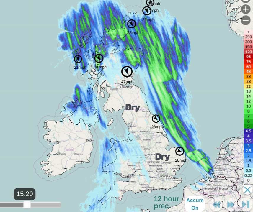
This pattern of showers in a northerly is often referred to as a wishbone formation. The focus is northern Scotland across the Northern Isles and mountains of the mainland but the feed continues down exposed coasts. Low pressures over Scandinivai keep this setup in place until high pressure edges in from the Atlantic later on Thursday. This looks to disrupt the cold Arctic flow and a milder southwesterly takes hold for next weekend.
The background picture is a cold northerly (N to NNW) flow bringing snow showers to exposed parts of the UK. There have already been problems due to the wintry conditions in northern Scotland. Some schools are closed, there have been problems on the roads in northeast Scotland and cancellations or alterations to Scotrail services on Monday.
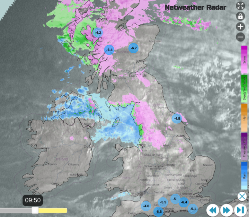
Interrupting that picture will be a small feature toppling into western or southwestern Scotland on Tuesday morning and running across to the North Sea. This will bring rain, sleet and potentially disruptive snow in the north.
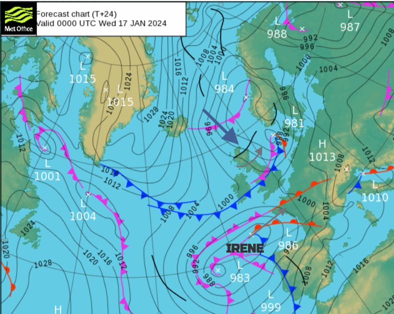
As bands of precipitation continue to affect northern Britain, even north Wales during Tuesday night a different area of concern develops. A large low pressure has been named 'Irene' by Meteo France. This will bring strong winds and rain to Portugal and Spain but the focus and main impacts will be disruptive snowfall for France, maybe the Benelux countries and Germany midweek. There have been fluctuations run to run from the various weather models showing the northern edge of the fronts of this low skimming along the English Channel. Will they, won’t they bring sleet and snow to the south coast of England? The Netweather community forum has seen heated discussion this week.
Northern Ireland and Scotland are covered by a yellow severe weather warning for Ice and Snow. This extends into Wales and northwest England ready for Tuesday morning. After all the recent wet weather, there will be frost further south and a wider risk of icy patches.
“Further snow showers, perhaps merging into a longer spell of snow, are likely to cause further disruption on Tuesday” Met Office
It will be another cold start on Tuesday, but bright for many. There will be more cloud for western Britain and Northern Ireland with ongoing snow showers for northern Scotland. The small low pressure will bring precipitation in from the west and the UKV model is keen for that to affect Strathclyde, Ayrshire and Dumfries & Galloway for the morning commute. Wintry bands also reach over Northern Ireland, heading southwards. The western main area looks to push through the Central Belt on Tuesday morning, over southern Scotland into the far north of particularly Cumbria.
There are variations in the models about how much snow will come from this feature. Snow is most likely on the leading edge as it moves over land with sub-zero air temperatures around dawn and along the northern edge as it heads eastwards during the day. Bands of heavy snow showers will continue to feed in from the far northwest over Scotland and there has been a signal for a stationary feed off the Irish Sea for NW England to end the day. Be aware of this potential as the detail of its location may be missed by weather apps but the mix of coastal rain turning to sleet and snow over the hills and moors could also cause disruption locally for Tuesday evening and night.
Further bands of heavy snow will work their way south/southeastwards over Scotland on Tuesday night and again, there could be impacts to travel. Keep an eye on the Netweather radar if you do have to drive and prepare well.
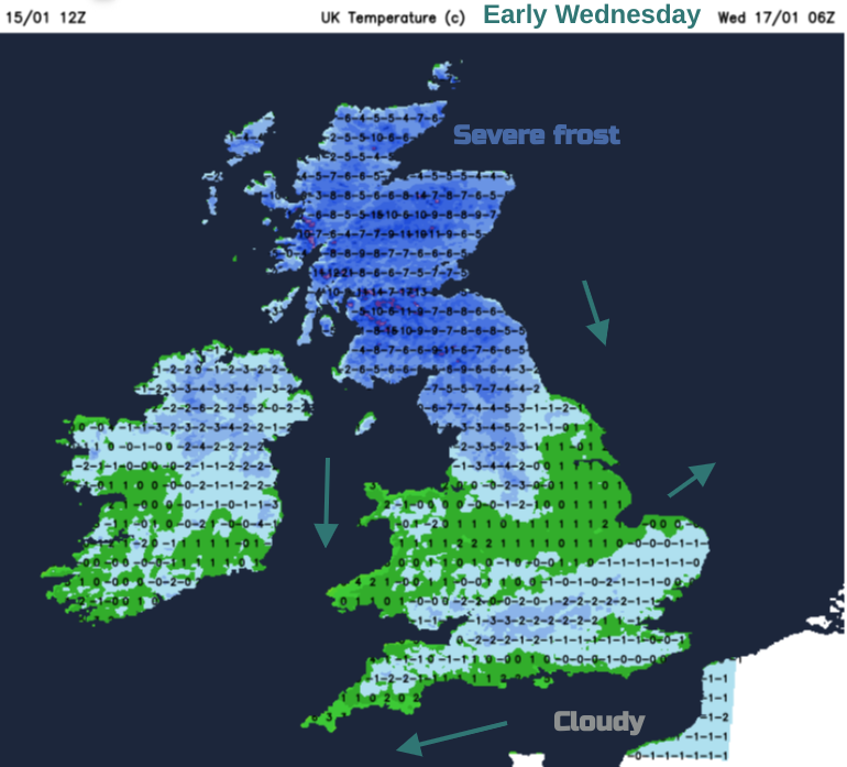
Irene’s cloud could save the temperatures from falling too far over southern Britain early on Wednesday but it will feel cold in the breeze. Further north, there will be a severe frost with temperatures plummeting overnight and the feed of snow showers continues. We’ll have to see how the models firm up the precipitation track in the English Channel on Tuesday.
Loading recent activity...


