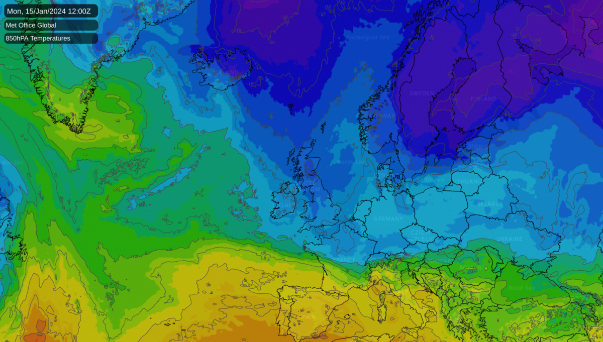
We are about to head into a spell of cold northerly and north-westerly winds, associated with a blocking high over Greenland. The cold spell will bring snow for some, but the potential for widespread snow has receded recently relative to what some model runs were suggesting around midweek last week, with the big frontal system on Tuesday/Wednesday of next week looking likely to stay to the south of Britain, potentially just grazing the extreme south of the country.
Some earlier model runs had this covering a large area of England and Wales and producing an area of persistent snow over Wales and the Midlands and southern England, which now looks unlikely. The cold spell will not be especially prolonged, and there is very strong agreement among the medium-range forecast models that mild and moist south-westerlies will push in by next weekend.
While the medium range models such as the GFS and ECMWF keep this mild and wet regime going for the foreseeable future, longer range guidance suggests that it, too, will probably only be short lived. High pressure looks likely to return towards the beginning of February, bringing colder and much drier weather, with potential for more wintry weather to develop as the high moves northwards and opens up potential for northerly and/or easterly winds.
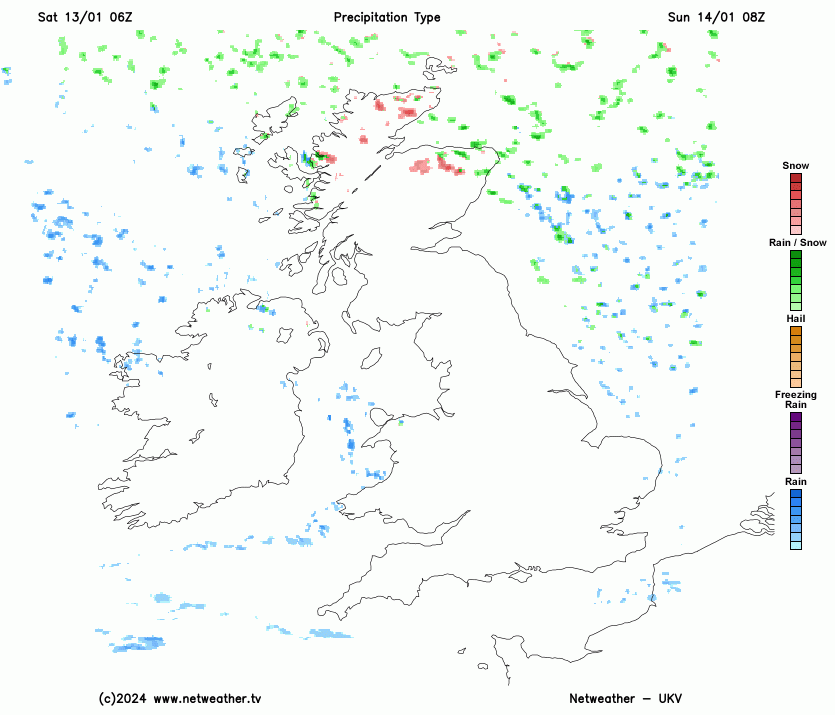
It has been another cloudy start to the day in western and southern England, Wales and Northern Ireland, but we have an area of dry sunny weather covering the east Midlands and north-east England, and clear skies have also been developing in parts of Scotland. This brighter weather will extend southwards during the day as a northerly wind sets in. Most places will have a dry day today, but the northerlies will bring a scattering of showers near north-facing coasts, these mainly in northern Scotland, the far north of Northern Ireland and north and west Wales. In Wales and Northern Ireland these showers will be predominantly of rain, but they will turn to snow in northern Scotland.
Temperatures will reach around 7 or 8C in most parts of the country, but it will be colder in southern England, where the cloudier weather will hang on for longest, with highs of just 3 or 4C in some places. It will also be colder in Scotland, where the Arctic air associated with the northerlies will arrive first, with highs of between 4 and 6C.
Overnight tonight, wintry showers will become more widespread in northern Scotland, the north of Northern Ireland and the north and west of Wales, with a few along eastern coastal fringes of England, but the wind direction - a north to north-westerly - will not bring many showers inland, so most of the country will be dry and clear. There will be a widespread frost in Scotland and northern England, but much of Northern Ireland and southern England will remain frost free with lows of around 3C. South-west England may see a frost early in the night, as cold continental air hangs on.
On Sunday, most places will be dry, sunny and cold, but there will be frequent snow showers in northern Scotland. There'll also be frequent showers in Northern Ireland and north and west Wales, which will be mainly of rain at low levels early in the day but will turn increasingly to sleet and snow. A scattering of showers may break out inland during the afternoon, especially in southern England, though in the south they will mainly be of rain.
With progressively colder air pushing in from the north, it will be a very cold day in Scotland with most places reaching around 2C, and not getting above freezing at on high ground. Highs of between 3 and 5C will be typical elsewhere, but reaching up to around 7C in southern England.
The cold air will be firmly established in all parts on Monday. South-west England and south Wales will see top temperatures of around 5C, but elsewhere they will generally be no higher than 2 or 3C. It will be a dry sunny day for most, with snow showers mainly restricted to north-facing coasts, with a few brushing against western and eastern coastal fringes. Northern Scotland, Northern Ireland and the east of Norfolk will probably see the most showers, with a widespread snow cover in northern Scotland.
On Tuesday and Wednesday there is now just a low chance of a frontal system pushing into the south of Britain, and with a pool of less cold air moving in from the west at the same time, if the system does push into the far south there is a fair chance of precipitation mostly being rain at low levels. However, this less cold air will be associated with a frontal system which will bring snow on its northern flank for Northern Ireland, northern England and the Midlands, with snow generally to low levels in northern England and on higher ground elsewhere, perhaps with snow penetrating to low levels in the Midlands for a time as the system clears away south-eastwards. Snow showers will continue in northern Scotland, which will remain in a cold north to north-westerly regime. Snow showers may develop more widely in western Britain on Thursday as the wind will change to a north-westerly direction, but it looks set to turn mild and wet through Friday and Saturday.
Loading recent activity...