Returning to work after the Christmas and New Year break can feel hard enough with the dark mornings but this time people had Storm Henk to contend with as well. Some may not have heard about “Henk” until they had set off on Tuesday. An impactful low pressure was named by the UK Met Office as it moved across Wales and England on January 2nd. With more rain, leading to widespread flooding, strong winds and damaging gusts there was travel disruption for post-holiday travellers and commuters. There have also been power outages and numerous fallen trees. For the start of Wednesday 3rd, there are nearly 350 flood warnings in England and Wales.
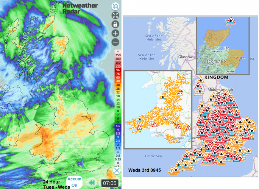
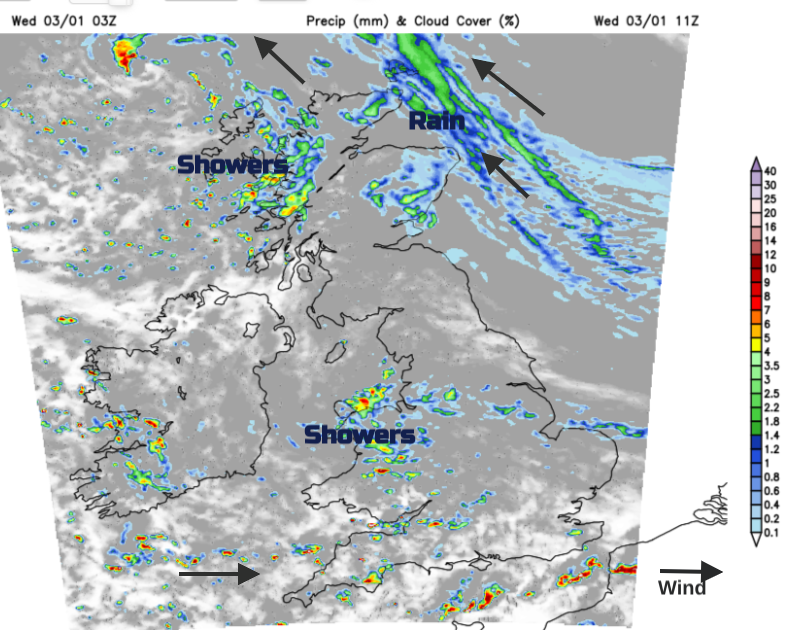
Storm Henk 24 hour rainfall from Netweather Radar and flood warnings & alerts on Weds 3rd Jan 2024
'81mph at Exeter Airport (No.2) a record for the site which opened in the early 1990s, and the 3rd strongest at Exeter Airport overall (including the original observation site). Only 83mph on 28/02/1990 and 85mph on 25/01/1990 (Burns Day Storm) were stronger.' @RoostWeather Dan Harris
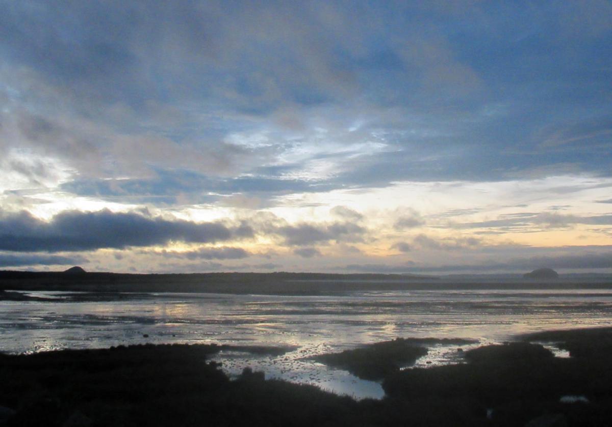
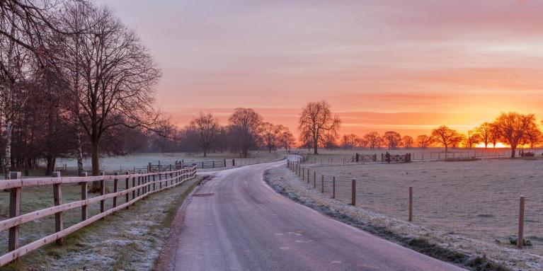
As the clear-up continues there is a change on the way with our UK weather. It has been very wet (we await the official December summary from the Met Office). The ground is saturated, river levels are high, and it is muddy underfoot with lingering puddles hampering those trying to get out for exercise or just a bit of fresh air. The outlook is drier and more settled but colder.
High pressure will build over the NW Europe and block the feed of rainy low pressures. Colder air will be pulled over the UK with widespread frosts by night at the weekend and taking hold next week.
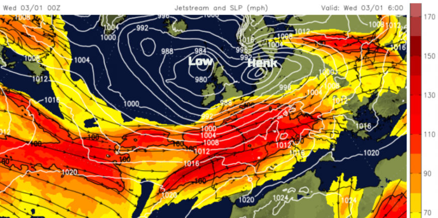
The zonal jetstream has been feeding low pressures our way. Rain just keeps on falling onto the already saturated ground. Henk was the eighth named storm (from the Western Group) of this season, which starts in September. Last season (running Sept. to Sept.) it was France being bombarded with low pressures (in the Southwestern naming group) reaching Patrícia by August 2023. Here it took until August for Antoni and Betty to appear, there were no named storms for us all winter, although Storm Noa (named by Meteo France) impacted the UK in April 2023.
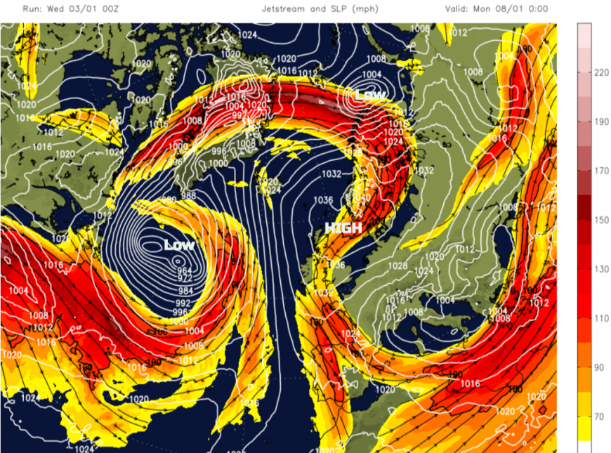
There will be a great shift, a meridional pattern to the jetstream and the Atlantic low pressures will be thrown northwards to Iceland and northern Norway. We do have some more blustery showers over the next few days before the high pressure takes hold.
It has been very windy and wet for northeast Scotland overnight with very rough seas and severe gales for the Northern Isles. It stays very windy for Orkney today with disruption to ferry services after the extra Bank Holiday in Scotland. It will be quite a shock for those going back to work in Shetland with snow, strong SE winds, gusts over 50mph and an air temperature of +1C, but feeling more like -7C. Across the UK there will be bright even sunny spells and then hefty showers from the west, including hail. It won’t be as windy as yesterday for England and Wales but there will still be a brisk wind for the south coasts making it feel cooler. East Anglia, southern England and Wales should see temperatures of 9 to 11C. Northern Ireland and northern England 8 or 9C today and Scotland, slightly cooler.
Concerns as more rain and strong winds are forecast to affect Channel Islands and southern/SE England later on Thursday
The showers will turn to snow over the Grampian mountains overnight, as the strong winds continue in the far north of Scotland. There looks to be a drier lull for southern Britain by tomorrow morning but a developing little low pressure will need watching later on Thursday. It looks like it could throw heavy and persistent rain over southern counties of England through the afternoon and over SE England by the evening. The day will start calm for many but around this incoming low there will be stronger cyclonic winds potentially whirling around the Thames Estuary and SE England by the small hours of Friday. Northern France will be keeping an eye on this and it might cause delays to ferry services in the eastern English Channel although there is uncertainty this far ahead.
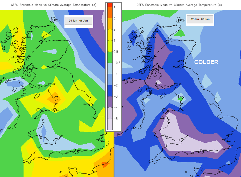 Temperatures around average for most in the next few days but colder next week
What does need watching today is the flood warnings. The river catchment areas including the Welsh mountains still have plenty of water from Storm Henk. This will continue to feed into the river systems and the flood warnings from the Environment Agencies should guide you on peak timings in vulnerable locations. There is a rain warning from the Met Office for Thursday over southern England with 20 to 50mm of rain forecast into the night. We will await the change to drier weather through the weekend with hopefully more sunshine next week although there will be frost, ice and fog for the morning commutes and back to school.
Loading recent activity...