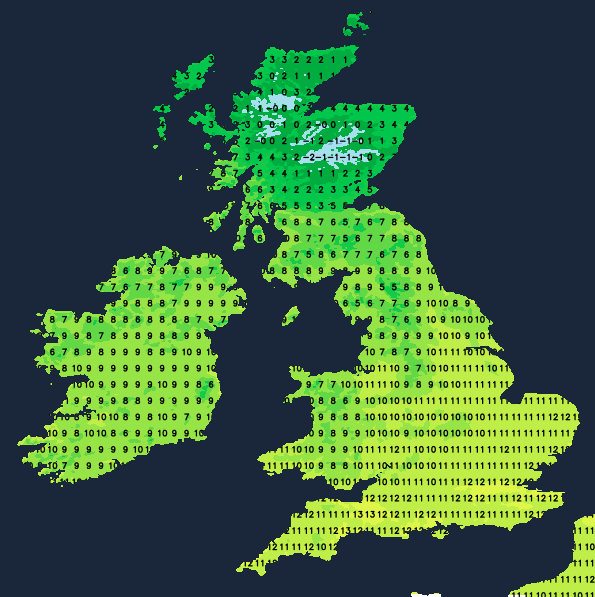
It's Christmas day, it's mild for the vast majority, with patchy rain spreading in from the west through the day, so it's not the most seasonal feel for England, Wales and southern Scotland at least. But, head north and there is some snow to be found - with northern Scotland seeing some accumulations through the day, especially over the higher ground.
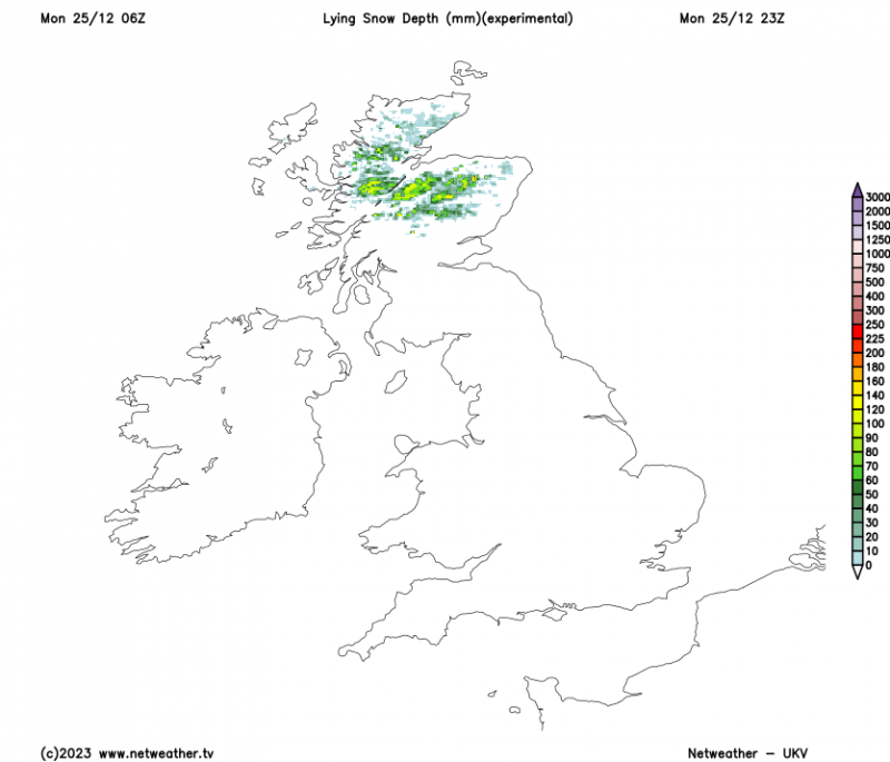 Snow accumulation map for the end of Christmas Day
Yesterday (Christmas Eve) was exceptionally mild for the time of year, and one of the mildest recorded Xmas Eves, with a max of 15.3c recorded in London. With the cloudier skies and rain moving in during the day, it's not likely to be quite as warm today, so the Christmas Day record of 15.6c isn't too likely to be under threat, but even so, highs into the teens are on the cards. It'll not be anything like that in Northern Scotland, though, with temperatures not too far from freezing through the day.
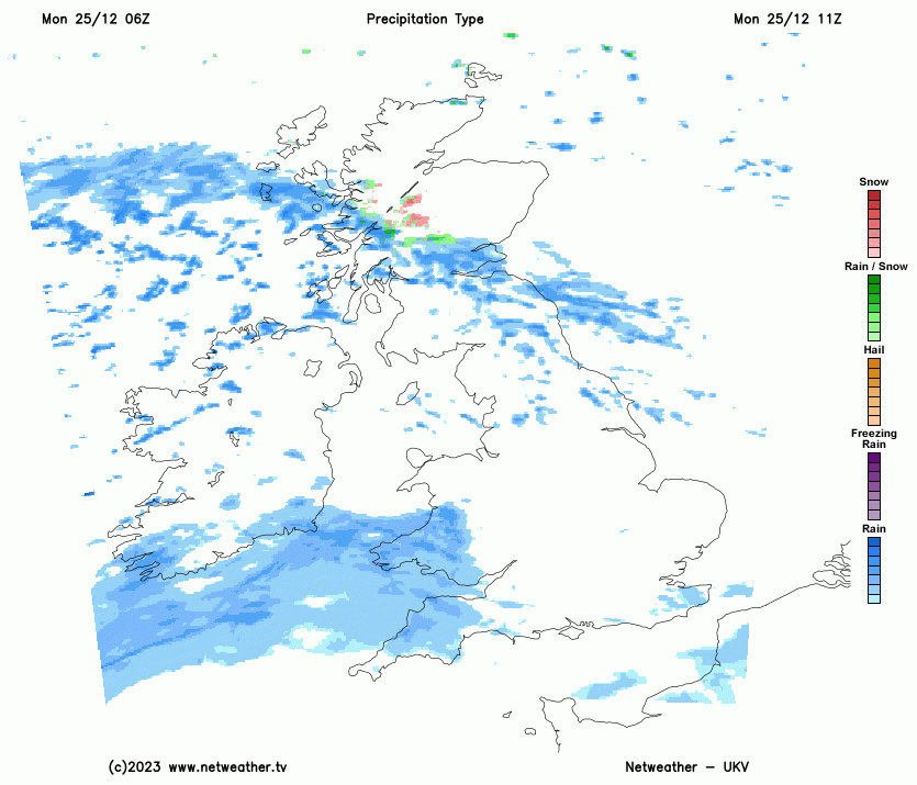
Rain will become more widespread through southern and central parts through the day, with the wintry showers in northern Scotland gradually sliding south at the same time. These will mostly fall as rain over southern Scotland and Northern England once they get that far, but there could be some wintriness over the tops of the hills.
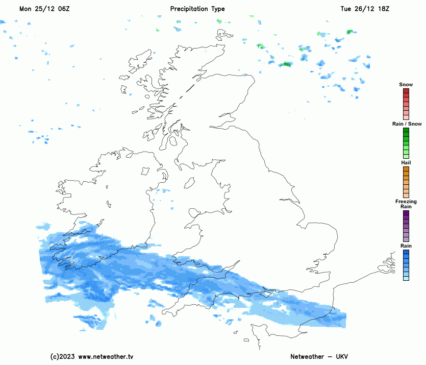
There'll be a few showers leftover on Boxing day, especially in the far north and northeast, but most parts will be dry with sunny spells. The next bout of wet weather will make a move up from the southwest during the day though, and this one has the potential to bring a couple of complications. For much of England and Wales that's going to be in the form of heavy rain (again) - which is going to make travel conditions tricky from late Boxing day and into the 27th. Plus, as it moves further north during the 27th (Wednesday), it's going to bump into some colder air, to also bring the threat of snow. This is liable to particularly affect higher routes in Northern England, but is likely to fall to lower levels as it moves across Scotland.
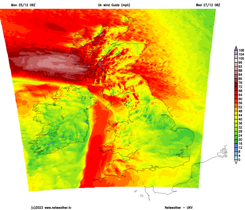
It's going to be windy too, with gales or severe gales possible near to western and southern coasts, and across northern Britain.
Following on for the remainder of the week it'll stay blustery with a mix of sunshine and potentially heavy showers, with the threat of snow at times in Scotland - particularly over the hills.
Loading recent activity...