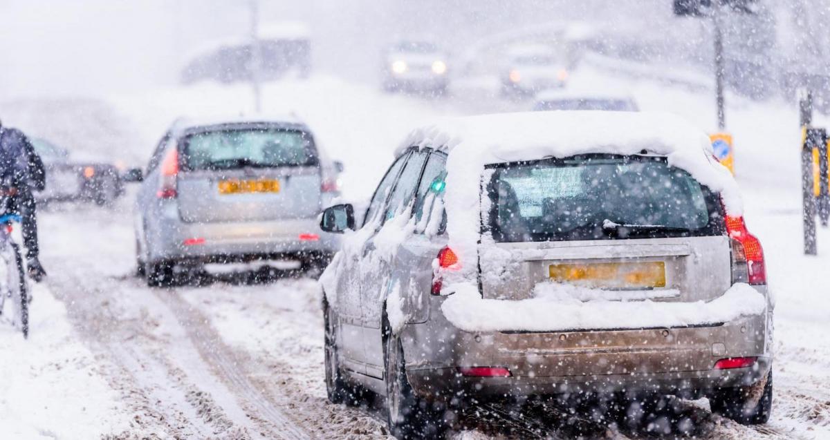
It’s been cold this past week thanks to a cold northeasterly flow from a bitterly cold Scandinavia, albeit the air has ‘warmed’ on its crossing over the relatively warmer North Sea compared to when it left Scandinavia. There has been snow around too, chiefly across northern Scotland and towards eastern coasts of Scotland and England, while Thursday also saw an area of rain moving up from the southwest turn to snow inland across parts of southwest and central southern England, bringing some traffic issues in Cornwall.
It remains cold over the weekend, temperatures today have stayed close to or below freezing all day across many areas, making it an ‘ice day’. And there will be a further risk of snow for some, but there will be a difference to where the precipitation for the snow comes from. Instead of looking east we will be looking west for systems moving in off the Atlantic to bump into the cold air and bring snow.
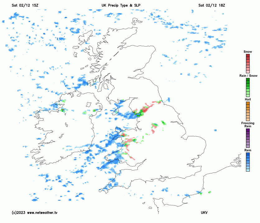
Heavy snow last night across SW Scotland through to the central belt, forced Glasgow Airport to shut its airport for a time earlier today before opening at 10am, causing disruption to flights. Focus this afternoon has turned further south to Cumbria, where a streamer of persistent snow has pushed inland off the Irish Sea forcing the Met Office to issue an Amber Warning.
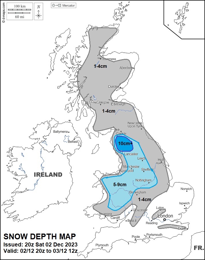
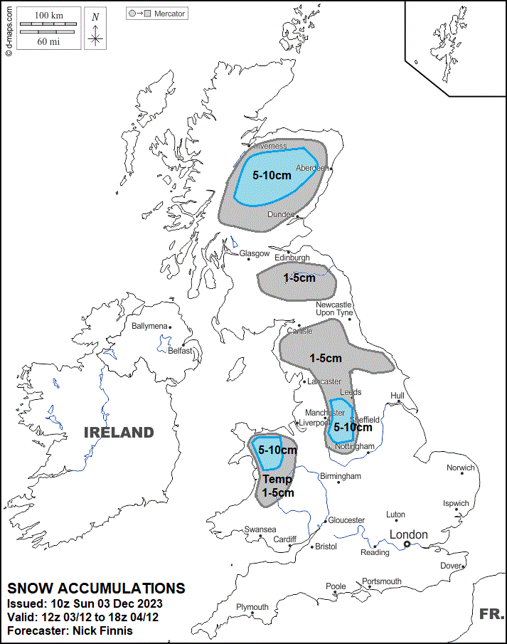
Tonight, a frontal system moves in from the Atlantic, bringing a more organised area of rain, sleet and snow east across England and Wales. The front could bring a few centimetres of snow across inland areas of Wales, northern England and the Midlands by dawn, over the Pennines, Cumbria Fells and mountains of North Wales there could be 5-10cm, in addition to what’s already fallen across NW England today.
Rain or sleet falling further south over southern England, there may for a time, be some freezing rain here, as a warm front moves up from the south and rides over freezing air at the surface. So snow falling from the cloud base turns to rain in the warm air aloft before falling into freezing air near the ground. This could cause some icy conditions before a slow thaw sets in, as milder air mixes in at the surface later in the night.
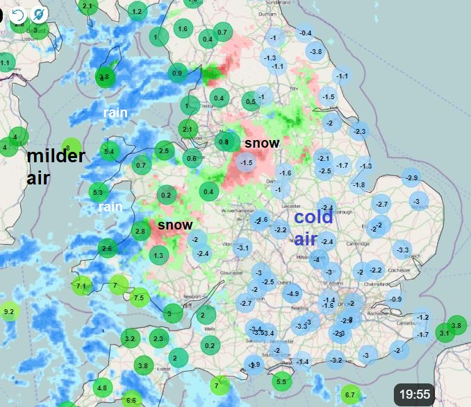
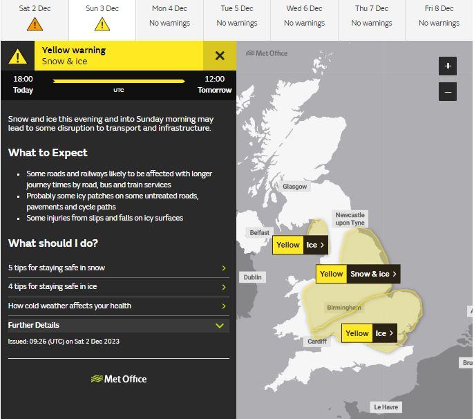
As a result, the Met Office have issued yellow warnings snow and ice for the snow falling overnight across east Wales, the Midlands and parts of northern England. While another yellow warning is in place for SE Wales, South Midlands, East Anglia, London and parts of SE England for rain or sleet falling on frozen surfaces. Especially as much of the country has seen temperatures around or below freezing all day.
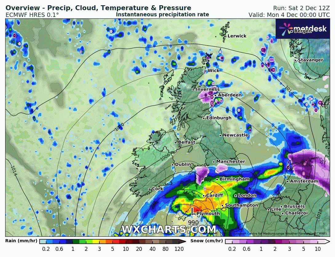
But it doesn’t end tonight. Once the overnight rain, sleet and snow clears east, further showers or longer spells of rain, locally heavy, look to spread northeast across Wales, Midlands and northern England Sunday morning, turning to snow as moves into colder air hanging on towards the north, chiefly over the hills, but perhaps to lower elevations of north Wales and northern England for a time. Then during the evening and overnight into Monday, a deepening low pressure system over the Atlantic looks to move northeast in across SW England by midnight, before moving east across southern England during Monday. This low will spread outbreaks of heavy rain north and east across England and Wales during Monday, reaching southern Scotland in the evening, the rain turning readily to snow across the hills of north Wales and northern England, but also perhaps to lower levels temporarily too. Parts of north Wales and the border areas of Shropshire may see a few centimetres temporarily at lower levels overnight and through Monday morning, 5-10cm over the north Wales mountains along with the Peak District and southern Pennines. Further north, wintry showers affecting eastern Scotland will bring a few centimetres of snow at lower levels inland, over the Grampians 5-10cm.
Elsewhere across S England and East Anglia - rain or sleet. Turning milder across southern England on Monday, perhaps reaching double figures towards the south coast, but remaining cold across north Wales and northern England northwards, with temperatures still in low single figures.
Rain, sleet and snow should clear away east into the North Sea on Tuesday morning, followed by drier and brighter conditions for most, as a ridge of high pressure builds in. But it will be a chilly day in a northerly wind, with a slow thaw of lying snow across northern areas.
Loading recent activity...