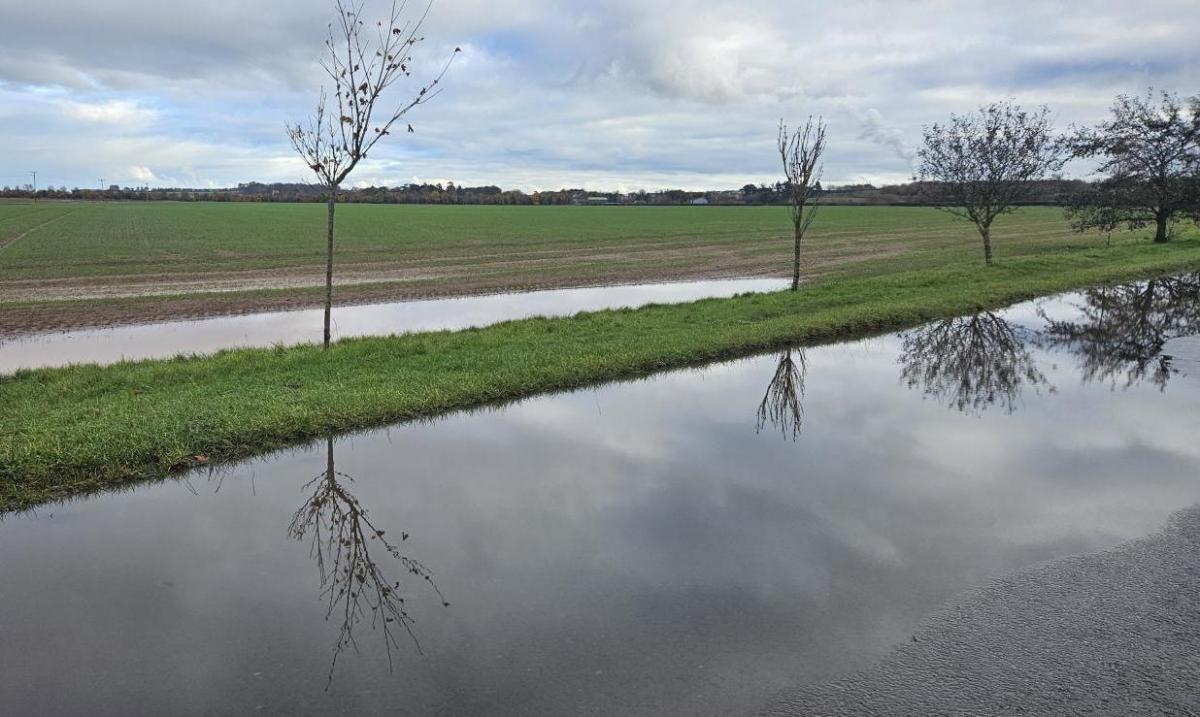
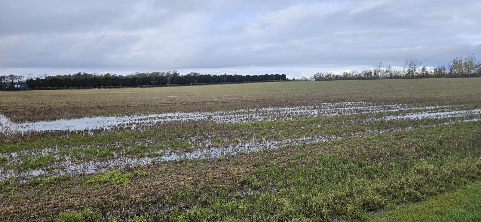
A look at the water situation from October and the conditions for November as any more rain just adds to the local flood risk and boggy conditions on the ground.
The British weather can be tricky to work alongside and for farmers nationwide, it can be a roller coaster from one weather extreme to the next.
There can be too little rain which leads to the expense of abstracting and transporting water to the fields and crops. Too much rain and vegetables begin to rot, crop roots are damaged or the fields become waterlogged and so, difficult to access. This can lead to reduced grazing areas and livestock having to come inside for longer. Or flooded by rivers and the soil quality is affected, or the topsoil just runs off. Too damp and mild can lead to extra pests and disease or too cold and the whole lot is frozen solid. Even if it is warm and sunny, it can get too hot, too dry and wildfires break out. There can be benefits and adaptions for crops and agriculture as seasons vary and our climate changes but for anyone looking at fields this month, or even just walking in the countryside, it is wet out there.
“Eastern Scotland had its wettest October on record, back to 1836, with some counties seeing well over twice their average rainfall for the month, according to provisional Met Office figures.”
“Northern Ireland had its fifth wettest October on record with 191.8mm being 68% more than its average. England had its eighth wettest on record with…63% more than average.” MO

"In addition to some counties in the east of Scotland; Staffordshire, Nottinghamshire and the Isle of Wight also provisionally had their respective wettest October on record. In Northern Ireland, counties Armagh and Down also had their wettest October." MO

Environment Agency said “October 2023: was the wettest October across England since 2000 with rainfall totals well above average across most of England, with almost all catchments receiving above average rainfall.”
Looking back at October overall the Environment Agency said that river flows increased and the majority of sites recorded above-normal monthly mean flows. Groundwater levels increased and the majority of sites were classed as normal or higher. Reservoir stocks increased but some in the south were still showing signs of the dry effects of last year. Soils across much of south-west, central, north-east and north-west England were near or at saturation levels. A wet picture in many places
For the river levels, all indicator sites were normal or higher for the time of year, with the majority of sites classed as above normal. A quarter of sites, predominately in south-west England particularly Wessex, were classed as notably high. Nearly a fifth of sites, mainly in central and east England, had exceptionally high monthly mean flows for the time of year. EA data
As our UK and global climate changes and warms we should expect longer spells of hot, dry weather in the summer and heavier winter rainfall, thinking about the year in only two parts.
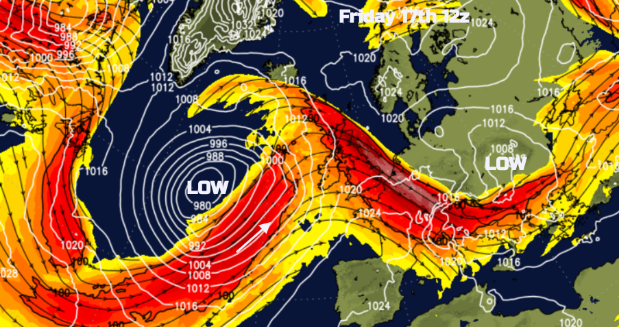 We have had a run of wet weather, although northern France has been clobbered by heavy rain, gales and flooding. The jet stream has been a little further south and brought a succession of low pressures our way.
When the jet is strong and zonal it comes straight across the Atlantic and can deepen lows which zip by. Great meanders can develop and slow down the progress from west to east. Low pressures can get stuck and then bring too much rain, currently, there is a large low pressure edging towards the UK for this weekend, but it keeps on moving by.

Eastern Scotland will remember Storm Babet, just as the Channel Islands recover from Storm Ciaran. In Scotland, there were huge crop losses, flood defences washed away, and potato stores with over a metre of water inside. Crops sown for next year’s harvest had washed away or been destroyed and livestock impacted or even dying in the flooding.
The vice president of the NFU Scotland, said "South Aberdeenshire and down into Angus have been the most badly affected...To try and recover from this financially as well as the mental health impact for farmers and growers is huge." Mr Connon

The twelve-month cumulative rainfall totals were exceptionally high in more than half of catchments across England. The 12-month cumulative rainfall total to October was the wettest since records began in 1871 for the SW Isle of Wight; the West Sussex chalk; the River Test and the east Hampshire chalk catchments in southeast England. Rainfall data for 2023, derived from EA intensity rain gauges. (Source: EA Crown Copyright, 100024198, 2023).
Total reservoir storage increased across all areas of England at the end of October except for southeast England.

Reservoir storage map - "As well as for public water supply, some reservoirs are drawn down to provide flood storage, river compensation flows or for reservoir safety inspections. The Dee system (Wales) has been drawn down as part of reservoir safety works which are expected to continue until 2025."
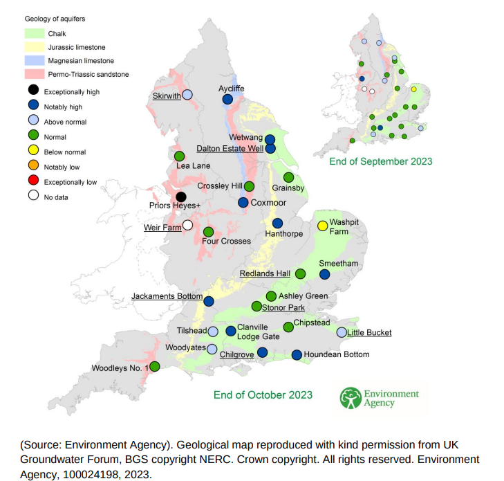
The majority of sites were classed as notably high for the time of year. Groundwater levels for indicator sites at the end of September 2023 and October 2023 Major aquifer index sites are underlined.
 There is more rain in the forecast this weekend but from the more usual westerly direction, particularly for western Scotland. All a bit more back to normal after the eastern focus around Babet.
FORECAST- There will be frontal rain moving eastwards across the UK on Friday night and Saturday, followed by a showery cooler flow for Sunday. There are local flooding concerns, mostly due to the ongoing conditions.
SEPA Scotland “No flooding is expected over the next three days, however there is a possibility of some localised impacts in the west on Saturday due to heavy rain. Localised property flooding, flooding of roads and disruption to travel are possible.”
Natural Resources Wales: low risk on Saturday “Local flooding from surface water and from rivers is probable across parts of South and Mid Wales on Saturday, and possible for parts of Mid Wales on Sunday. Land, roads and some properties could flood and there could be travel disruption.”
Environment Agency: Local flooding from surface water is probable across parts of South West and South East England on Saturday, with local flooding from rivers possible in these areas. Local flooding from rivers and surface water is also possible across parts of North West England on Saturday and Sunday. Local groundwater flooding is possible in parts of the South of England throughout the next five days.
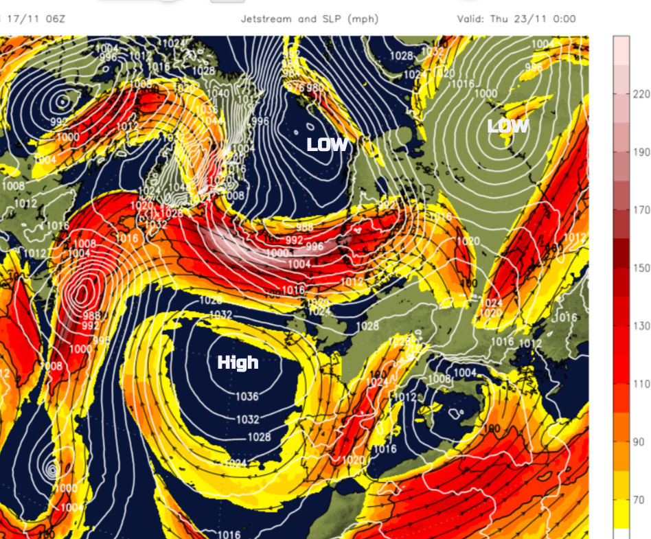 There does look to be a change in the current pattern, the jetstream forecast looks like it has been shaken up and dumped over the chart in random pieces by next week. There is a high pressure lurking out west drawing down some cooler air to the UK with a bit more frost and even the change of snow for northern mountains.

The Env Agency outlook “For the 3 month period for the UK from November to January there is a higher than normal likelihood of wet conditions, with spells of wet and windy weather throughout the period.” It’s not showing signs of a settled high pressure this month nor significant dry, settled weather yet a bit of a lull for next week thanks to the Atlantic high. It could be closer but at least it's a change.
“Improving farm resilience through climate change adaptation will be vital in ensuring that the agricultural sector is prepared to deal with these conditions in the future.” Farming for a better climate