
There are numerous warnings for Saturday across the UK, for wind and rain from Babet, including the reappearance of a Red warning for heavy rain over eastern Scotland. The good news, after this extended event, is that there will be some respite on Sunday. Lighter, westerly winds, bright even sunny skies and drier weather for the flood-hit regions.
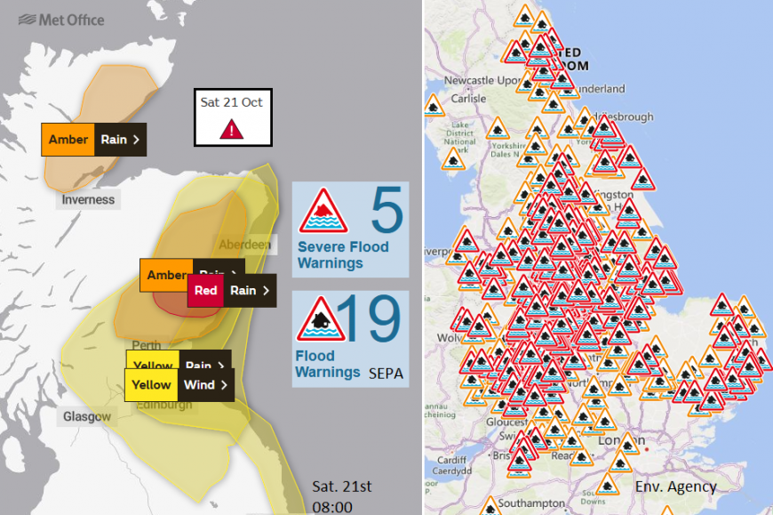
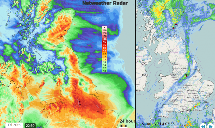
However before that, we have more heavy rain and lots of flood warnings with five severe flood warnings in eastern Scotland. Parts of the town of Brechin in Angus had to be evacuated and water flowed from the breached river on Friday. Major roads were flooded and closed with widespread disruption on the rail network. Sadly, two people have died in Storm Babet. More of northern England and the Midlands were hit by flooding on Friday with road closures and large amounts of water.
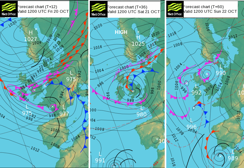
There are occluded fronts straddling Britain which have brought heavy and persistent rain, driven inland on brisk easterly winds with large waves along the North Sea coast. To the north of these bands, there have been strong and gusty east winds with plenty of showers off the sea. As southern Britain sees lighter winds, some clear spells but a scattering of sharp showers from the southwest tonight, the push of very wet and very windy weather begins to rotate back to northeast Britain.
Eastern Scotland will be back under Amber or Red rain warnings with more heavy rain adding to the already difficult conditions. Another band of rain will swing down through Wales and the southwest of England with heavy, even thundery showers moving over southern counties of England towards London and Kent. There is a slow drift of this unsettled weather towards eastern England through Saturday with drier weather behind but a cooler feel in a northwesterly flow. Northern Ireland will see a scattering of showers on Saturday but also bright spells and a cool NW breeze.
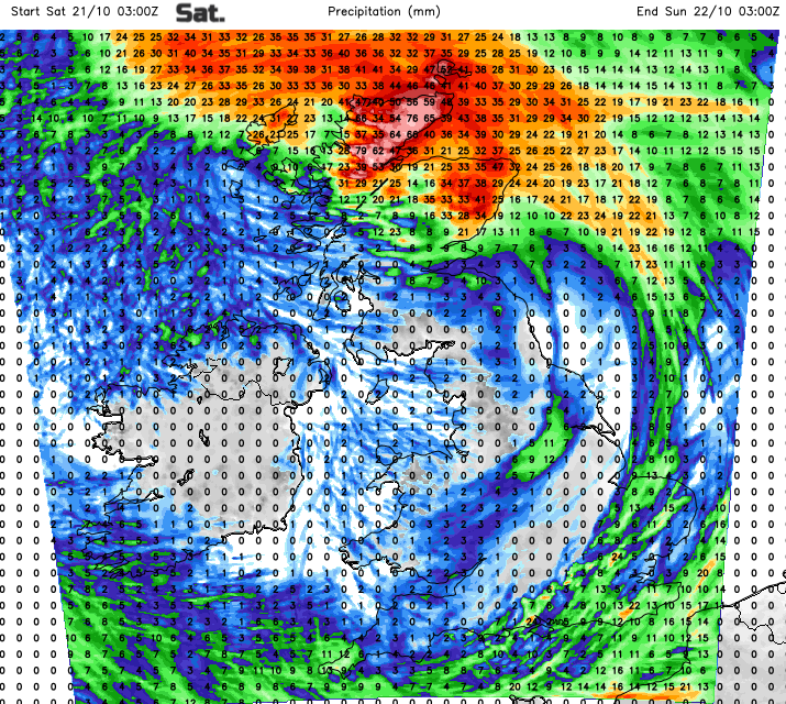
Forecast rainfall totals for 24 hours early Saturday and into Saturday night
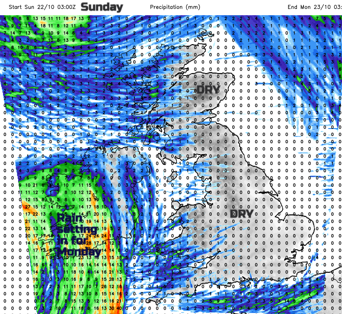
Forecast rainfall totals for 24 hours early Sunday- becoming drier slowly, through til early Monday with Atlantic rain reaching Ireland
The heavy rain will continue for NE and northern mainland Scotland with strong winds. Gradually all of this rotates away to the northwest and leaves behind a cool, clearer picture. There will be a scattering of showers from the west on Sunday but overall, it will be a much better day with brighter skies and lighter winds from the west. Quite a change.
Loading recent activity...


