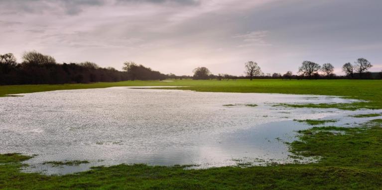
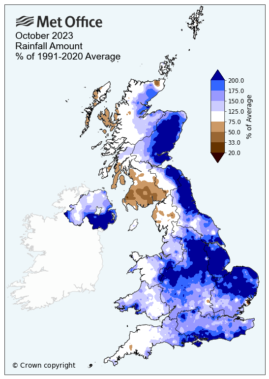
Following a wet October across most areas, and a wet start to November, with numerous flood warnings in force across parts of the UK, some might be wondering whether there will be a break in the unsettled weather to bring at least a few dry days.
A wet October and November so far ...
The good news is after today, it will turn drier and sunnier for a few days across more eastern areas, however, showers will affect more western areas. Rain looks to return on Wednesday, followed by showers on Thursday. Friday could turn drier away from coasts and Saturday could repeat this too, but it does look like unsettled, sometimes wet and windy weather will return at some point next weekend. Unsettled and mild conditions look to prevail through the rest of November too, looking at longer range output.
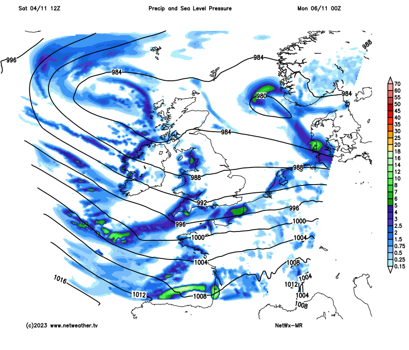
More rain and showers have affected most parts of England and Wales today, thanks to a deep depression, named Storm Domingos by the Spanish Met Service (AEMET), moving across southern England this evening. Very strong westerly winds on the southern flank of the low have slammed into the Atlantic coast of France and also the north coast of Spain, with a gust of 132km/h (82mph) on the Isle d’Yeu off the west coast of France, while Bares in the extreme NW coastal area of Spain recorded a gust of 155km/h (96mph).
However, unlike Storm Ciaran, wind is not such an issue across the UK today, but additional rain its brought is not welcome to areas that are under flood warnings now or recently. Thankfully, Sunday should be drier for eastern areas, thanks to winds turning westerly or northwesterly in wake of Storm Domingo moving east, but this will favour western areas to see showers.
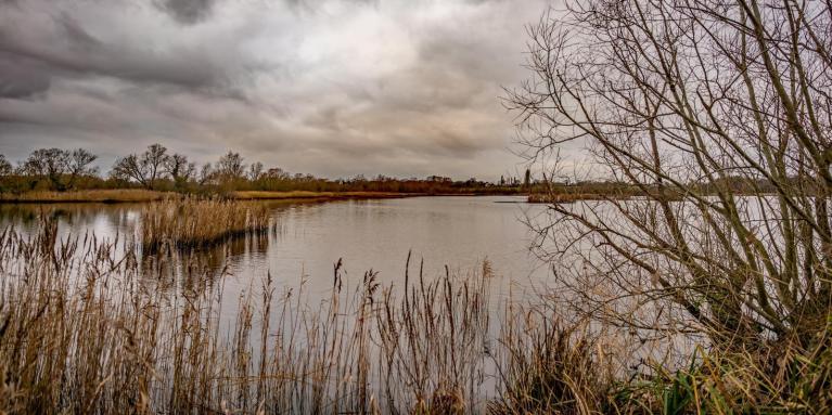
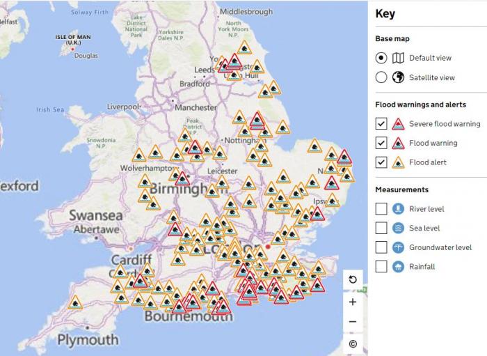
Plenty of Flood Warnings in force across England, but mostly in the south and east
Monday and Tuesday are actually looking mostly dry and bright or sunny too away from western coastal areas – which will continue to see scattered showers of the sea as the brisk and blustery westerly wind continues.
Drier away from western coastal areas first half of next week, then rain followed by showers the rest of the week
But, another Atlantic frontal system arrives from the west for mid-week, with quite a compact low embedded within it, this looks to cross the whole of the UK with a band of rain west to east on Wednesday. Following will be an increasingly windy and showery westerly backing southwesterly flow – as an Atlantic depression reaches the west of Ireland by Friday. So sunshine and showers for Thursday, heavy with thunder around southern and western coastal areas. Showers easing to coastal areas Friday, with most inland areas dry and bright as brief ridge of high pressure builds over Ireland, a cool northerly wind develops too, so could be a frost first thin Saturday morning.
Some uncertainty over how long the brief ridge of high pressure holds into the weekend, GFS very keen to return us to the more mobile, windy and sometimes wet Atlantic low driven regime on Saturday. ECMWF delays the return until late on Sunday – so could be a fine weekend with showers limited to coasts, or could turn wet and windy.
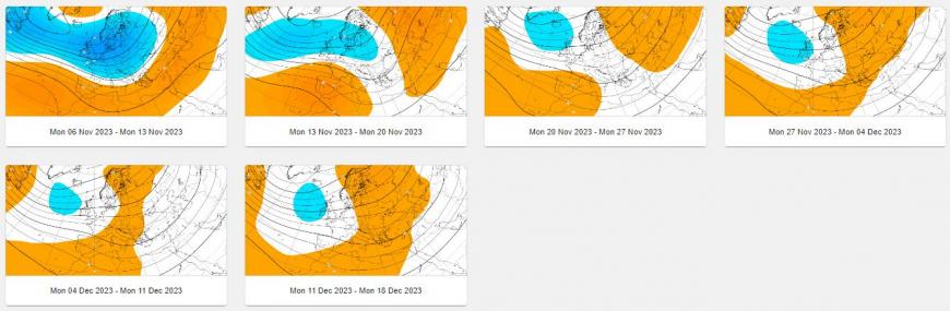
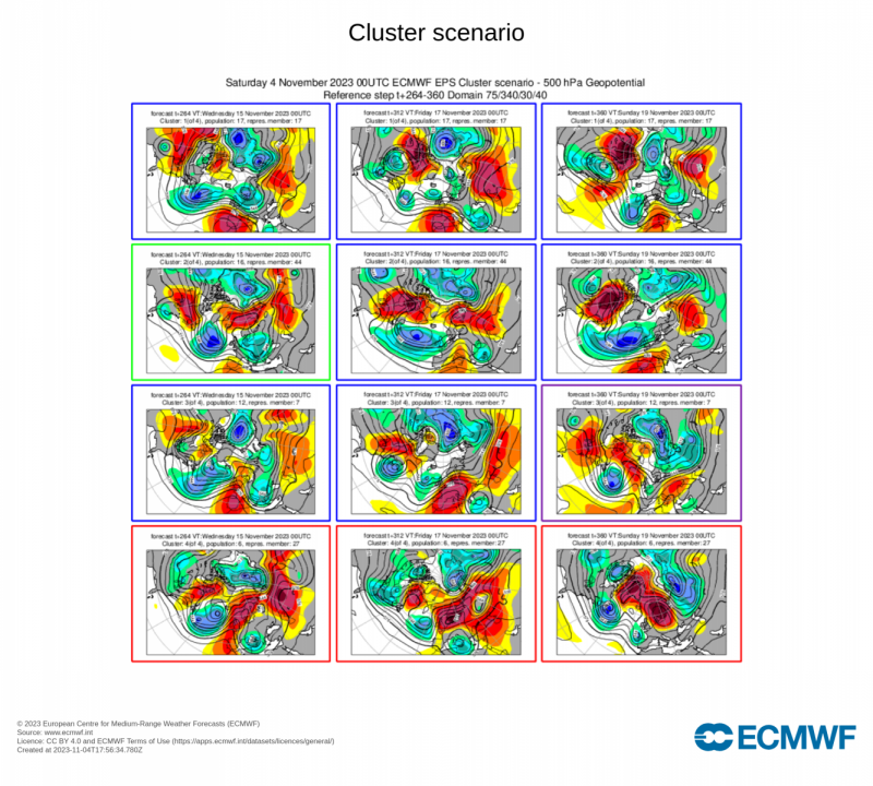
What there is fairly good confidence on in the broader picture is for unsettled and mild weather to continue through the rest of the month, dominated by an upper trough in the means close to the west and northwest of Britain and a conveyor of Atlantic lows moving across or close to the UK and Ireland much of the time. Only brief ridges of high pressure building in between these lows, bringing the odd mostly dry and calmer day here and there. But in general, an unsettled outlook looks more likely than not, with temperatures a little above average with the wind from the southwest much the time. This is the picture from the most recent ECMWF long range weeklies, with a mean upper trough close to the west or northwest. While the twice daily ECMWF cluster scenarios also point to Atlantic troughing dominating NW Europe, with a classic +NAO (positive North Atlantic Oscillation) which signifies a mild and low pressure-dominated conditions for NW Europe.
EC weeklies for 500mb heights through to 18th December show upper trough close to or over UK through to end of the month and into early December too. This means staying unsettled and wet at times.
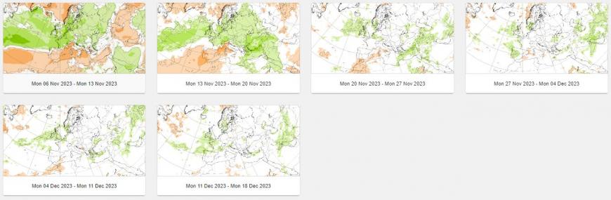
EC weeklies for rainfall show wetter than average next few weeks, then more average after.
EC clusters out the 18th November mostly support upper troughing dominating the UK weather
This is not good news for areas prone to flooding which have been under flood warnings recently, particularly southern areas of England. But many areas have saturated ground, so flood warnings may become more widespread through the month, with an increase in flooding unless we get a week of dry weather, which looks unlikely given the entrenched pattern likely.
Loading recent activity...