Despite a dry first ten days of the month, the last few weeks have more than made up for the dry start, with many areas now close to or above the October rainfall average. Some places are well above the average, seeing over 175% of the usual monthly total when there was still a week to go, and more rain in the forecast.
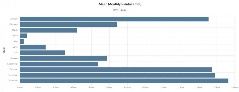
October is one of the wettest months of the year, the 1991-2020 UK average is 123.3mm, following closely behind November with 124mm and the wettest month on average, December, with 127.8mm. Compare this with the driest month, May, which would average 70.9mm.
Obviously, there are big regional variations, with western areas, on average, seeing more rainfall than eastern areas – particularly with higher ground exposed to the prevailing moist west or southwesterly flow, such as SW Moors, Wales, NW England and western Scotland. Below are these regional variations of the October average.
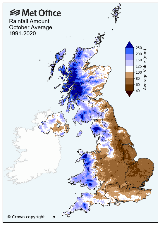
However, although this month has been wetter than average for the UK as a whole and for England, Wales and Scotland individually, the month so far has reversed the usual trend for the west to be wetter than the east – this is more evident across Scotland, northern England, Lincolnshire and East Anglia. While for some areas in the west, rainfall has actually been below average, as the October 2023 rainfall anomaly so far map below shows:

Data courtesy of Starling Roost Weather
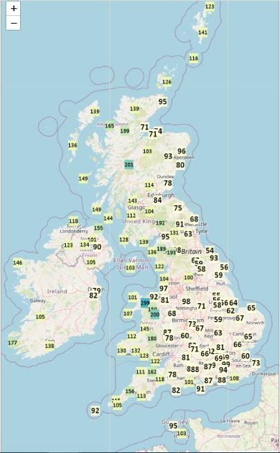
Actual rainfall totals so far this month
Data courtesy of Starling Roost Weather
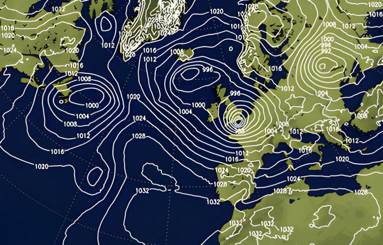
The recent extreme rainfall totals have been over eastern Scotland, the eastern side of northern England and East Anglia. Slow-moving weather fronts were part of the blame for the high rainfall totals, whose progress was slowed by strong high pressure over Norway, especially in the case of East Anglia, Lincolnshire and South Yorkshire. But also the flow of moist air on persistent southeasterly winds that accompanied the fronts favoured high rainfall totals over east-facing upslope areas of higher ground of northern England and eastern Scotland.

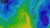
UKV 24 hour forecast rain totals
More rain is on the way, with low pressure generally sitting close to the west over the next 7 days. More significant rainfall, mostly from heavy showers, will affect southern and western coastal areas across England, Wales and Ireland. But for Scotland, because of the position of low pressure close to the west of Ireland over the weekend, the flow will again be from the southeast here. This will favour eastern Scotland seeing the highest rainfall, as the moist southeast flow is forced upwards by the eastern Grampians, creating a lot rain again over east-facing slopes, as it moves inland from the North Sea. This area saw over 150mm in places in 24 hours and significant flooding recently, so could do without this extra rainfall. Hence a yellow rain warning is in place over eastern Scotland for the next four days.
ECMWF Rainfall accumulations over the next 7 days
But there is a risk of flooding elsewhere, particularly southern and western coastal counties exposed to frequent heavy showers moving in off the sea on southwesterly winds. With seas around the UK and most of the North Atlantic seeing above average sea surface temperatures – the more warmth, the more moisture the air can hold. So when it rains, it’s often heavy, sometimes torrential.
Loading recent activity...