Many early risers will have woken to their first grass frost of the coming winter this morning, but until yesterday, what an unusually warm October we've had. Yesterday, in fact, was the first time this month that nowhere in Britain reached 20C, a truly remarkable statistic for so late in the autumn. But It was Friday that brought the change, when a cold front finally pushed the high temperatures away to the South. Although not before parts of the Midlands saw more than half the month's average rainfall in less than 20 hours.
With conditions now much more akin to autumn and despite a good deal of sunshine for most, temperatures will be down a little again on yesterday. Although predominantly dry and fine today, the North and West of Scotland and mostly coastal areas exposed to the West and North will see a few passing showers that'll be wintry across the Scottish mountains at first.
After the cold start with the thermometer as low as -3 or -4C first thing around Shap and some other rural parts of Cumbria, temperatures will take a while to recover. However, with a West or North Westerly wind lighter than yesterday, it'll feel pleasant enough in the sunshine by the afternoon. Still, top temperatures of only 8 or 9C in the far North and 11 to 12C in the South will be below average for mid-October.

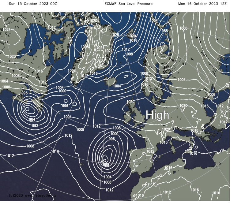
After dark, there'll be some patchy cloud, mainly over the North and North West of Scotland and across the North of Norfolk, where a few showers are still likely. But as an anticyclone becomes established across England and Wales, most places have a dry night with clear spells. There'll be another ground frost in places and a slight air frost in the coldest spots by morning, and with generally light winds, mist and a few fog patches will form towards dawn in rural areas as temperatures fall to between -2 and +3C.

The new working week begins fine but cold, but there'll be a few exceptions. The far North of Scotland continues to see showers, with a few patches of cloud drifting about elsewhere in another predominantly dry day. Mist, patchy fog and very low cloud make it grey and murky initially for some. It may also take a while to lift and clear, but it'll be fine again with sunny spells for most. Winds generally remain light, with top temperatures across the country mainly in the range of 10 to 13C.
After dark, the far North of Scotland continues to see a few showers, with an easterly breeze beginning to develop in the far South. For most, it stays dry, with a mix of patchy cloud and clear spells in light winds. It'll probably turn misty fairly generally, with patchy fog and maybe a touch of frost again in places. However, it shouldn't be as cold overnight, with the lowest temperatures mainly between 2 and 6C.
High pressure keeps the bulk of the country fine and dry until mid-week, although cloud amounts will vary, with patchy mist and fog mainly in the North. By Tuesday, easterly winds will freshen in the South, eventually spreading to all parts. This'll bring outbreaks of rain up from the South, with the week ending on a much more unsettled but milder note.
Loading recent activity...