High pressure over Scandinavia has brought a largely fine and sunny Easter Weekend, Saturday saw the warmest day of the year so far in Scotland, with 17.3C at Kinlochewe, not as warm today with more cloud, though this afternoon temperatures have reached 16C in the sunnier south of England.
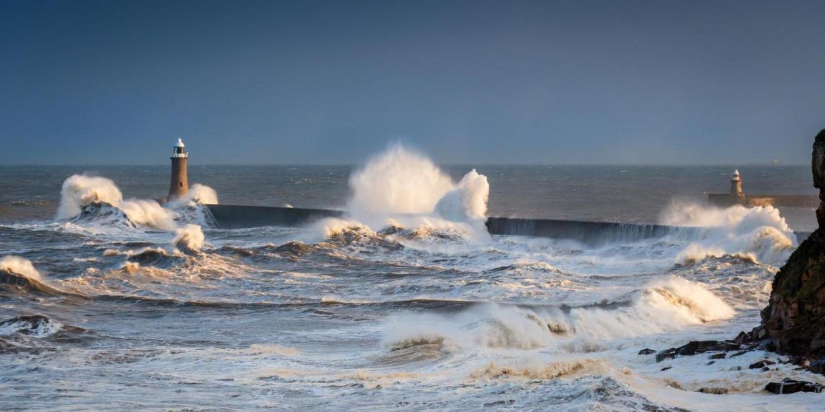
However, the high close to the northeast responsible for the fine weather will retreat east to allow low pressure in from the Atlantic to dominate our weather for the rest of the week, bringing unsettled conditions, with spells of rain or showers and windy at times too. An unseasonably deep area of low pressure looks to develop to the west on Tuesday and swing in across Scotland by Wednesday - bringing a spell of wet and windy weather across the British Isles from late Tuesday and through Wednesday, with a risk of gales across southern and western areas, with the potential for disruption. The Met office have issued yellow wind warnings
Strong jet stream takes aim at the UK, pushing away high pressure close to the northeast and introducing unsettled conditions:
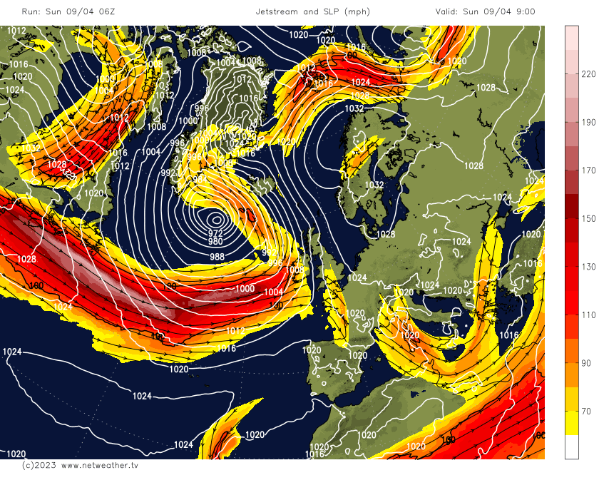
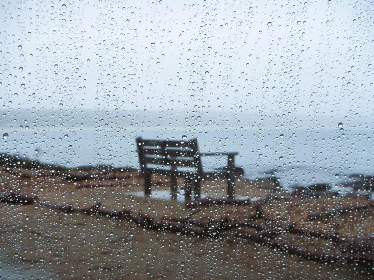
A strong westerly jet stream arriving off the Atlantic from tonight will bring the change to unsettled weather in the week ahead. A frontal system heralding this change has brought cloud and outbreaks of rain east across the island of Ireland this afternoon and is now spilling across the Irish Sea and in across western Scotland early this evening. The outbreaks of rain will spread east across most parts tonight, clearing the east Monday morning to be followed by windier conditions with sunny spells and blustery showers – some of which will be heavy with hail and thunder.
Then on Tuesday, further showers around southern and western coasts at first, before a spell of wet and increasingly windy weather spreads from the southwest across England and Wales through the afternoon and evening. Gales possible across the southwest, with 35-50mm of rain falling in places.
Vortex of cold air moving over the Atlantic originating from northern Canada will deepen an area of low pressure which will bring gales mid-week:
The wet and windy weather will be brought by a frontal system moving ahead of a deepening low moving east over the Atlantic towards the north of Ireland on Tuesday. The low looks to deepen in response to a cold upper vortex originating over northern Canada and moving out over the far North Atlantic early next week, which steepens the thermal gradient / baroclinic zone to allow a low to form and quickly deepen ahead of it. The deepening low moving east across Scotland on Wednesday.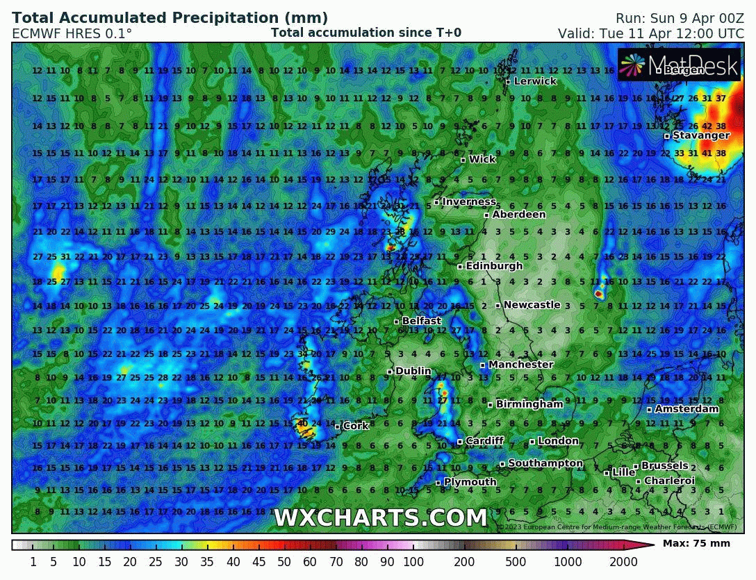
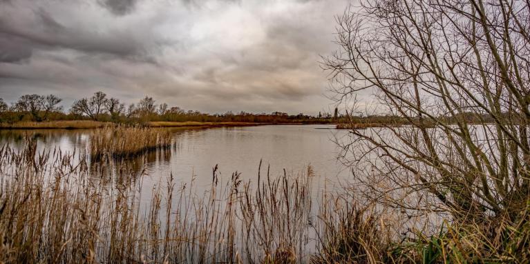
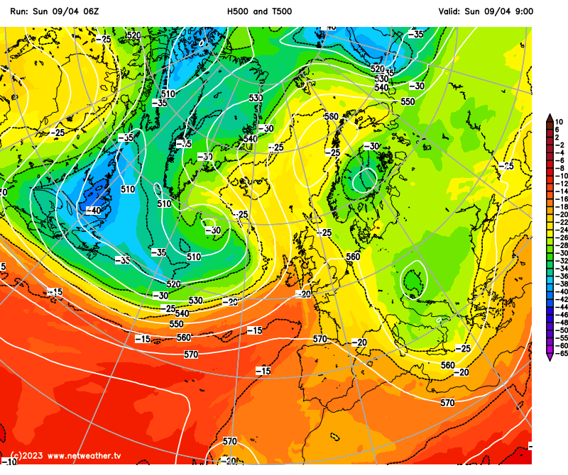
The spell of heavy rain should clear most of England and Wales Tuesday night but looks to linger across parts of Scotland as it pivots around two low pressure centres that move in and eventually merge with each other to form one fairly deep low for April just off the east coast of Scotland at noon on Wednesday. The rain could be heavy and persistent from the central belt northwards and looks to turn to snow too over the Highlands, as colder air undercuts in from the north as the low moves towards the North Sea.
Quite a steep pressure gradient looks to accompany the low pressure system on its southern flank as it tracks east across Scotland on Wednesday, with gusts of 60-70mph look possible over exposed hills and coasts of western and southern coastal areas, 40-50mph gusts possible inland across the west.
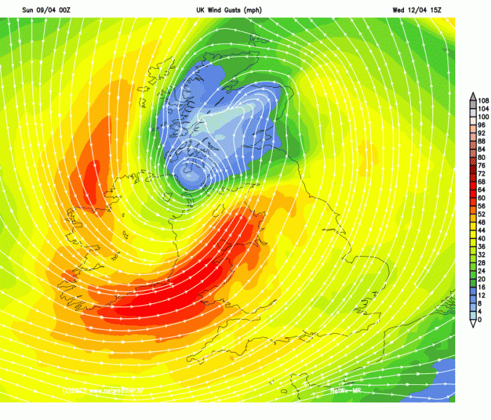
The Met Office have issued two wind warnings covering Tuesday afternoon and through Wednesday. One warning covers Irish coast of Northern Ireland, SW Scotland, NW England, Wales, western and southwestern England for the period Tuesday 3pm to Wednesday 6am. The other warning covers south Wales, SW and southern England for the period Wednesday 6am to midnight.
Wednesday’s deep low will move out over the North Sea and weaken on Thursday, but will still be close enough to bring a classic April showers day for many on Thursday. Another low, though not looking as deep for now, looks to move across southern Britain on Friday, bringing more rain. However, the track of this low is uncertain for now. ECMWF takes the low east through the English Channel, with just south Wales and southern England seeing rain, GFS further north taking the low across Wales and Midlands.
Loading recent activity...