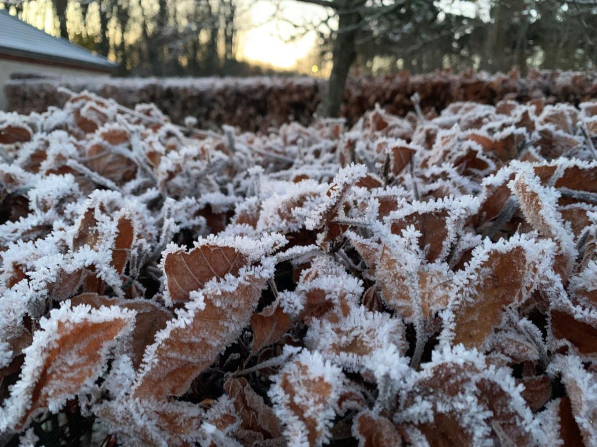
Next week looks colder with a northerly wind and snow for some parts of the UK. February was very dry and also mild overall. The frosts return.
The provisional statistics for February 2023 have been issued by the UK Met Office and show a dry, mild month. Exceptionally dry for large areas. The start of March and meteorological spring looks colder than average as a northerly flow sets in from the Arctic. This north wind will bring snow but currently, details of where are proving elusive beyond a cold showery flow clipping exposed coastal areas and hitting the far north of Scotland. You could imagine lively troughs pushing southwards and maybe a little low pressure running across southern Britain against the cold air to enhance the nervous excitement snow lovers have bubbling up for next week. There are snow signs and ingredients but little certainty for exact locations.
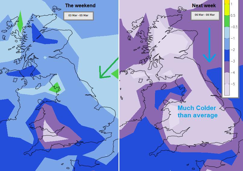
Without the usual west to southwesterly flow, SW Britain has been colder than average for the start of March. Once the northerly winds set in,everywhere will be much colder than average for the time of year.
High pressure over England in February led to a lot of dry weather as the high blocked the usual Atlantic weather systems from bringing frontal rain across Britain. Wales saw MSLP readings of 1048hPa on Sunday 5th February and high pressure remains important as March begins.
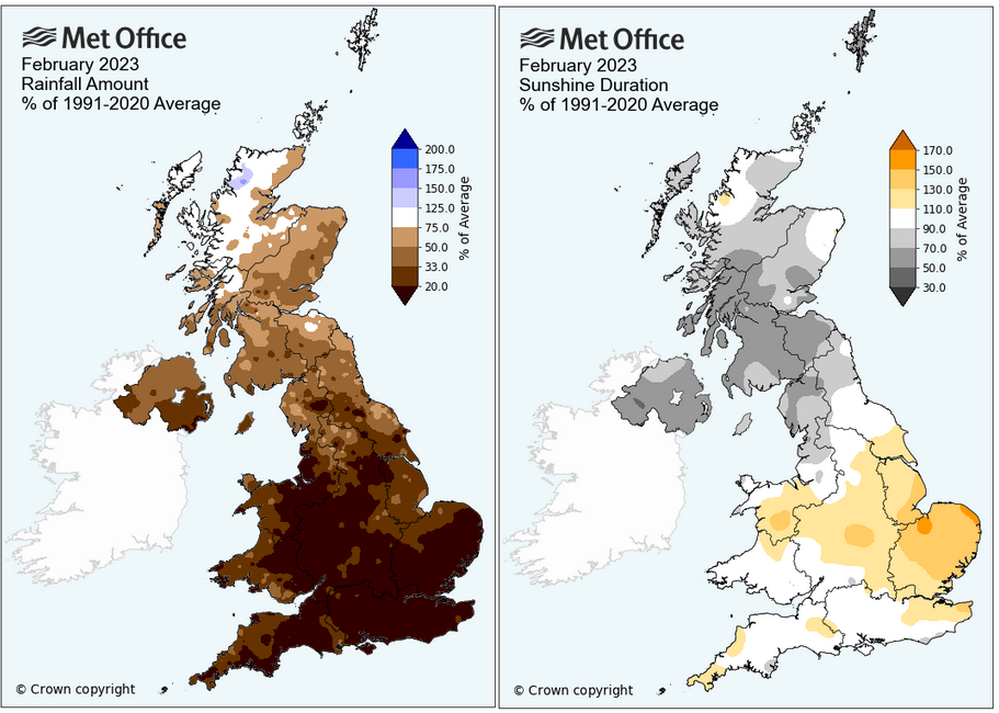
France also had a very dry February thanks to the same anticyclone. England saw its driest February in 30 years and much of the UK was drier than average, except for NW Scotland.
“Areas to the south and east (of the UK) were particularly dry, with Bedfordshire, Greater London and Essex all recording figures to put the month in their respective top five driest Februarys on record.” Met Office
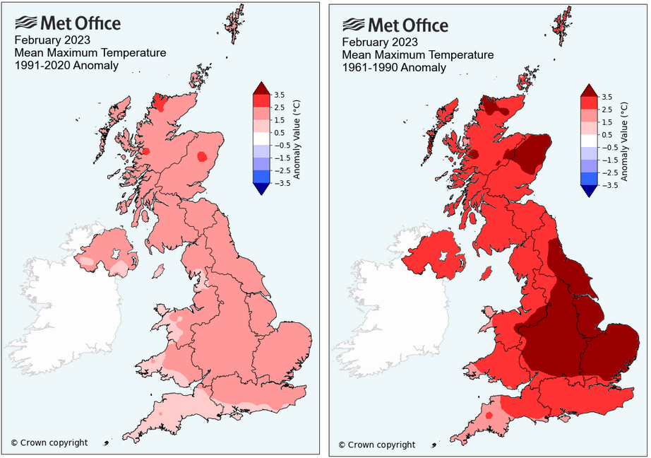
It was also mild across the UK, the joint fifth mildest February with records going back to 1884. Scotland had its third mildest February on record and Northern Ireland had its fourth mildest. East Anglia was sunnier than average under the high pressure and Northern Ireland with Scotland were duller.
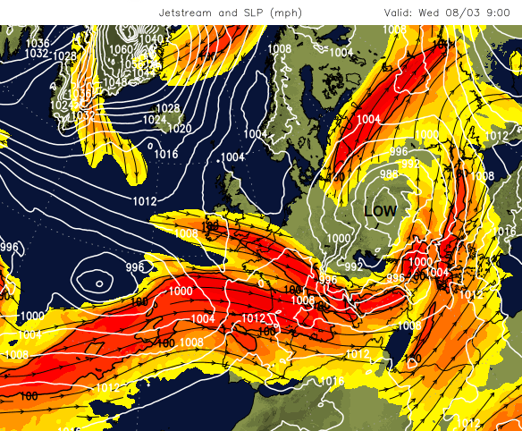
We’ve had two Sudden Stratospheric Warming (SSW) events and the forecast shows high pressure building towards Greenland. The Jetstream looks to sink southwards and further low pressures move over more southern parts of Europe. Storm Juliette has already brought wet, windy and wintry weather to Mallorca and it looks another significant low will move over Italy in the middle of next week.
The SSW is an upper atmospheric event and forecasters have been waiting to see if that change leads to a shift in the lower atmosphere. It’s called coupling, a joining up in the behaviour of the two layers. Back in 2018, as high pressure slid over Scandinavia after an SSW, intense cold fed around that high from Russia and NE Europe. This time, with the high pressure in a different location, there will still be a shift to colder conditions but it’s a northerly flow, not a ‘Beast from the East’.
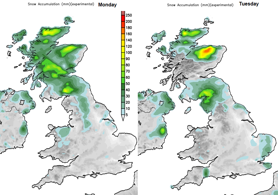
We’re creeping further into March as well, so more daylight is on offer but it will be cold by day with frosts overnight. There will be snow for some areas, but not for all of the UK.