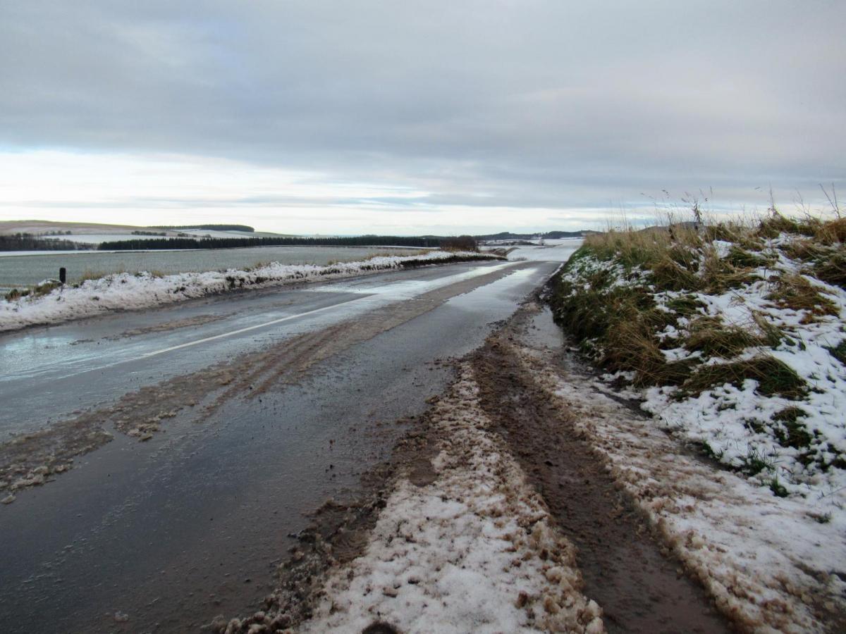
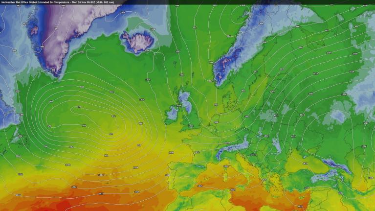
It’s mid-November, and there is a chill in the air with an ice warning for parts of northern Britain, sub-zero temperatures down to -6C in the Highlands and a Met Office warning for snow tonight.
Before anyone goes into a Daily Express panic and cracks open their three-day emergency supply of Weetabix and UHT milk, it’s a yellow warning with a high (50-75%) likelihood and a moderate impact.
Daily Express says “Met Office issues snow warning as huge parts of UK face blizzards this week- 7 regions hit”
The Met Office says “Snow may cause disruption on high ground during Tuesday morning” and, relating to moderate impacts “Some transport routes and travel services affected. Some journeys require longer travel times.” Which isn't as dramatic.
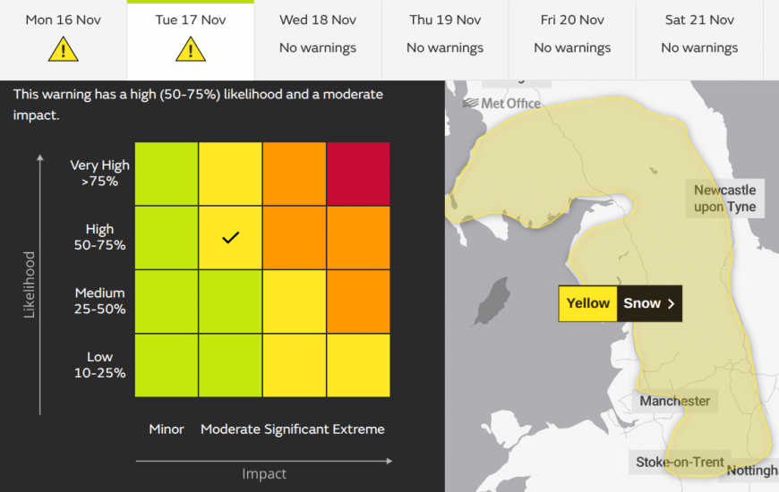
Met Office yellow warning for Snow Tuesday 17th midnight til midday. The regions highlighted are: East Midlands, NE England, NW England Strathclyde, SW Scotland, Lothian Borders and Yorkshire.
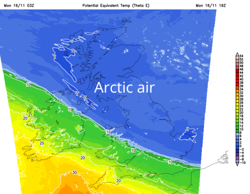
There is cold Arctic air from the north but an incoming Atlantic weather front from the southwest bringing rain on Monday. As the two collide later on Monday, the leading edge will turn wintry. Snow over the high ground of a central swathe of Britain is possible, and sleet or lying wet snow to lower levels for a time on Tuesday morning, but there is uncertainty.
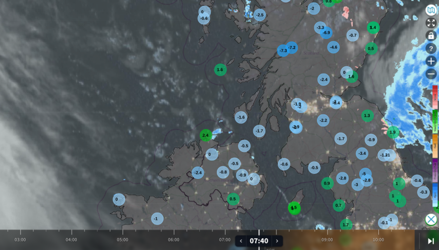
The Netweather radar from before 8am shows the low temperatures inland for Scotland this morning. A circulation over the North Sea which has brought rain, sleet and snow showers to northeastern Scotland overnight, brushed SE Scotland and continues to clip the coast of Northumberland. Showers will pass Newcastle and the North Yorkshire Moors this morning with a cold breeze along North Sea coasts. Over much of the UK there are clear skies, which enabled temperatures to fall away but mean a fine, sunny start for many. Even if it is frosty. You will notice on the left-hand side of the radar and satellite image, white cloud. This is the high cloud ahead of a new Atlantic low pressure and the precipitation bands which will collide with the cold air on Monday night.
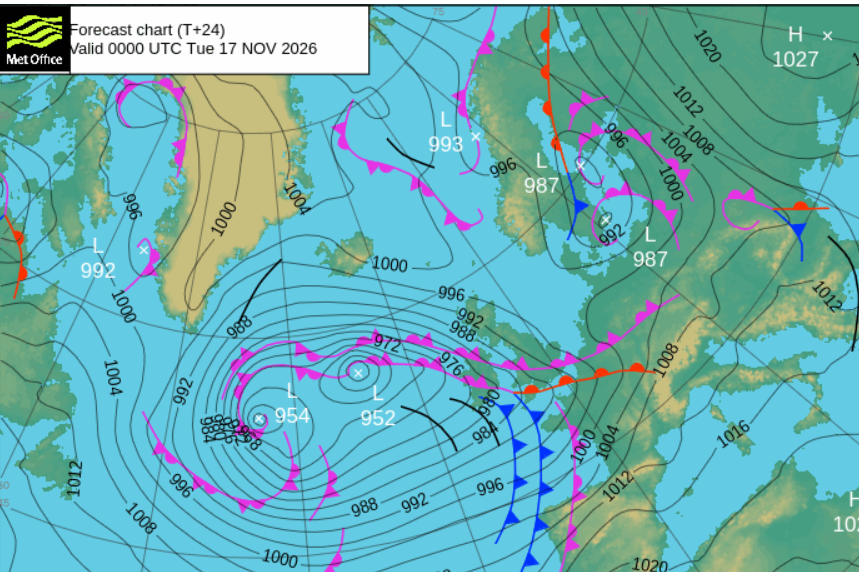 Monday
For most a good part of the day will be fine, cold with light winds but sunny and dry. High cloud will arrive over Northern Ireland, and it won’t be as cold for SW Britain. Southampton and Exeter should reach 9C as Newcastle and Edinburgh stay at 4C.
A southwesterly wind will pick up by teatime for Northern Ireland, western Wales and SW England, with afternoon rain over Cornwall and Devon. So with the breeze and damp conditions, it will also feel cool.
Now comes the tricky part, we have an incoming front with heavier pulses in the band of rain. There will be snow over the tops of the Welsh mountains. The UKV model shows the front edge of the rain reaching the Peak District and the Yorkshire Dales around midnight and turning to snow. Also along the Pennines, the Cumbrian Fells and the Southern Uplands.
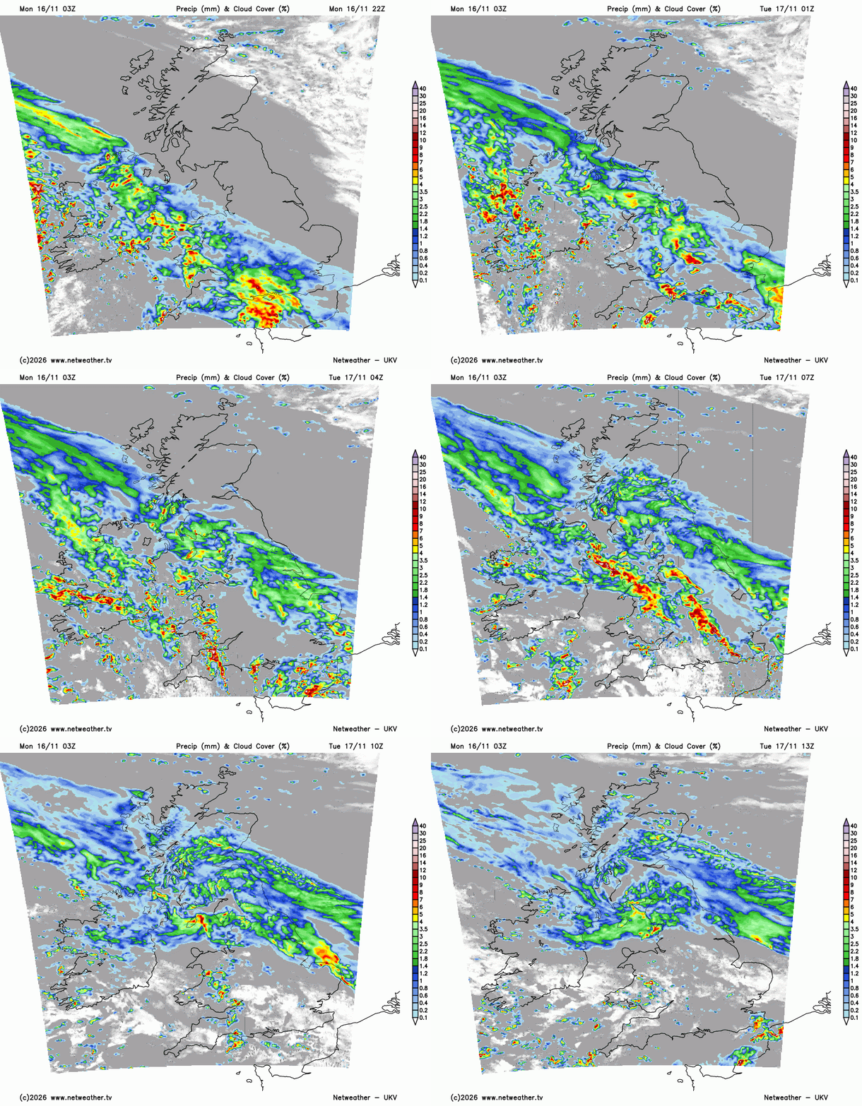
UKV model showing precipitation band heading north tonight
It will be windy with gales around the Irish Sea and for the west coast of Scotland. The rain band continues northwards with snow for the higher ground of central Scotland, but further south there will be more rain. There is uncertainty as heavier rain could turn to snow as it meets the cold air, but we have more rain behind which might just leave a wet picture for Tuesday morning. Rather than an excitement pulling back the curtains to see white stuff.
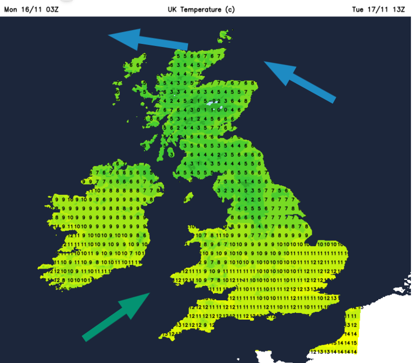
Tuesday
By Tuesday, the rain band will be over Scotland, Northern Ireland and northern England with a cold easterly flow. There will be drier weather for the far north of Scotland with the cold Arctic air lurking. To the south of the frontal bands, it will be milder air with a southwesterly wind. Temperatures will be into double figures, up to 13 or 14C with sunshine and a few scattered heavy even thundery showers.
The cold air in the northeast will push southwards later in the working week with a return to frost.
Loading recent activity...