May 25th 2016 would go down in history as the Netweather Storm Chasing Teams' longest duration Tornado event in the 20 years we have been Chasing Stateside.
It was the 5th of 6 days of incredible Chasing across the Central and Southern Plains in a set-up conducive to Climatological Tornado Events. Much like the past four days, an upper-Level Trough had become Stuck over or just East of the Central Rockies, with a High Pressure blocking its progress east over the Mississippi and Ohio Valleys. Ample Moisture was still in place across Central and Northern Kansas, and like the previous day, the trigger mechanism would be an Outflow Boundary from overnight Storms that had passed through in the preceding hours.
We awoke in Pratt, Kansas and early signs from the SPC were of an outside chance of a Tornado in the areas I have highlighted above, and they went with a Marginal Risk of Storms and a 2% Tornado Risk in NE Kansas. I must admit some of the models predicted some very tasty-looking parameters with Temperature in the High 80s and Dewpoints in the Mid to High 60s. Abundant Cape on the order of 3000jkg and what looked like a couple of Outflow boundaries showing up on early morning Vis Sat.
We stopped in Great Bend for a quick Pizza Lunch and headed onto Mcpherson along the I-135 Corridor to effectively split both Outflow Boundary areas with that location 50 miles North of the Southern Outflow Boundary and 60 miles south of the Northern Boundary. We topped the cars off at the Loves Gas Station and watched the skies. We were in a nice area of clear skies, and to our South and North, both areas had agitated Cumulus Towers building nicely. The Southern area Towering Cumulus had a pronounced Pileus Cap on top, suppressing the convection at times, whereas the Northern Area looked like Capping was not so much of a problem.
A big decision was now needed to either blast south towards Wichita or North to Salina (And it's these split decisions literally can make or break your chase day). Thankfully, we chose the correct option today and headed on the 1-hour journey North towards Salina and the I-70 Corridor. By the time we got there, the area of convection we were watching had a lot of lightning already, so the chase was already on. We left the Highway near Minneapolis and played with some decent-sized hail. The Storm straight away was Tornado Warned, and worryingly for locations downwind of this Supercell, it looked like this Storm might ride an Outflow Boundary pretty much in line with the I-70 Corridor eastwards through the Flint Hills.
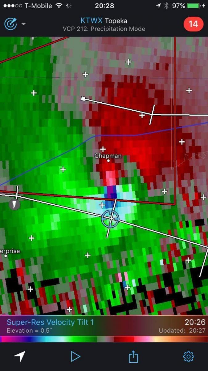
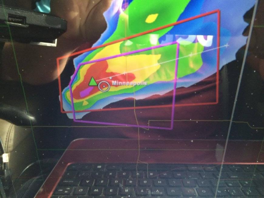 Our Position is the White Circle, the Purple Box denotes the Supercell is Tornado Warned.
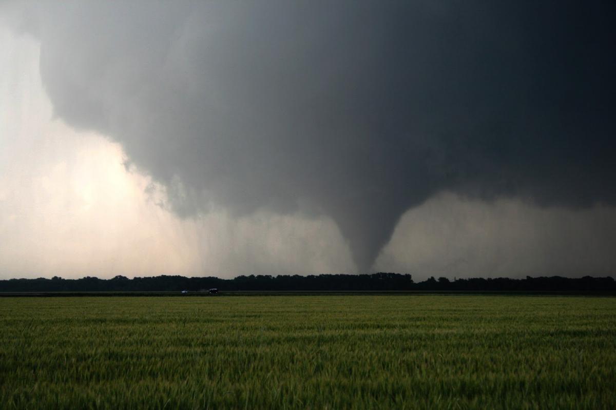
We watched the Storm for around 45 minutes, and then at 6pm, with the Storm almost stationary, the first Tornado of the day dropped just after 6pm. Unbeknown to us, this was just the start of 90 minutes where this Tornado would be on the ground continuously for 90 minutes fluctuating between EF2 And EF4 at times.
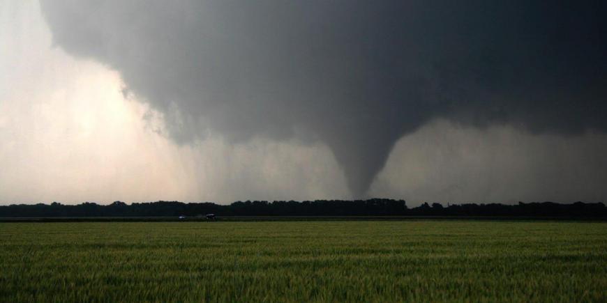 Tornado Touching Down at 6:02pm near Solomon (Kansas)
The Storm was easy to follow, with the Tornado always visible and moving along the Outflow Boundary to the ESE at 7mph. We snapped further shots of it in various stages near the Towns of Solomon, Abilene and Chapman.
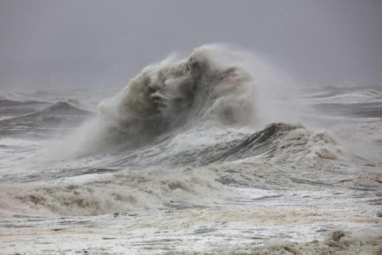
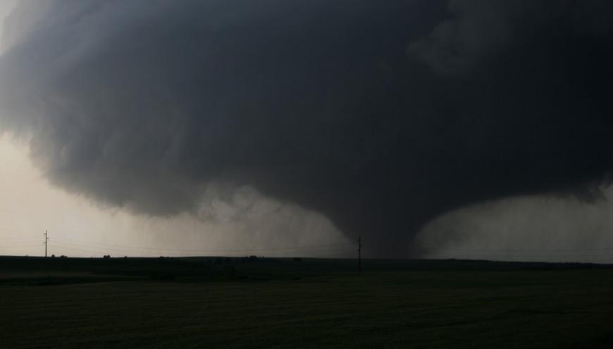 Wedge Tornado North of Abilene (Kansas) at 6:52pm
The Tornado finally crossed the Interstate from NW to SE around 3 miles West of the Chapman Turn off along Interstate 70 as a fully-fledged EF4 Wedge Tornado at that time, and a Tornado Emergency was Issued for the Town of Chapman as it looked like a direct hit was about to Happen.
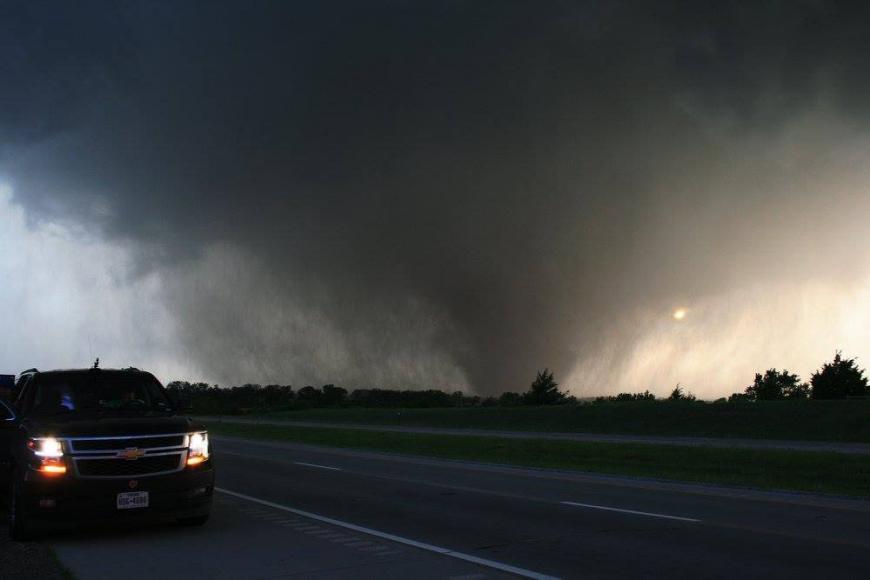 EF4 Tornado about to Cross Interstate 70 from R-L or NW-SE about 3 Miles from Chapman (KS)
After leaving the Interstate, we continued south through Chapman with Tornado Sirens blaring and members of the public out on their porches looking up towards the churning sky to their west. I navigated us around 2 miles South of Chapman, and when I was happy we were far enough South, we could only watch and listen to the roar of this Violent Tornado to our North and hoped it had missed the town somehow.
 Our Position shown as the Blue Circle with the Violent EF4 Tornado to our North.
We all collectively agreed to head into the town to be first responders once the Tornadic Storm was well SE of us and moving away, and seeing as we had 2 Nurses on the trip, everyone was in agreement. As we inched closer, it then dawned on us that the Tornado had somehow swerved around the town, taken apart an area of Trees just south of the town, and snapped them like matchsticks. Everybody breathed a huge sigh of relief. We then headed back towards Salina, where we ate at Applebys and stayed the night, swapping our emotions from the three cars over a few beers. An exhilarating chase day once again.
Tornado was EF4 Strength. It was on the ground for 91 minutes. It travelled 12 miles in Total and somehow managed to miss most structures in its entire path with 0 Fatalities and 0 Injuries.
Loading recent activity...