Storm Franklin has brought gales overnight and added to flooding problems from Sunday. Gales continue for Monday morning. Not as wild this week, with temperature ups and downs.
Storm Franklin has raged overnight with another bout of gales and high gusts. These strong winds continue this morning for Northern Ireland, Wales and England, particularly southern Britain. The amber warning over northern counties of Northern Ireland lapsed at 7am, it was this that led to the third storm being named in under a week. If it was half term for you last week, then it was quite a week with Dudley, Eunice and Franklin. If your February break is just starting, it doesn't look as action-packed once Franklin fades today but still unsettled.
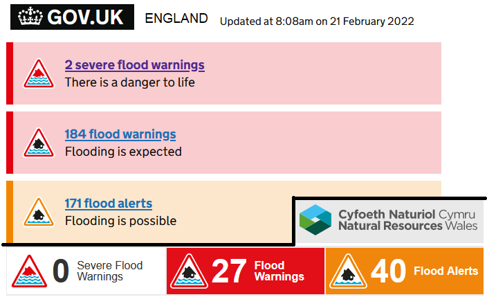
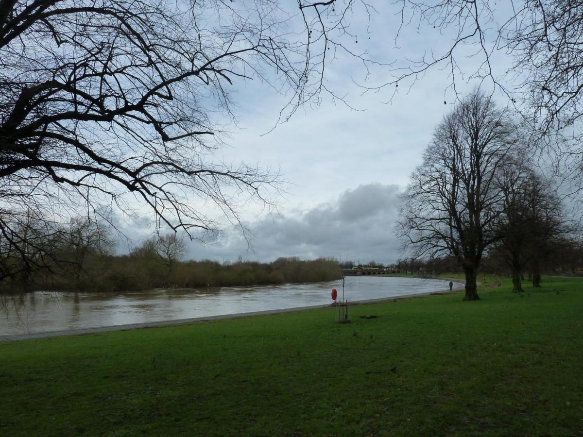
Overnight there have been evacuations due to flooding in northern England with two ongoing severe flood warnings for south Manchester after wretched weather on Sunday. Western Britain saw heavy rain with record river levels (Vyrnwy, Severn at Llanidloes and Ithon on gauges reaching back 30 to 50 years). Northern Ireland has also seen flooding overnight. As the low centre from Storm Franklin moves down the North Sea there is a push on the water ahead of it. The Thames Barrier will close today.
"We're planning for the 206th flood defence closure today from 12.45 - 18.45. This is due to tidal surge from #StormFranklin. Smaller barriers at Barking and Dartford will also be operating this afternoon." EA
The heaviest rain this week will be for western Scotland and although weather fronts do move in from the Atlantic, they all move through quickly which will be good news for those with flood warnings.
On Sunday, as the cold front linked to the Franklin system moved down through Britain there was a vicious squall line. The line convection brought a spell of torrential rain, stormy gusts and plenty of standing water. The front also affected Belgium and the Netherlands. This event then continued into the night with wild conditions around the North Channel and Irish Sea and again for western Wales, SW England and into this morning along the English Channel. All areas which were battered by Storm Eunice on Friday.
.png)
This morning there is transport disruption from the amount of rainfall and so flooding but also a worry that the gales and gusts could bring down already loosened trees or structures, so soon after Eunice. There are still thousands without power and as northern Britain knows after Storm Arwen, the recovery can take a long time.
There has also been snow, from showers drawn around the low centre. It hasn’t been as windy for much Scotland overnight (away from the southwest) but there were wintry conditions with ice. Now as the wind veers to the north or northwest it will feel cold in that wind for the west coast. And pick up in the far northeast.
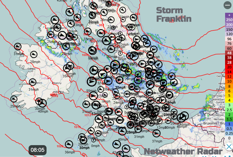
The low centre is over the North Sea and moving south-eastwards. The strong NW winds over Northern Ireland will ease down today but it’s a windy start with problems from the heavy rain and gales. The strong westerly winds will continue this morning for Wales and Irish Sea coastal areas such as Lancashire, into Merseyside and Flintshire. Also windy for Cheshire.
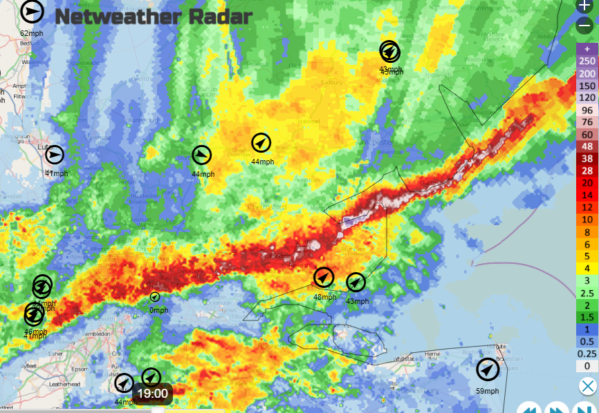
Netweather Radar Extra on Monday morning showing isobars around the low centre and wind strengths (mph) with rain
If you have had enough of this wind, or just not looking forward to half term with wind-induced skittish children, there will be a lull later today with sunshine. However, it’s brief, there are more Atlantic lows whizzing in bringing bands of rain and blustery winds but not looking as severe at this point.
Tuesday sees a warm then cold front move across the UK. So fair for SE Britain in the morning as early rain moves from Northern Ireland and Scotland, down to Wales and northern England by lunchtime and then more of England in the afternoon. Keep an eye on the Netweather Radar for its progress. Wednesday looks better, although western Scotland will have rain and wind from a cold front. This looks to only move south later in the day so allows fine, bright conditions midweek but it will be over Wales and England for Thursday morning, bringing rain.
Temperatures today look to be on the mild side today and tomorrow, into double figures but tempered by the wind today. There will be a frost in the north tonight, but London could see 14C on Tuesday by day. Tuesday night will be nippy with a frost inland, quite a change for England by Wednesday morning. Much colder in the north to end the working week.
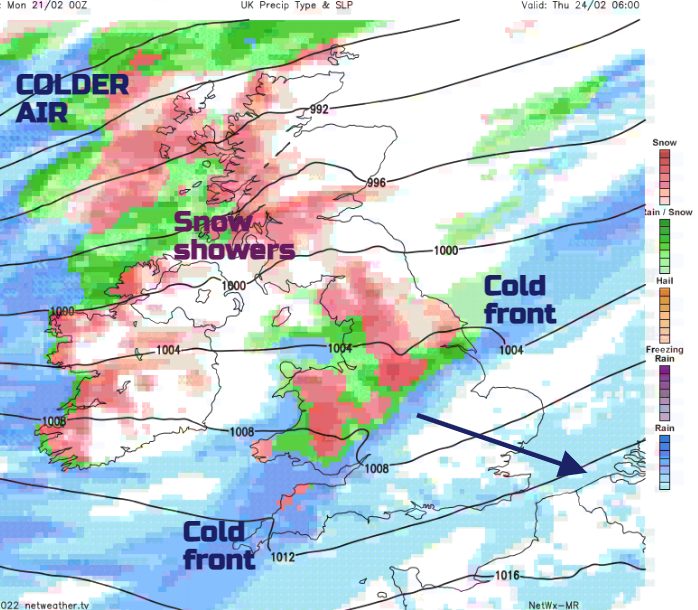
If you are looking for snow this week, it’s a continuation of “northern hills” in the most part. Wednesday night into Thursday sees much colder air arrive from the northwest and there could be snow on the back edge of the frontal system and snow showers following. Don’t get excited in London, it will be rain for you. Even colder air follows for Thursday night with signs of heavier snow for northern Scotland, maybe even reaching down briefly to NE Britain early Friday as the low clears.
It's changeable, it’s February. If you’re wanting a day out this week, there are some fair gaps. Storm Gladys would be the next name. No signs of this yet but after the past few days, we probably all need a rest.
Community forum discussion thread for Storm Franklin
A look back at Storm Franklin on Sunday as the squall line moved through.