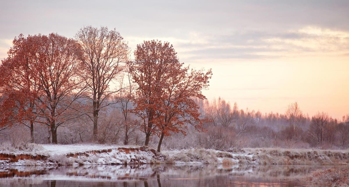
The UK weather looks to remain changeable through the rest of this month but no sign of any widespread wintry weather away from northern hills, but there will be a risk of frost where skies clear, especially into the weekend. The rain and showers over the last few days will ease away south today replaced by drier, colder and sunnier conditions from the north - which will linger through the weekend, with crisp and frosty mornings, though rain looks likely across the southwest on Sunday.
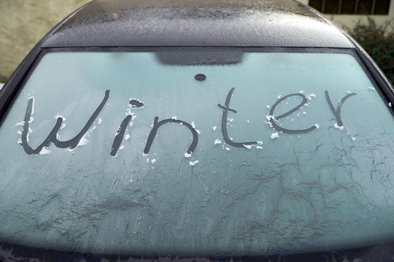
Tonight looks to be the coldest night, as skies clear and a widespread frost forms. Sheltered spots could drop to about -8°C in the Scottish Glens, possibly making it one of the coldest nights of autumn so far, so expect icy cars and roads on Saturday morning.
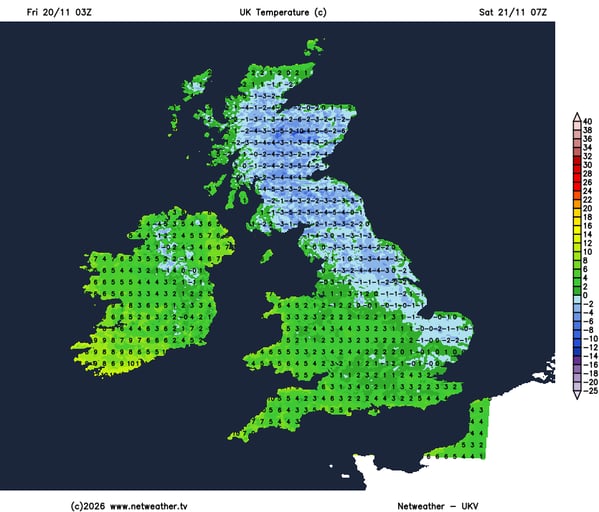
The weekend off to a chilly and frosty start on Saturday leading into a largely dry, calm, and sunny day across most of the UK. Frost will be more confined to the north Saturday night, where skies remain clearer, while cloud builds from the west across the south, with outbreaks of rain moving into far southwestern regions while elsewhere remains dry with sunny spells, but with a chilly easterly wind.
High pressure building down from the north will bring a mostly dry weekend, though low pressure will cross the far SW on Sunday, bringing some rain here.
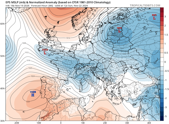
Then after a dry start to next week with a frost start leading into a mostly dry and sunny Monday, rain off the Atlantic tries to return on Tuesday, with bands of rain along weather fronts making erratic progress eastwards through the rest of the week. Weather models are somewhat uncertain how far east rain gets and how much the rain weakens, as fronts come up against blocking high pressure to the east and northeast. So next week could end up seeing dry and bright conditions a lot of the time, but with chances of rain. It’s not looking as wet as this week in the south. The north will tend to remain on the cold side after the weekend, but turning milder in the south.
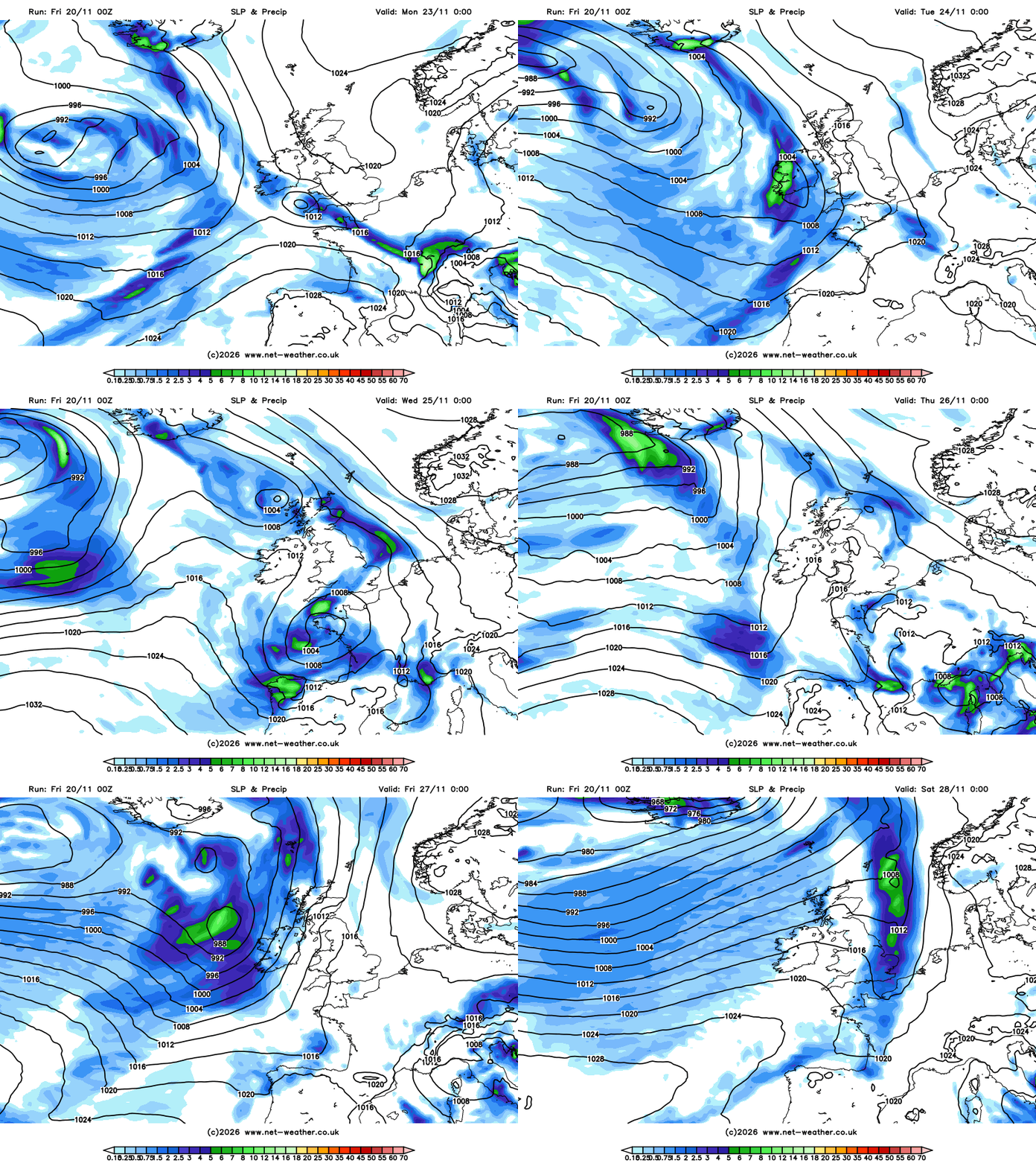
Looking further ahead, into the final days of this month and into early December, it looks like changeable conditions will continue, with areas of low pressure approaching off the Atlantic bringing fronts with spells of rain erratically eastwards, thanks to blocking high pressure still to the northeast and east. It could be windy at times, especially in the west, but no signs of stormy weather that is often typical of this time of year.
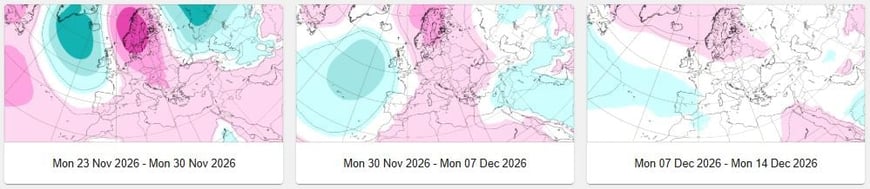
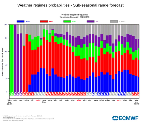
As we go through early December, there are signs from the sub-seasonal ECMWF that the jet stream will become displaced further south than usual, allowing high pressure to the north to have more influence across northern regions, while low pressure systems moving east off the Atlantic track further south across France. So, highest rainfall totals could be focused across the south and southwest of the UK through this period . This is indicative of a negative North Atlantic Oscillation (NAO), with higher-than-usual pressure to the north of the UK over the far north Atantic and lower than usual pressure further south over the North Atlantic towards the latitude of the Azores and Portugal. This can favour colder and drier conditions at times across northern UK, while wetter and milder conditions affect the south.
Blocking features alot in the ECMWF Euro-Atlantic weather regime frequency in early December
There is potential, if the jet stream is far enough south, for colder and drier conditions to affect all of the UK, though with showers near coastal areas which could be wintry, but there’s lower confidence in this scenario this far out.
The ECWMF and GFS polar cap vertical height forecasts show the reversal of winds in the stratosphere slowly 'dripping' down into the lower troposphere in early December
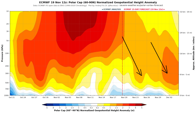
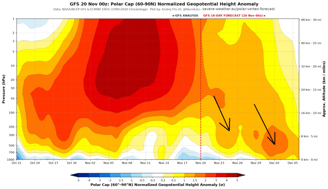
Earlier this month there was a Sudden Stratospheric Warming, the earliest on record in the satellite era, there are signs from ECWMF and GFS polar cap vertical forecast for geopotential heights from the ground up into the stratosphere for the wind reversal that occurred in the stratosphere to work down into the troposphere, where our weather happens, in early December, which could promote high latitude blocking and force the jet stream further south than normal. Hence the potential for colder and drier conditions extending further south through early December.
A damp dark and dismal start to the day here ☹️
7 minutes ago, HarvSlugger said: 82mm here 😝 Looks like the southwestern quarter of the UK getting most of the rain... par for the course in the Oct-Feb period these days for the SW UK to be wet. No measurements sadly, but I suspect we're well...
46 minutes ago, Andy Bown said: I wouldn’t be so sure. More likely a clearance after sunset this far South. I stepped out at 06.30 and the air felt drier. Decided to hang a load of towels on the line. It’s now gone misty and drizzly which has...
3 minutes ago, StingJet said: Just 23mm here for the month which is shy of a 1/4 of 1990-2020 CA .. Under "normal weather" synoptics we would be a good bit wetter than the south east of England .. most odd 82mm here 😝
2c with some sun brrrr
56 minutes ago, LetItSnow said: For all the talk of rain, a pretty dry month locally so far. Heathrow reporting around 29mm so far. It’s not been a washout everywhere. Just 23mm here for the month which is shy of a 1/4 of 1990-2020 CA .. Under...