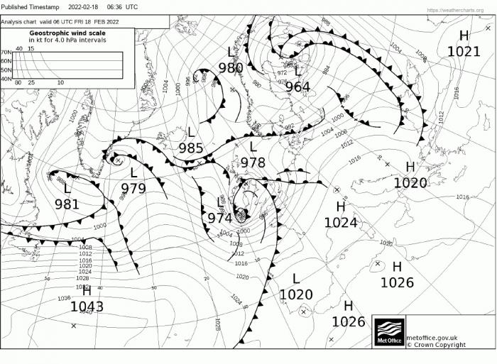
Storm Eunice has deepened explosively over the last 12 hours, at 6am the centre was over southern Ireland at 974 hPa, a drop of 12mb in 12 hours since the 6pm fax yesterday.
Latest fax chart for 6am this morning
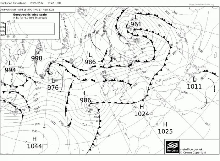
Fax chart for 6pm Thursday
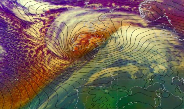
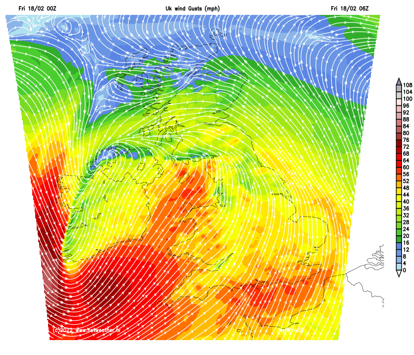
Models show the centre of Eunice low will become stretched as it tracks northeast over the Irish Sea then over the northern half of Britain later this morning, as new centre forms over Scotland, while a southern centre swings east across northern England. The whole system moving out over the North Sea this afternoon. It’s the tight isobars with steep pressure gradient to the south of the southern centre over south Wales and much of southern England across to East Anglia that is of concern for violent and damaging gusts developing through this morning and last into early afternoon before strongest winds ease.
In addition to the Red Warning issued for northern coasts of SW England and coastal south Wales yesterday, a Red Warning was issued for parts of SE England overnight around 4am. Perhaps rather short notice a few hours before it starts at 10am, given many will be preparing to go work, with some perhaps not realising a red warning is in place and what this means.
But anyway, extremely strong west to southwest wind gusts of 60-70mph are likely inland under the red warning area covering parts of SE England, perhaps briefly 80 mph in a few places, mainly towards the English Channel coast. In the southwest, the Red Warning area is for higher wind gusts of 70-80mph, with gusts of around 90mph near some coasts.
The Met Office says this is what to expect under the Red Warning:
Outside the red warning areas an Amber Warning covers much of England and Wales south of a line from Morecambe Bay to The Humber. Even here we can expect wind gusts of 60-70mph.
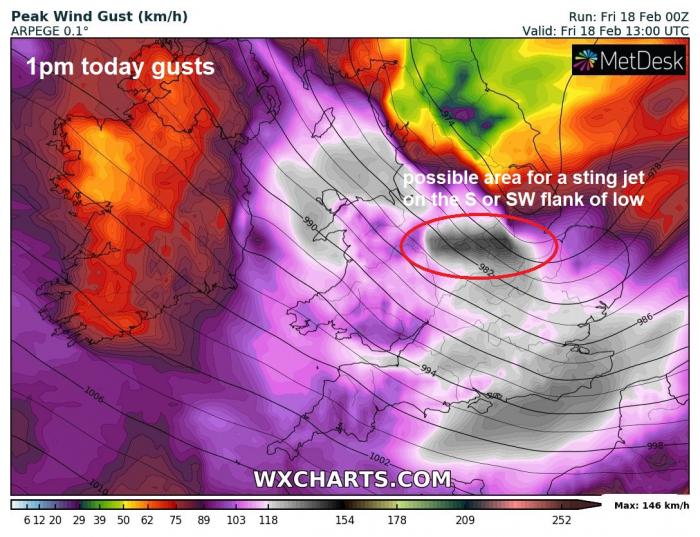
There is potential, given the Shapiro-Keyser cyclone type of this storm, as described in my last blog, that a sting jet may form on the southwest side of the southern low centre of Eunice as it clears east. Some high res models, such as ARPEGE and AROME have hinted at this forming over the North and East Midlands early this afternoon, with a narrow slot of brief gusts in excess of 80mph. So this needs to be watched through the day. A sting is usually associated with a narrow band of violent winds developing in the hooked cloud head on the southern flank of the low centre, also in the gap or fracture between cold front and warm front. The strong winds caused by the jet stream winds and associated dry air descending towards the surface and manifesting in violent wind gusts.
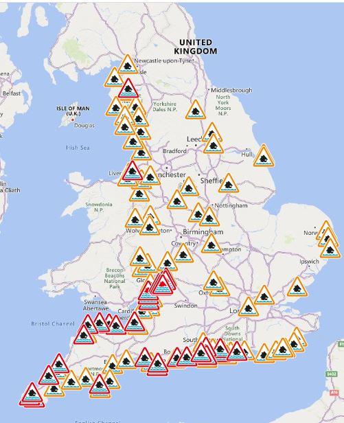
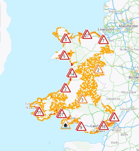
Not in the Met Office warnings, but there are multiple Severe Flood Warnings in place too, for Severn and Wye River Estuaries – due to the huge Atlantic swell pushed up the Bristol Channel by Storm Eunice being funnelled into the narrowing Channel towards the estuary mouths and causing tidal defences to be overtopped on the high tides. These severe flood warnings are rare and imply a risk to life.
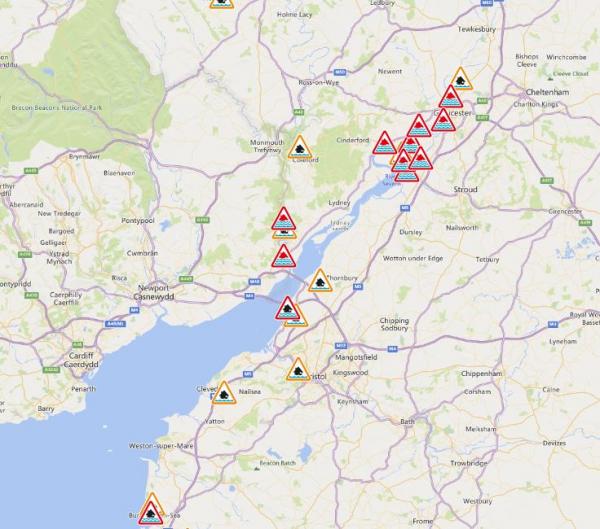
There are numerous other coastal flood warnings for coasts around England and Wales for risk of sea or tidal defences being overtopped by large waves at high tides.
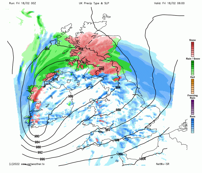
It’s not just the wind that’ll be an issue from Storm Eunice, heavy snow will affect parts of the north throughout the day, particularly higher ground of northern England and N. Ireland and Scotland but also to lower levels in Scotland. Up to 5cm possible at lower levels, 10-30cm above 300m. Given the wet nature of the snow and thus its greater ability to stick to everything, build up on tree branches and power cables may bring them down, bringing power cuts, especially combined with strong winds, particularly over higher ground, which may bring blizzard conditions too. Worth checking travel updates for road closures over higher routes and also train cancellations.
.png?w=700)
Chat and discussion on Storm Eunice on the Netweather Forum
Loading recent activity...