In contrast to January, which for two-thirds of the month was dominated by blocking high pressure, this month is following a somewhat more typical route for winter - with a strong jet stream aimed at the UK and westerly flow bringing unsettled, often windy conditions with a few deep lows bringing bouts of gales, spells of rain, but also some snow for northern hills occasionally - as colder polar air digs in across the north in the wake of these lows.
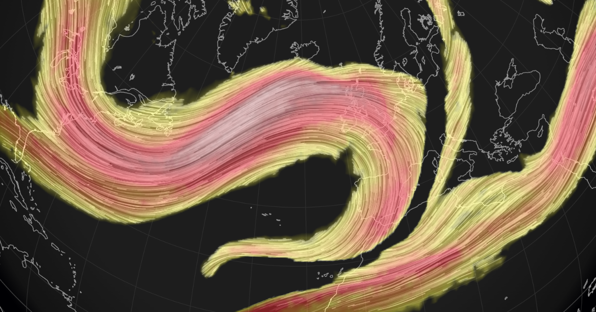
The jet stream, which spent most of the time to the north of Britain when we saw high pressure over the UK in January, has now shifted south and is forecast to run with vigour west to east over the UK over the coming 7 to 10 days, particularly next week when a 200mph+ jet streak in the strong upper westerly flow arrives over northern Britain from mid-week.
Strong 200mph+ jet streak arrives by mid-week across northern Britain
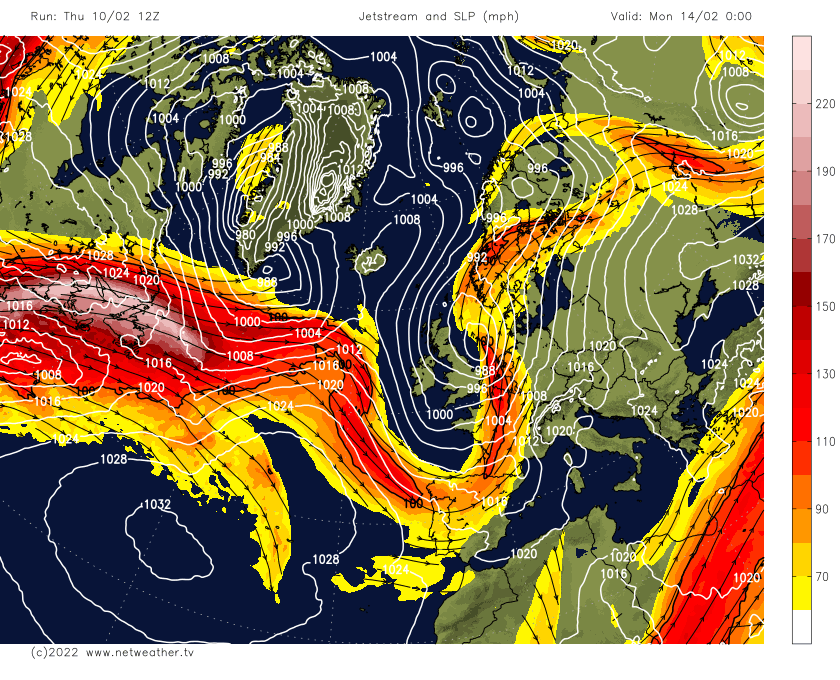
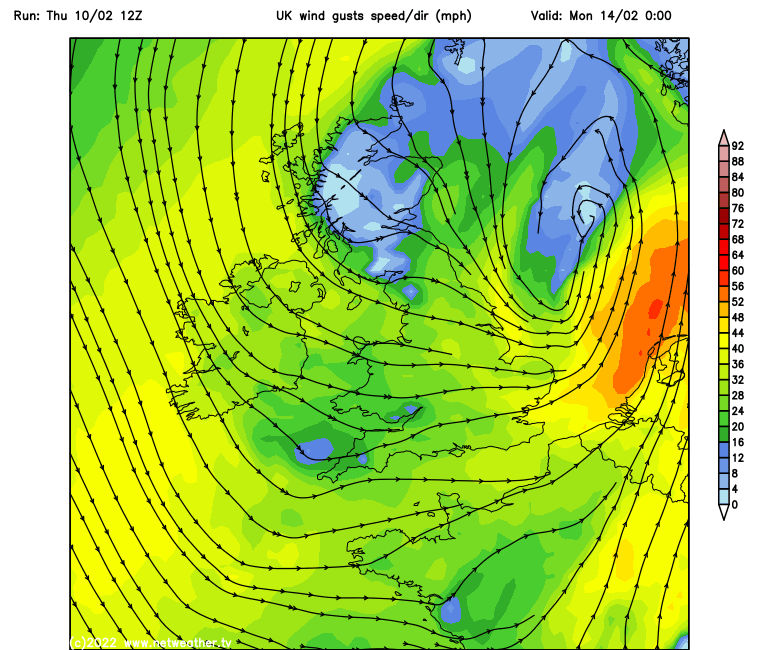
With the jet stream close to the UK, areas of low pressure will be in charge of our weather over the coming days. Some of these lows look like they will be deep and will gales at times to parts of the UK.
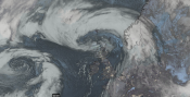
The north has born the brunt of one of these deep lows, which tracked southeast across Scotland today, bringing severe gales here, with snow showers wrapping around the low bringing blizzard conditions over high ground.
A brief ridge of high pressure builds in to end the week, as the jet stream slackens and buckles, quietening things down for Friday. But a renewed surge in the jet stream pushes in from the west over the weekend, with low pressure taking over again. Although the centre of the main low pressure area moving west to east over the Northern Isles this weekend won’t be particularly deep, it will be windy across all parts, with gales around coasts and over hills and also locally along the cold front moving southeast on Saturday with a squally band of rain. Sunday sees a secondary low forming over the Atlantic in response to an amplifying trough in the upper flow digging southeast towards NW Europe. The low tracking northeast across England and Wales, deepening as it does so and bringing a spell of heavy rain and gusty winds to many areas, though uncertainty over the track of the low for now.
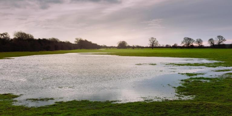
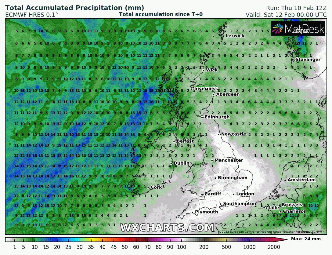
After a very dry January, there's plenty of rain on the way over the next 7 days, especially in the west
Next week and the jet stream really ramps up a gear on current model output. A very strong westerly 200mph+ jet streak looks to arrive across northern Britain by mid-week. So after a quieter lull thanks to a weak ridge of high pressure on Monday, the wind picks up Tuesday with a frontal system rain spreading east across most parts. Then with the arrival of the strong jet streak we could see rapid cyclogenesis of one or even two lows that form and move under the developmental left exit region of the jet, these deep lows are likely to move just north of Scotland but could bring severe gales on Wednesday and Thursday across the north, with gales possible around coasts in the south too. Accompanying the lows will be spells of rain or showers sweeping the country.
Windy next week, especially from mid-week, as some deep lows pass by the north
But given the range, uncertainty this far out on potential track and depth of the lows mid to late week. But all-in-all it’s looking rather unsettled, sometimes wet and often windy next week after Monday.
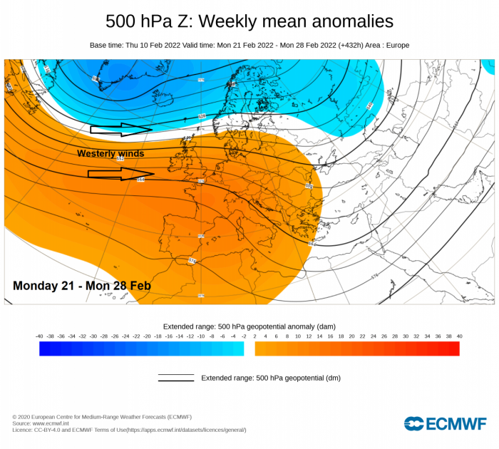
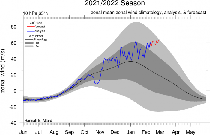
A similar theme looks like it could continue into the following week too, thanks to very cold air wrapped up in a strong polar vortex over Greenland and NE Canada contrasting with warmer air streaming northeast over the NW Atlantic and eastern seaboard of North America driving a very strong and zonal jet stream across the North Atlantic into NW Europe. The exceptionally strong stratospheric polar vortex since the start of the year, record-breakingly strong for a few days recently, also looks to finally couple fully with the troposphere. This means a strong polar vortex through all levels of the atmosphere is looking most likely as we see out meteorological winter. So it is likely NW Europe including the UK will see a continuation of strong zonal westerlies with a conveyor of lows passing over or north of the UK bringing spells of wet and windy weather at times and generally it will be on the mild side, though the odd brief colder polar incursion in the wake of lows moving on east may bring some hill snow to the north. So after a very dry January, rainfall should be more average for this month and it’ll be windier too than last month, with plenty of green electricity being produced!
A zonal westerly flow continuing for the last week of February as per ECMWF weeklies tonight, so likely generally mild, unsettled and windy right to the end of the month
Postive Arctic Oscillation forecast, a sign of a strong polar vortex
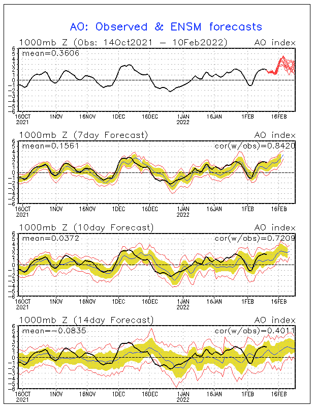
Strong zonal mean zonal winds at 10 hPa / 65N forecast well above average
But for those wishing for snow, especially as for many it’s been snowless this winter, unfortunately, it’s looking unlikely for most of lowland England and Wales. Perhaps northern hills at times. But even here not sustained snow cover away from the highest mountains.
Loading recent activity...