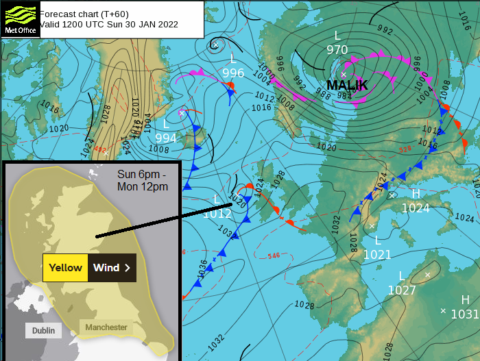
Two low pressures will impact the UK this weekend. There are already weather warnings out, for Saturday day, Malik (including an Amber for eastern/NE Scotland with NE England now added) and then Sunday evening, overnight into Monday morning (Storm Corrie just named by UK Met Office). The Saturday low pressure then moves over Scandinavia to the Baltic sea, continuing to deepen. It has been named by the DMI, Danish Meteorological Institute which is part of the northern Storm Naming Group. The UK is in the Western group with Ireland and the Netherlands. There are wild conditions for Scotland on Saturday morning with more to come.
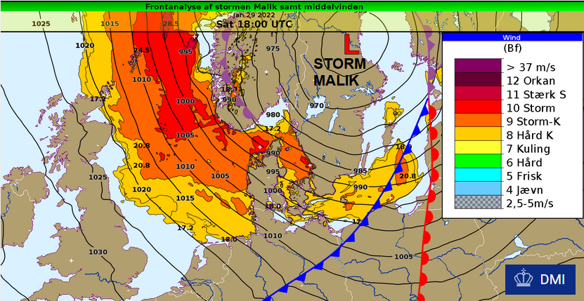
“Malik also increases the wind to between gale and stormy gale from the northwest, and in several places up to storm (force). The gusts also increase to between strong storm and hurricane, 28 m/s (63mph) to about 35 m/s (78mph). The storm continues through the night until Sunday.” DMI
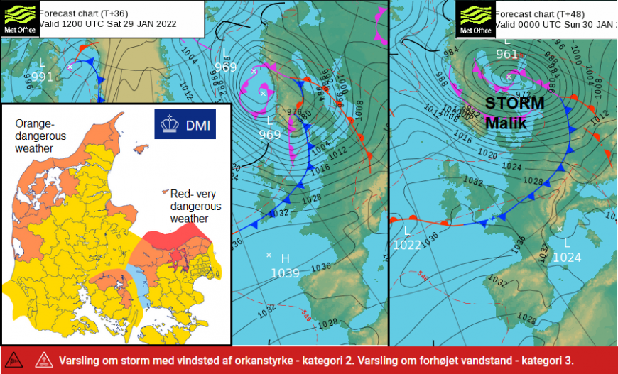
There is a category 2 warning of storm with gusts of hurricane force and category 3 warning of elevated water level. The orange areas show Dangerous weather and red is Very Dangerous weather.
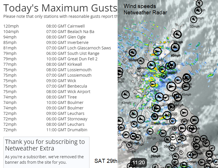
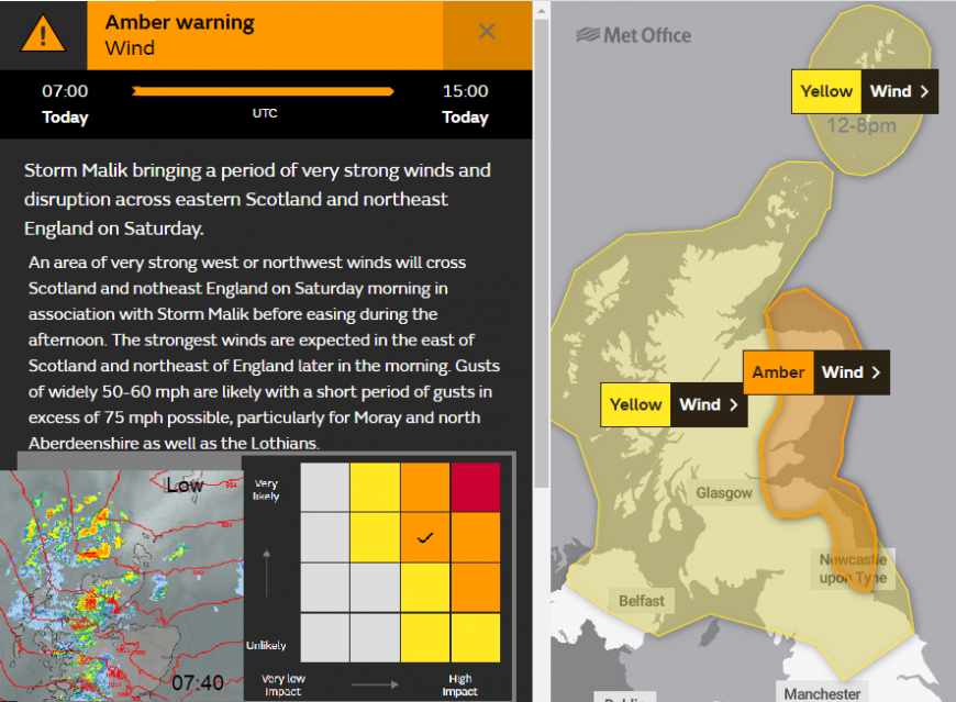
The UK Met Office issued three yellow warnings on Friday, different areas and timings during Saturday. The Eastern Scotland area includes Aberdeen, Dundee and Edinburgh with gusts potentially over 75mph by day. Worth noting. It has now been upgraded to Amber with people out and about, driving, planning trips or shopping after payday. The sudden high gusts will be quite something. But the later Amber means there was no need for UK Met Office to name a storm as it was already called Malik by another Met service.
The DMI named Storm Malik on Friday morning due to concerns about the stormy conditions but also the push of water from the incoming low. The warning text mention high waves and the risk of coastal flooding as water levels could rise 1.2 to 1.9m above usual levels.
“In connection with the strong wind, there is a risk of elevated water levels along Jutland's West Coast. Therefore, a warning has been issued for elevated water levels in the Wadden Sea.” DMI
A couple of times a year, DMI warns of elevated water levels either on Jutland's west coast or in inland Danish waters. This means that there is a risk of storm surges and saltwater damage. For Denmark to be affected a combination of factors come together including wind strength, wind direction, existing water levels and how the low pressure moves by.
Storms in Denmark have since 1891 been divided into four classes depending on their strength. A Class 4 is calculated for average wind speeds equal to or above 28.5 m/s (64mph), corresponding to wind speed 11 (strong storm). This also includes hurricanes (wind speed 12). The last category 4 storm was Bodil, which ravaged 5-6th December 2013. For our 2021/22 storm season, there have only been two named storms so far. Storm Barra and the tree felling Arwen.
Malik then moves on, hitting the Baltic States next on Sunday, particularly western Latvia and western Lithuania. Also north coast Poland, southern Sweden and coastal SW Norway. Another low pressure (now named Storm Corrie) then develops over the UK on Sunday and this will bring strong winds, gales and heavy rain even snow. There are concerns about large and dangerous waves around the coasts and further damage after Malik, and still Arwen.
Further discussion on the Netweather Forum - Storm Malik
Loading recent activity...