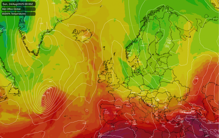
HIgh pressure has dominated the UK weather over recent weeks and is feeding the current heat to the UK. A large Atlantic Hurricane is being watched by Bermuda and Newfoundland. Larry is making waves.
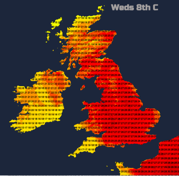
High pressure has been dominating our UK weather. The dull gloom for eastern Britain for much of August with the flow off the North Sea, yet warm sunshine further west. A shift at the weekend of that high pressure has now allowed real heat to pull up from Europe. Temperatures on Tuesday 7th Sept reached over 30C which is unusual for September in the UK. The heat continues with higher temperatures for Scotland on Wednesday as more cloud breaks up. Showery rain and thunderstorms will edge in from the west as this week's burst of heat peaks. What next, more autumnal wind and rain from low pressures or back to the settled High?
Continental United States is still recovering from Hurricane Ida which made landfall over Louisiana on Sunday 29th August. Ida continued north and went on to bring historic flash-flooding to New York state and surround areas later on the 1st September, resulting in 45 people losing their lives.
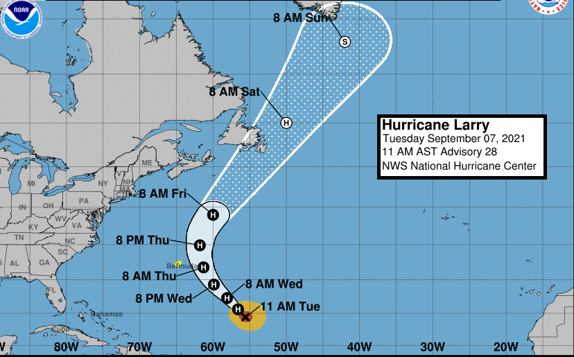
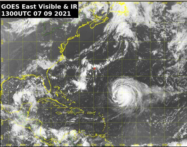
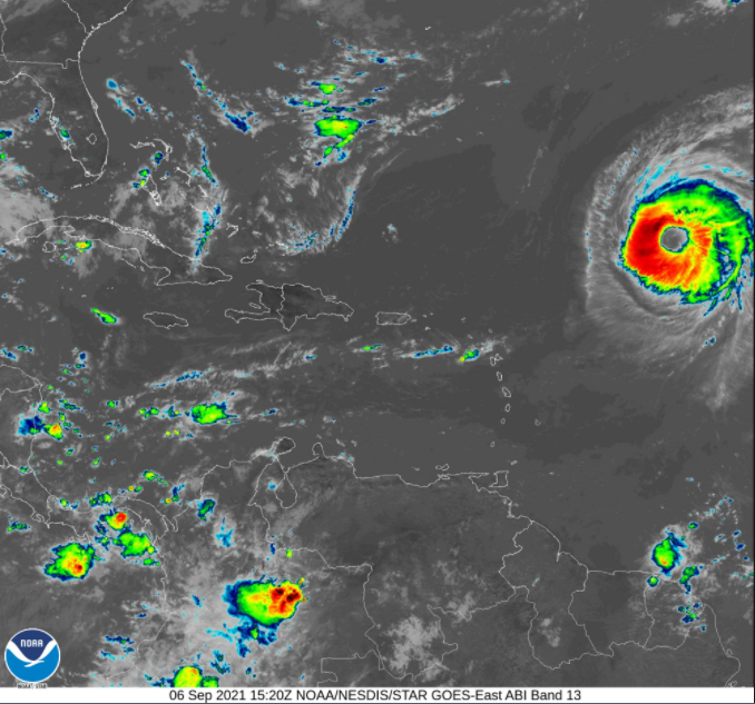
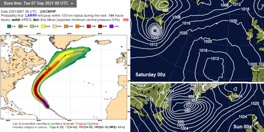
Although tropically quiet here at the moment, way out in the mid-Atlantic is Hurricane Larry. This looks to impact Bermuda and then possibly clip Newfoundland at the weekend. "Larry is expected to pass east of Bermuda on Thursday as a large hurricane." NHC
“approaching Hurricane Larry, which brings deteriorating conditions Wednesday night into Thursday with strengthening winds and further wet weather. Hazardous swells gradually develop, especially along the South Shore, with dangerous surf and rip currents.” Bermuda Met.
The long period, powerful swells are already beginning to develop. Increasingly hazardous and dangerous surf with strong rip currents will develop. The Bermuda Met Service is including strong to tropical storm force winds in their forecasts with the possibility that they could go higher. There is uncertainty about the rainfall amounts as Larry passes to the east of Bermuda.
Although Larry is forecast to gradually weaken it is such a large hurricane in scale that significant swells are affecting the east coast of the US and Caribbean islands. East coast Canada will soon also see the impacts, large swell, dangerous surf and rip currents. The current forecast path does include Newfoundland.
Canada does have its own Canadian Hurricane Centre, separate from the NHC, the National Hurricane Centre for the USA which is the Regional Specialized Meteorological Centre for the Atlantic.
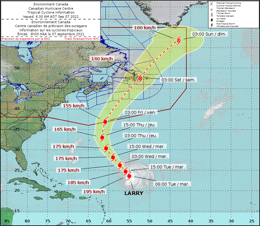
CHC "Latest information indicates that Hurricane Larry is likely to influence the weather in eastern Newfoundland this Friday. Many of the numerical weather models predict the storm to track offshore while some now expect the centre to travel across the Avalon Peninsula. At this stage, most of the models have the hurricane making transition to a post-tropical storm while travelling very quickly through the region."
Sometimes these post-tropical storms or the remnants of ex-hurricanes reach across the north Atlantic to influence our UK weather. However high pressure will return to the UK after a mid-week blip. The heat and south-easterly flow around one high is edged out by a different Atlantic low pressure which brings showery rain and the risk of thunderstorms later Wednesday through til Friday. So, after passing 30C, eastern Britain holds onto warmth but not those high temperatures Thursday til Saturday and the weekend will feel cooler and fresher. H pressure looks to return for next week with an easterly flow. Keeping an troublesome lows at bay.
The Philippines has a (Severe) Tropical Storm moving across the Islands. Conson, locally known as Jolina is forecast to impact Metro Manila on the 8th Sept with moderate to heavy rain, thunderstorms and the risk of flash flooding. There is also TS Chanthu to the northeast which is forecast to head near to Taiwan.
Community forum thread on Hurricane Larry
Loading recent activity...