The UK has been warmer than average for June 2021 and away from SE Britain, it has been drier than average. It has rained a lot for Southeast England, which has been wetter than average and for many parts of northern UK and eastern England, it has been sunnier than average.
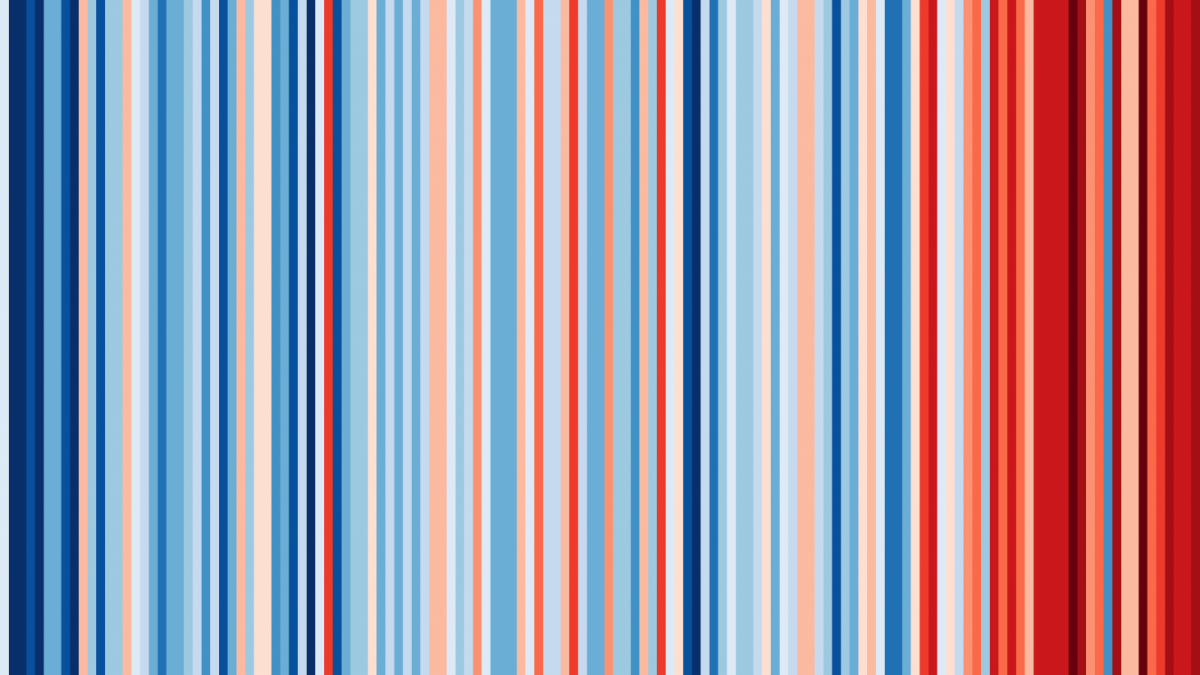
Each month the UK Met Office issues their monthly summary, comparing rainfall totals, sunshine hours and temperatures with long term averages which typically span 30 years. This year’s #ShowMyStripes campaign reinforced the global warming climate message:
“These ‘warming stripe’ graphics are visual representations of the change in temperature as measured in each country over the past 100+ years. Each stripe represents the temperature in that country averaged over a year. “
And there is a lot of red on show in recent years. This has to be factored in when looking at the temperature anomaly maps.
Looking at the June mean maximum temperatures (which nearly always occur in the day) you can see the differences from the average sets of 1961-1980 and 1981-2010. As our planet warms then the average temperatures also creep up. We await the next time segment, 1991-2020.
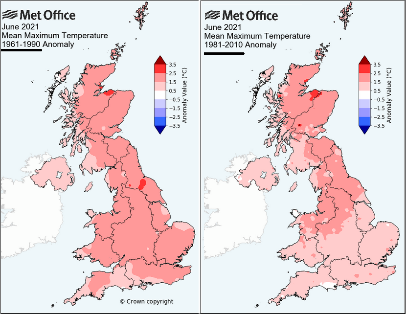
The mean temperature, for night and day, was slightly above average across the UK for June 2021. For the daily minimum (overnight temperatures), SE Britain was around 2 degrees above the recent average thanks to warm June nights. Provisional data shows that England has reported its joint 2nd highest average minimum temperature, 10.7C with records stretching back to 1884. For daytime maximum, it was 2 degrees warmer than average for much of Scotland, northern Britain and north Wales. Looking back at the 1961 data, it is comparatively warmer through much of Britain.
This warm weather contrasts with the cool, wet May and cold, frosty and dry April of this year.

The rainfall data for June shows more of a contrast. SE England has been wetter than average, subjected to frontal rain and heavy showers. Some of these were in thundery clusters surging up from France in very warm, humid air. London saw double its average rainfall and parts of Hampshire and the Isle of Wight had over 3 times the amount of rainfall that they would normally expect. Very wet indeed.
For the rest of the UK, away from SE Britain, it has been drier than average. After the wettest May on record in Wales, June was drier and warmer than average with only 37% of the usual amount. Parts of Highland Scotland are now very dry with heightened concerns for the wildfire risk.
Much of northern Britain has been sunnier than average, particularly NE Britain. For Northern Ireland, it has been sunnier than average in the east but dull in the west. Although drier than average everywhere, particularly for Co. Down.
Copernicus has now started using the 1991 to 2020 data but alongside the 1981-2010 set for comparison. In a week’s time, they should issue their data which will look at Europe and the world in June. For May:
"Globally, it was 0.26ºC warmer than the 1991-2020 average for May. For Europe, May 2021 was 0.46ºC below the 1991-2020 average"
Loading recent activity...