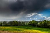
An identification guide for cloud types, more understanding and knowledge for your Instagram photos with an extra hashtag or maybe just to enable the joy of Cloud Spotting.
Cloud watching – the every day, the stunningly beautiful and sometimes, the quite scary. Our skies can bring gloom, brightness, danger and occasionally bizarre phenomenon. This guide will look at different cloud types to help your understanding as you gaze off into the distance, impart some knowledge for your Instagram photos with an extra hashtag or maybe just enable the joy of cloud spotting.
High Clouds
Medium Clouds
Low Clouds
You could put each one of these six on a piece of paper and move them about in pairs to get most of the cloud genera.
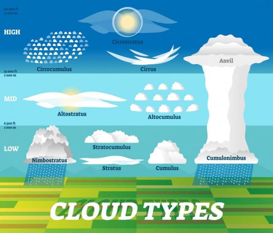
They are usually divided into Low, Medium and High levels. So high clouds start with Cirr-, medium level cloud have Alto in name and low-level ones Strat-. Anything with Nimbus in signals rain. Nimbostratus can reach higher or lower than the medium level, and Cumulonimbus clouds (CBs) reach all the way up through the levels. They are the dramatic thunder clouds with dark bases, lightning, hail and wispy ice anvil-shaped high tops.
Sometimes it is hard to tell whether clouds are medium level or high. It can be tricky even for Met. Observers if they don’t have a cloud base recorder (a machine with a laser that shoots up and bounces back off the bottom of a cloud right above it). If you have a nearby hill, mountain, or skyscraper that you know the height of, that can help. Cirrocumulus is rarer than Altocumulus, so that might assist. Also holding out your arm and looking at the size of cloudlets (the small lumps that make up a wider cloud pattern). These cloudlets can be compared to your thumbnail or little fingernail for Alto to CirroCu.
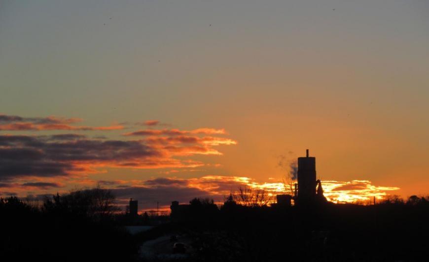
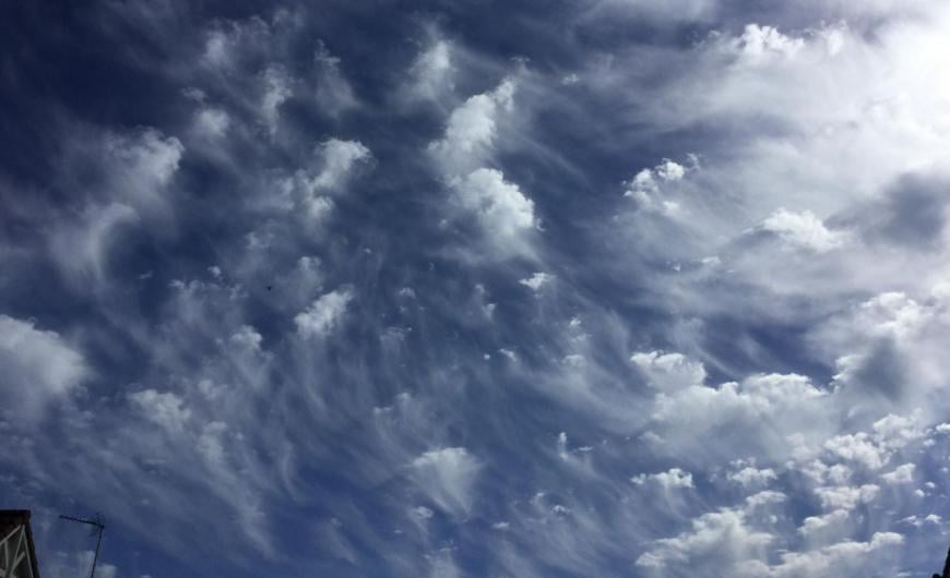
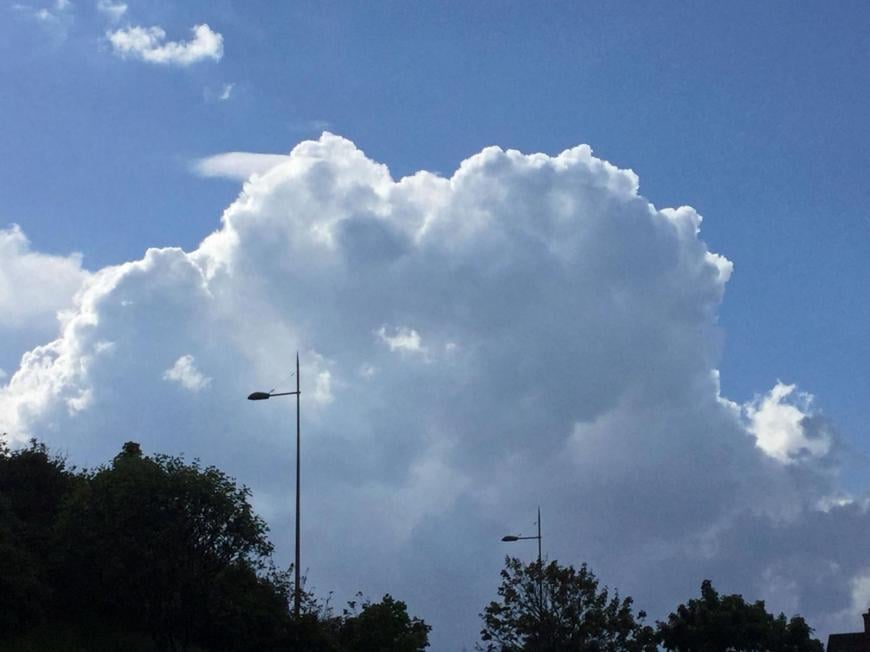
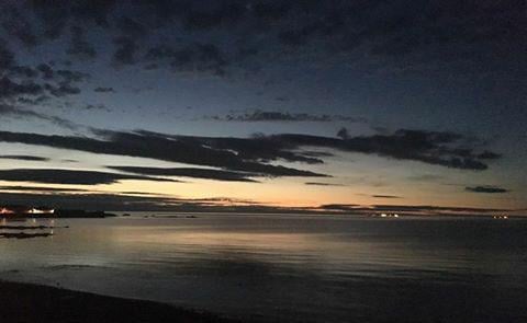 Summer midnight altocumulus
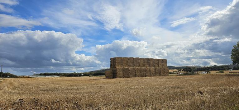
When first looking at clouds, if they are like sheets, layers or rather featureless, then there won't be a speedy change in the weather. High pressure brings slowly descending air and with light winds, often StratoCumulus or Stratus/fog. An incoming front might show itself over a day with an invading layer of cloud, but it will all take time. Clouds that are lumpy have more about them, they aren't staying still, they are unstable, rising and have the potential to bring downpours. The available energy, moisture and warmth will govern how far they bubble up by day, and they often fade in the evening.
Many clouds are white, reflecting the sunlight but early morning and by evening, they can catch the colours of the lower sun. Thicker clouds can appear to have darker areas, often grey/black bases where the sun's rays can't reach.
Cumulus grow. There can be clear blue skies in the morning, and one little puff appears, 20 minutes later it is a small cumulus, and other bits are forming around it. They then can develop from fair-weather Cu to towering Cu, depending on atmospheric conditions. If you are sitting on a beach or a hillside for a while, you can watch the Cu “bubbling up”. They all have different names, such as Cu Humilis and Cu Congestus.
Cirrostratus is like a veil of thin high cloud in the sky and can produce a halo around the sun or the moon. That is an easy tick for cloud identification.
Stratus can be gloomy, brings drizzle and is a low cloud. Convective clouds give showers of rain, snow or hail. High clouds don’t give precipitation that would reach the ground.
Beyond these six Genera, there are Species where words such as Lenticular (almond/lens-shaped) Castellanus (like castle turrets) are added. Also, Varieties such as Undulatus (undulations). There are also supplementary features and accessory clouds such as Mamma (mammatus). It’s all quite involved.
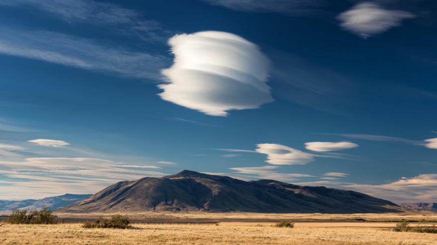 AC Lenticularis
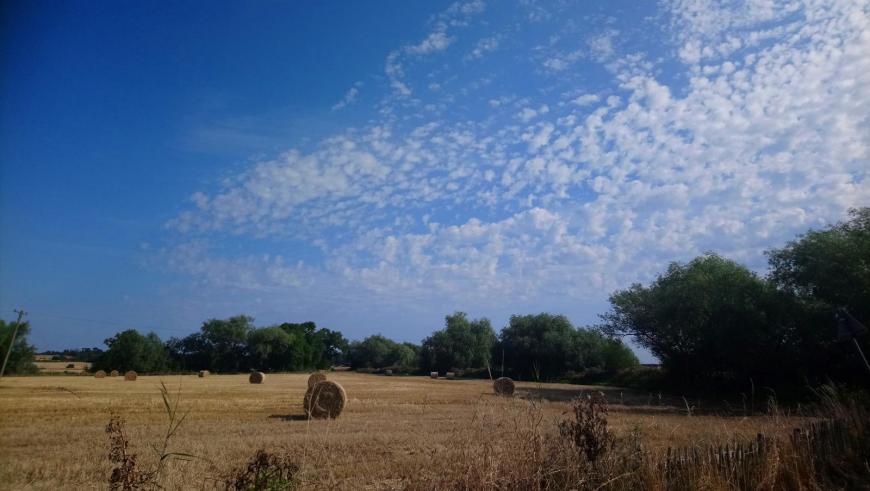
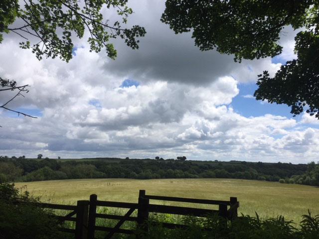
Amounts of cloud are divided into eighths, Oktas. It is easier to visualise the cloud in the sky as portions of a pie. Clear blue skies = zero oktas, invading Cirrus 5 oktas, Altostratus 8/8ths. You can have 2/8th of low-level cloud and 7/8ths of mid-level. The amount of Cumulus present is often less than an oblique view would suggest. (See top image)
Evening clouds can look ominous and make it look like it will rain. However, often this is just a lack of light, shadows of the cloud on itself or dark bases, again from shadows. Sudden downpours come from convective Cumulus, which often develop thanks to diurnal heating. Cumulus clouds give short showers that come and go or heavier ones that surprise you with the sudden rain, dark skies and blustery winds before it's back to sunshine, and you feel bewildered at what just happened. Cumulonimbus also gives sudden bursts of rain, including torrential downpours, hail, lightning, thunder, and strong gusts.
 Supercell thunderstorm over Devil's Pulpit from 2019 Netweather Storm Chasing tour .
Frontal rain is more stratiform, layers of cloud moving in, gradually lowering and darkening before the rain. Cirriform cloud is generally a signal of fine weather for now but can herald a change is on its way. Many weather sayings relate to clouds, such as “Mackerel Sky, Mackerel sky never long wet, never long dry”. This compares to the ripples and patterns on cirrocumulus clouds to the banding from a mackerel.
So, we have ten Genera. Most of the genera are subdivided into Species based on the clouds' shape or internal structure. Such as Floccus, Lenticularis, Spissatus and Castellanus. Then Varieties different arrangements of the visible elements of clouds such as undulations and varying degrees of transparency - Undulatus and Translucidus.
We’ll have a look at High Clouds, Medium level clouds and Low Clouds. There are also Upper atmospheric clouds - Noctilucent Clouds and Nacreous Clouds.
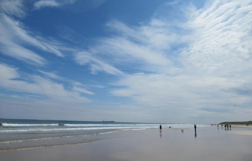
Let’s start with the high clouds, Cirrus Ci, Cirrocumulus Cc and Cirrostratus Cs. They would have a base above 20,000ft, around 6,000m. It’s cold that high up in the troposphere, so they are mostly made of ice crystals. They often look white and thin. We don’t get rain on the ground from these clouds. They can appear stationary whilst lower clouds whizz by. In part, an illusion as the high clouds are just further away.
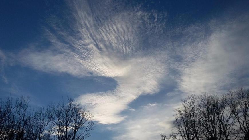
Cirrus Ci these are the wispy ones, hair-like and compared to mare’s tails or chicken scratches. These cirrus tufts can get trails underneath as the upper winds begin to veer and they begin to look more fibrous than wispy.
They are made of ice crystals and usually don’t affect how bright the day is but can just save temperatures from falling quite as low overnight, like a thin sheet to save from a frost. You would associate them with a sunny day, particularly in summer but maybe as a slight warning bell. They can be the first sign of an approaching warm front, so fine weather for now, but a change might be on the way in the next day. They can then thicken up to Cirrostratus before the cloud sheet lowers as the front nears.
 Fibrous ice crystal top of a low base Cumulonimbus which reaches right up to high levels, mamma also present (J.Farrow)
Cirrus can also form from the anvil cloud at the top of a Cumulonimbus and also from aeroplane contrails.
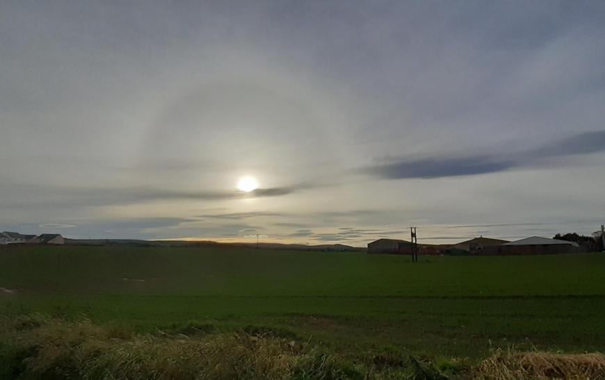
Cirrostratus Cs is a thin veil-like sheet that usually produces a halo. This happens as sunlight passes through the hexagonal-shaped ice crystals. Moonlight can cause the same effect and is very helpful to show that the high cloud is present when night-time observing. By day, this veil would still allow enough brightness that shadows would be seen on the ground (checking this helps decide which level cloud you are looking at), and the Cs can become widespread as it "invades" the sky. It can have a fibrous appearance, showing the ice content.
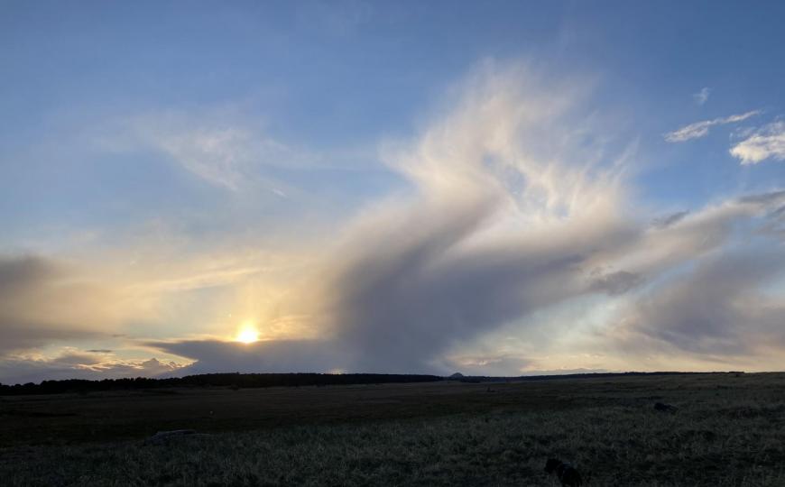
CirroCumulus Cc is unusual, so if you aren’t sure if you are looking at Altocumulus or CirroCu, the former is more likely. It consists of ice crystals and temporary supercooled water droplets. Cc tends to form from Ci or Cs, so previous observations can be helpful to identify it too. Cc has small cloudlets (the size of your little fingernail on an outstretched arm), which can line up in ripples and give the mackerel sky effect. It can produce stunning photographs with a low sun as orange and pink colours take over the sky. You may also see iridescence on Cc (green or pink colours almost like the colours of oil on a puddle) or occasionally Corona, a circular optical phenomenon close to the sun but not as wide as a halo. Virga can be seen hanging down, which is upper-level precipitation that doesn't reach the ground.
Within these 3 Genera, there are Species such as Cirrus Fibratus and Cirrocumulus Floccus (top image) and Varieties like Cirrocumulus Undulatus where ripples or ‘undulations’ appear in the Cc pattern.
"Mackerel scales, furl your sails.
Mares tails, Mares tails make lofty ships carry low sails."
The views of these high clouds are not associated with inclement weather right now. Still, the turbulent nature of Cc and Ci would be enough to catch a sailor’s attention and prepare for a deterioration in conditions with an unseen approaching low pressure. Another fabulous variety of CiCu is Lacunosus, which looks like spooky webbing. In Spanish, it is known as 'Nubes de Fantasma' ghost clouds!
So three main high cloud types: CirroCumulus, CirroStratus and Cirrus. Usually signifying fine weather for now, but that change is afoot.
Next up medium-level clouds, AltoStratus As, AltoCumulus Ac and NimboStratus Ns.
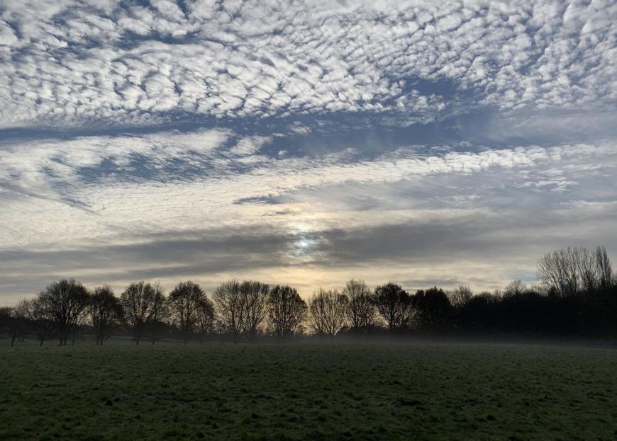
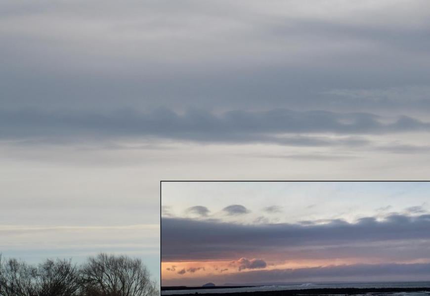
Altocumulus can give stunning and intriguing cloud forms such as the spaceship-like Lenticularis, castle turrets of Castellanus, the pendulous mounds of Mamma (top image Mammatus) and jellyfish Floccus. Altocumulus and Altostratus don’t tend to give precipitation to the ground. These have a base above 6,500ft and up to 20,00ft. They are composed mainly of water droplets but can include ice crystals. Alto is used for a higher-level version of Stratus and Cumulus, mid-range clouds. Altostratus is really quite an unexciting cloud, but it can develop into Nimbostratus on an incoming front. Nimbostratus, as the name suggests, gives rain, which can be persistent, moderate rain. It could give you a soaking. Nimbostratus can extend between 2,000 ft and 10,000ft.
AltoCumulus Ac – This is the most common mid-layer cloud and the most eye-catching. It consists of rounded lumps which make a patterned layer or sheet. They can be aligned into rows or “cloud streets”. The lumps can have shadowed parts which will help identify what you are seeing. The 'cloudlets' will be larger than your little finger at arm's length (Cc) but smaller than three fingers at arm's length). By day, these clouds are white, but like Cc, they can look stunning and colourful as the sun sets.
Ac can form from Cc higher up as it lowers or from Sc mutating (low-level StratoCumulus). It can appear from Ac or Ns transforming. It can form in clear air or by the spreading out of Cumulus clouds.
This cloud can look like cotton balls delicately strewn across the sky. They are usually formed from water droplets, but you can get higher and lower layers of Ac and additional species such as Floccus or Castellanus, which include ice crystals and the well-defined edges of this cloud become more diffuse. Ice content rises in winter. Corona can appear around the sun or moon from this cloud and iridescence. Virga is often seen.
Altocumulus can reach upwards, indicating elevated instability. The Species AltoCu Castellanus is a delightful cloud and easy to identify, looking like the battlements of a castle. There will be an ongoing base with growing cumuliform turrets protruding upwards in a row. If you see this in the morning, there is the potential for a thunderstorm that day. There will be turbulence in these clouds, sometimes lightning but little precipitation reaching the ground. You may see echoes on the radar but be aware it could be over-reading in terms of ground truth. The rain is also in the mid-layer of the sky, caught in the radar beam. Other thunderstorms from Cumulonimbus clouds may follow.
AltoCu Floccus another favourite and can look like jellyfish with Virga hanging down from these. Small tufts of cumuliform clouds with ragged undersides and fibrous trails, the icy virga.
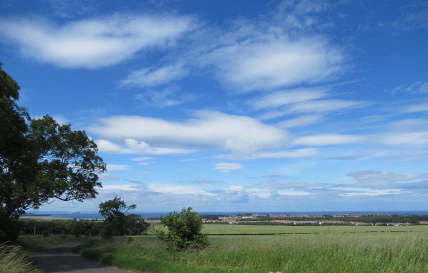
Altocumulus lenticularis are the dramatic cigar-shaped or spaceship clouds that form downwind of hills and mountains. More here.
AltoStratus As. - No such excitement for As. A grey sheet or layer. This one can make the sun look as though it is being looked at through ground glass. It is often featureless, stops shadows but doesn’t give much precipitation. It can spread over a large area, sometimes from Cs lowering as a warm front heads in and then the As can thicken to Ns and then it would give rain (or snow).
NimboStratus Ns - This forms from thickening Altostratus. From its base, low ragged clouds appear, and it lowers further as the rain sets in, yet it is considered a medium layer cloud. Again it s a featureless cloud; it can be dark and block out the sun. As warm or occluded fronts move in, this cloud layer can bring continuous moderate rain or, in winter, snow. Ns can have vertical extent and bring steady rain. Stratus is a lower level cloud and gives drizzle.
Pannus, the accessory cloud, is often seen under Ns. Sometimes as ragged shreds underneath another cloud, sometimes attached to it. These are scruffy low bits that can look darker and untidy.
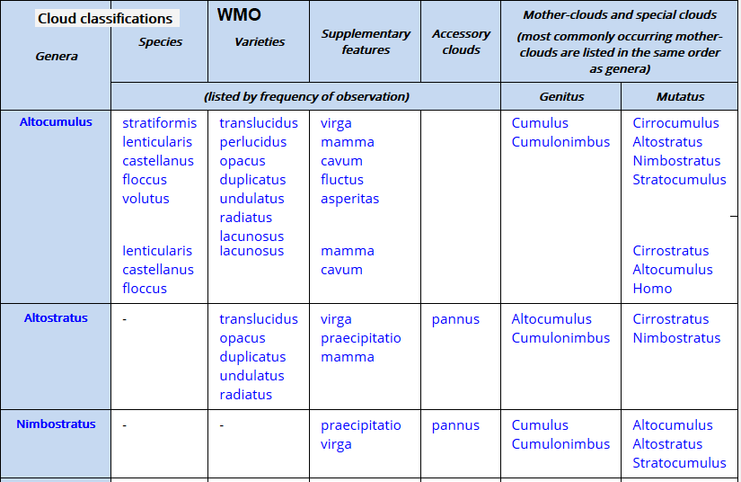
Flucus
"A relatively short-lived wave formation, usually on the top surface of the cloud, in the form of curls or breaking waves (Kelvin-Helmholtz waves)".WMO
It can occur in AltoCumulus and StratoCumulus. It is sometimes described as "extremely rare", but because of its fleeting nature, it might not often have been seen that often but is now being photographed more with varying degrees of drama.
 Flucus Insert photo M.McNeil
Within these 3 Genera, only Ac has Species such as Floccus, Lenticularis or Voltus. Ac can be viewed as Cc that the weather will be changing. As is part of that process as a front approaches, and Ns is when you will be getting wet from the frontal rain. High Ac can be considered Mackerel sky and signals changeable weather with the “never long wet, never long dry” proverb.
These medium level clouds can be difficult to identify (without a cloud base recorder, sending a laser up into the air to find the true height), but once more, it is the layer or lumpy theme which shows how steady or energetic the skies are. It's the Nimbostratus that could soak you, the others can produce captivating shapes or fascinating optical phenomena.
Low clouds: Cumulus Cu, Stratus St and Stratocumulus Sc. They would have a base below 6,500ft, around 2,000m. Low-level clouds are made of water droplets. And we’ll include Cumulonimbus CB, which has a low base but extends way up in the troposphere to join the other high clouds where an icy anvil top can sometimes be seen.
 Cumulonimbus anvil top and fibrous Cirrus plume Photo M. McNeil
Cumulus Cu these are the clouds of cartoons, the lumpy, flat-based ones which grow during the day. The word comes from the Latin for heap.
Cumulus grow. There can be clear blue skies in the morning, and one little puff appears, 20 minutes later it is a small cumulus, and other bits are forming around it. They then can then develop from fair-weather Cu to towering Cu depending on atmospheric conditions. If you are sitting on a beach or a hillside for a while, you can watch the Cu “bubbling up”. They all have different species names.
 Cumulus Mediocris
They are formed by convection, hence the growing and expansion during the morning as daytime (diurnal) heating gets going and then fade towards evening. Around their mid-afternoon peak can result in showers and downpours. Their location can reflect different surfaces over land and different heat or converging air currents forcing warm air upwards. They can give rain or snow or snow pellets, but most of the time they are known as fair-weather clouds in sunny skies. They can form distinct lines, cloud streets where there is uplift and condensation to form the clouds and descend on either side. They line up parallel to the wind direction. If the Cu encounters cold enough air, it can produce snow showers, but as the cloud freezes, it loses its identity.
Amounts of cloud are divided into eighths, Octas. It is easier to visualise the cloud in the sky as portions of a pie. Clear blue skies= zero octas, invading Cirrus 5 octas, Altostratus 8/8ths. You can have 2/8th of low-level cloud and 7/8ths of mid-level. The amount of Cumulus present is often less than an oblique view would suggest.
Cumulus will look white as they form in daylight and bright sunshine. Evening clouds can look ominous and give a sense that it may rain. However, often this is just a lack of light, shadows of the cloud on itself or dark bases, again from shadows. Sudden downpours come from convective Cumulus. The short showers that come and go, or heavier ones which surprise you with the sudden rain, dark skies and blustery winds before it's back to sunshine, and you feel bewildered at what just happened.
 Cumulus Congestus
There are several species of Cumulus clouds, such as:
Under AS, NS or CBs, Cumulus Fractus of wet weather can form. It is more ragged, less distinct and changes quickly.
 Cumulonimbus with outflow
In energetic scenarios, ice crystals may form in those parts of a Cumulus where the temperature is below 0 °C. The ice crystals grow at the expense of evaporating supercooled water droplets, transforming the cloud into a Cumulonimbus.
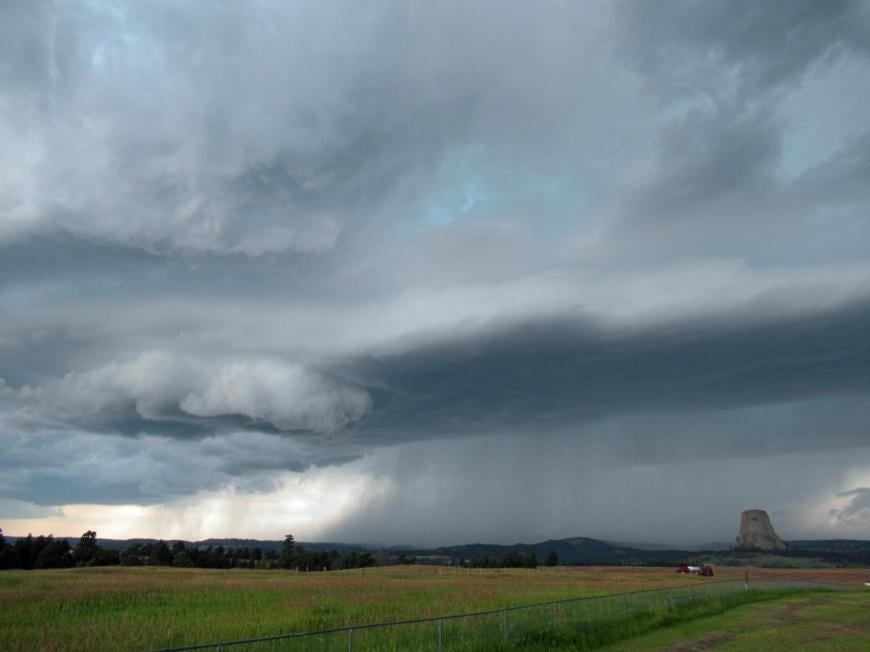
Cumulonimbus CB reach all the way up through the levels. They are the dramatic thunder clouds with dark bases giving heavy rain and sometimes lightning, hail and wispy ice anvil-shaped high tops.
The rain from these thunderstorm clouds can bring torrential downpours and so flash flooding. Sudden gusts, growling thunder and even funnel clouds, tornadoes or waterspouts.
 Cirrus top from distant CB photo M. McNeil
These are some of the most spectacular, perhaps ominous looking clouds. The top can still be well lit and white, looking more fibrous as it gains height and turns to ice. It can develop into a massive plume. Once it reaches the top of the troposphere, it stops rising, and winds will spread it out into the distinctive anvil shape. The top can over-shoot in places, showing that it could develop into a severe storm as it has plenty of energy.
Lower down the base of a CB can be very dark with all sorts of excitement. Only a Cumulonimbus cloud will produce hail, thunder or lightning. They usually formed from developing Cu Congestus.
“AltoCumulus Castellanus becomes Cumulonimbus altocumulogenitus, if part of upper portion is smooth, fibrous or striated, or if the cloud produces lightning, thunder or showers of hail” WMO Cloud Atlas
A cumulonimbus can generate all sorts of other clouds around it. Mamma is the most striking, often called mammatus (like udders/ linked to mammary glands). It shows rapidly descending air, turbulence plunging down from the anvil top of the CB.
“Mammatus clouds are some of the most unusual and distinctive clouds formations with a series of bulges or pouches emerging from the base of a cloud.” Met Office
It is a stunning cloud, and when lit by a colourful sunset, it can be quite spectacular.
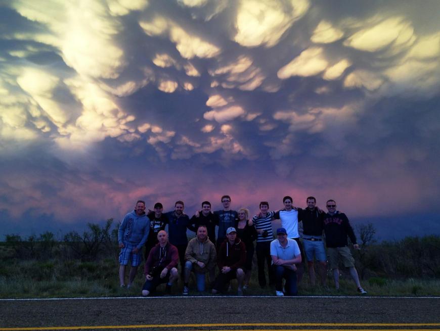 Mammatus in the background during a WeatherHolidays Storm Chase
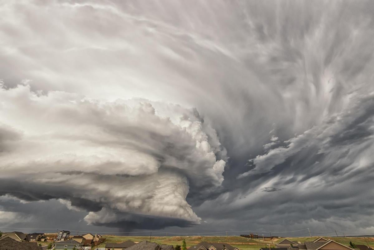
Arcus, a large dense roll cloud spreads out ahead of the storm cloud. Shelf clouds are attached to the storm cloud, whereas Roll clouds are a horizontal column separated from the storm cloud.
In a supercell, a smaller wall cloud Murus can be seen as an abrupt lowering of cloud from the base of CB. This will cause excitement for storm chasers as it shows an area of strong updraught and the possibility of a tornado forming.
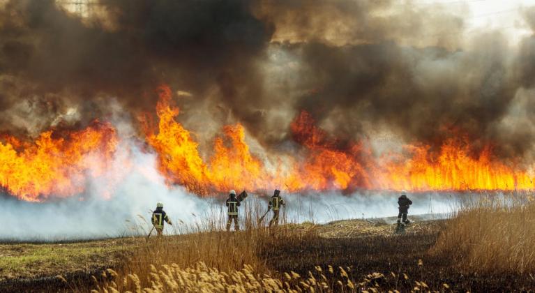
Cumulonimbus may develop from convection initiated by heat from forest fires, wildfires or volcanic eruption activity. Cumulonimbus that is clearly observed to have originated as a consequence of localized natural heat sources will be classified with the addition of flammagenitus. Cloud Atlas
 After all that excitement, Stratus St.
Stratus (St) A rather dull uniform grey layer cloud. If thick enough it can produce drizzle. If cold enough snow grains. It is often seen first thing in the morning and will break up during the day to give fine sunny weather. This is the lowest cloud, with “on the deck” being at the surface (then called fog) to just over 1,000ft, 300m. Fog is just stratus at ground level. Locally, it can be known as seafret or haar along the North Sea coast. It often creeps inland at night, filling the valleys and then can dissolve away by day depending on the time of year and strength of the sunshine. It needs calm conditions to form, and although precipitation will be light, you get quite damp and chilly from being in the cloud.
 East coast Haar or seafret over links golf course
Stratus nebulosus - a featureless, uniform grey layer that can produce drizzle. Stratus fractus - a stratus layer, which is beginning to break up, it is fractured. It looks ragged and changes.
Stratocumulus Sc This is very similar to AltoCumulus as seen in part 2, just lower. Just as high Ac can overlap with Cc, then Ac can overlap with Sc. It’s back to your arm length measurements. Regularly arranged small elements the size of three fingers + width at arm’s length.
They are still like a sheet (the Strato part) but have clumps or patches of cloud (the Cumulo part). At times, the sheet is thick and like a blanket but with some form showing lines or patterns, even waves. It can also be thin with more light, as though it has been stretched out too much and it has worn out, allowing the gaps. It is a very common cloud but can look quite stunning with its patterned areas and shapes. Stratocumulus undulates looks very ordered with a distinct pattern.
It can also abruptly end, showing a dramatic back edge with one half of the sky covered and the other clear. Precipitation is not likely. Species such as Floccus, castellanus and lenticularis can occur but are more often seen with Altocumulus.
So contrasting cloud Genera at this level, the small fluffy fair-weather Cumulus can grow and grow, sometimes reaching the Cumulonimbus thundercloud stage. The cloak of Stratus, damp and grey or the gloom of thick Stratocumulus sheet which can lift and thin to give brighter, decorative patterns above.
Hopefully, this has given some insight into the wonderful world of clouds, at all levels. There are so many. The WMO, World Meteorological Organisation even has a Cloud Atlas with numerous images and descriptions. The key areas are: what height region, what overall shape and then add in a few identifying phenomena to enhance your appreciation of the skies. Happy cloud spotting.
Loading recent activity...