The showers fade later on Friday with a fine start for Britain on Saturday. Rain over Northern Ireland will track eastwards and then clear. Windy with showers on Sunday. A changeable picture
The weekend weather will be changeable. Friday evening will see fine bright weather with a scattering of showers, particularly for Scotland. These fade away, and Friday night looks mostly dry and clear. Saturday will have a promising sunny start for Britain but cloud and rain will soon be across Northern Ireland and reach western Britain by lunchtime. This frontal rainband will be linked to the dominating low pressure for the end of this week.
The much-needed rain will work its way east and northwards, and although welcome in the current dry situation, it won’t be enough. Just a band moving through and it could be a bit patchy for parts of eastern Britain. As that clears, there will be evening brightness in the west. Sunday looks windy with the low centre to the northwest. There could be gales for exposed areas and a rash of showers developing.
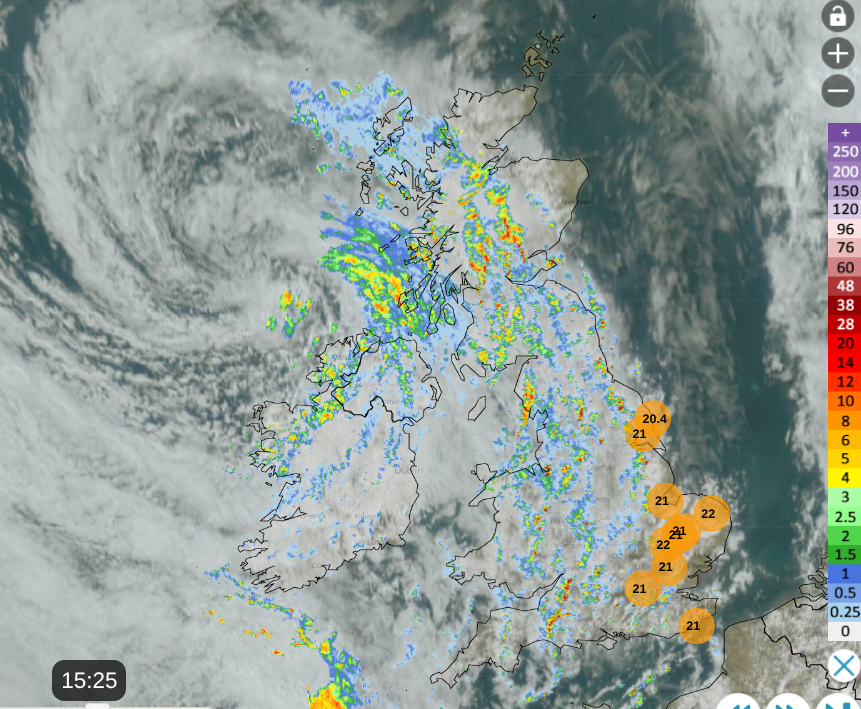
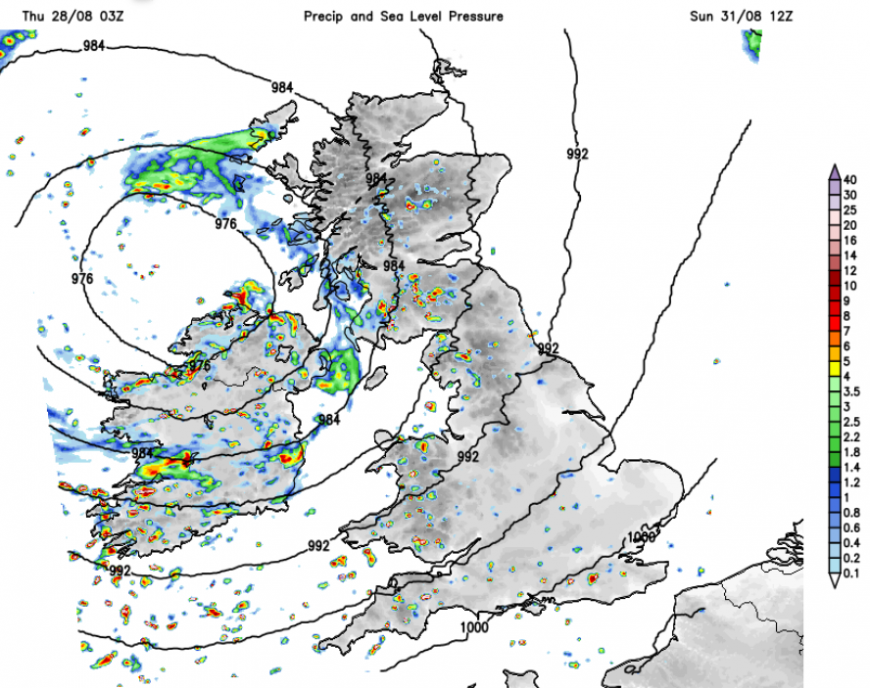
On Thursday, the low pressure to the northwest has brought a rash of showers. You can see on the Netweather Radar lines and clusters of rain showers with a swirl of cloud to the northwest around the low centre. There is clear, sunny weather over the North Sea and temperatures in that sunshine around 23C for parts of eastern England.
Just appearing to the southwest are new echoes on the radar, from a frontal band.
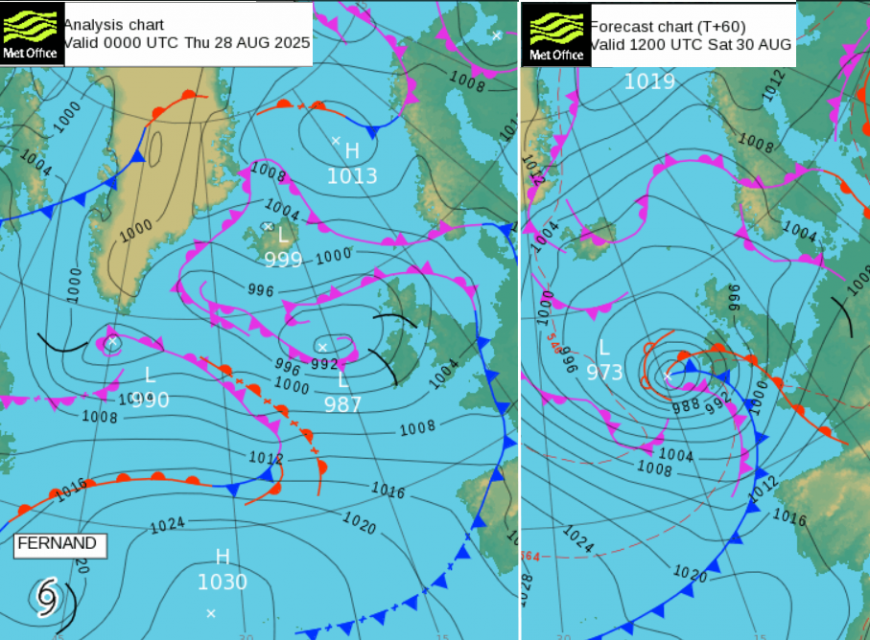
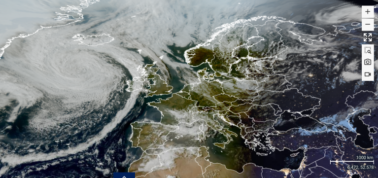
Trailing out across the Atlantic is a frontal boundary. Across the Atlantic, Tropical Storm Fernand will transition from a tropical cyclone and merge with a new low-pressure system that forms along the frontal boundary. So its energy and moisture are added to the low pressure, which ends up to the west of the UK on Saturday.
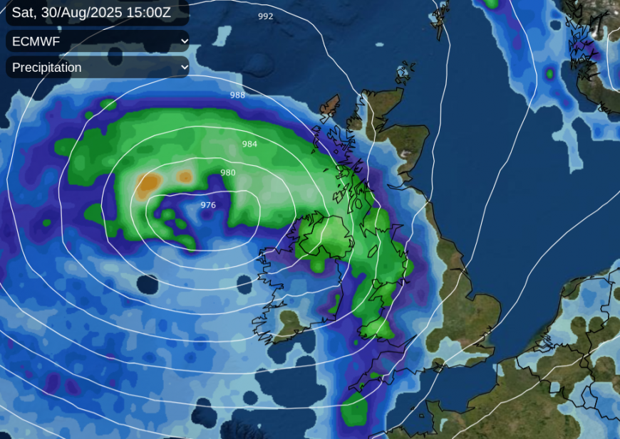
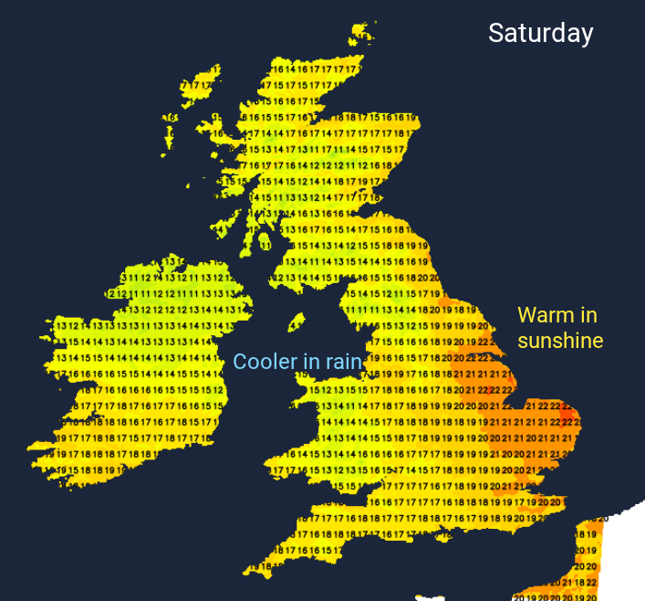
Ahead of the frontal bands, there will be fine weather and warm sunshine for Britain on Saturday. There is still some movement in the timing of when the frontal rain will arrive. You might see patchy outbreaks ahead of the main fronts and the cold front will have the heavier downpours. But this could make the difference between northern and eastern Britain, seeing a mostly fine day, with the rain only arriving in the evening. The ECM Model is slower than the UKV. East Anglia might see very little rain. Temperatures will be 18 to 23C but cooler in the rain.
The frontal bands will reach northern Scotland and SE England/East Anglia by Saturday evening and overnight with clear skies to follow, even fine, sunny weather for some on Saturday evening. There will be a southerly breeze for England during the day and the winds will strengthen around Northern Ireland and the Irish Sea on Saturday night.
Sunday will be windy. For many, it will start off fine with sunny spells but there will always be showers close to the low centre. A rash of heavy downpours will develop, particularly for Northern Ireland and Scotland, later into western Britain. Exposed parts of northwestern UK could see gales for a time on Sunday with heavy, even thundery showers. Much of England will miss most of the showers and see a fine but blustery day.
Loading recent activity...