“Unsurvivable storm surge with large and destructive waves will cause catastrophic damage from Sea Rim State Park, Texas, to Intracoastal City, Louisiana” NHC. “Hurricane-force winds are expected tonight in portions of the hurricane warning area with catastrophic wind damage expected where Laura's eyewall makes landfall.”
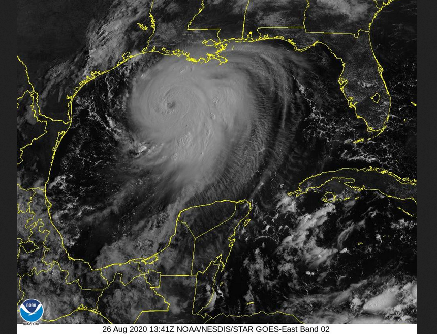
Hurricane Laura has rapidly strengthened from tropical storm dumping heavy rain over Cuba to a major hurricane with the possibility of reaching category 4 status. As it has churned across the warm waters of the Gulf of Mexico, it has ignored TS Marco which nipped ahead earlier this week.
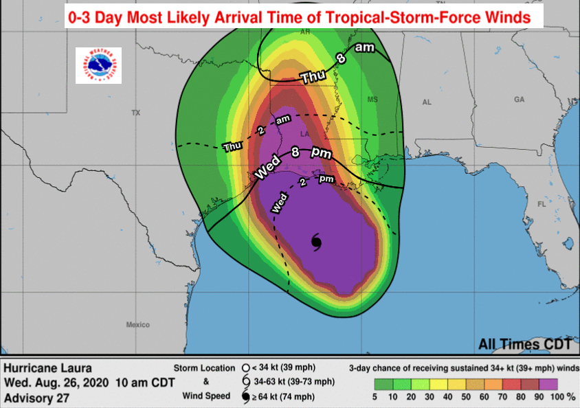
The focus of the warnings are eastern Texas including Houston and Louisiana with landfall forecast Wednesday night, early Thursday which would be around 7am for us in the UK.
LAURA STRENGTHENS INTO A MAJOR HURRICANE... ...POTENTIALLY CATASTROPHIC STORM SURGE, EXTREME WINDS, AND FLASH FLOODING EXPECTED ALONG THE NORTHWEST GULF COAST TONIGHT... ...STEPS TO PROTECT LIFE AND PROPERTY SHOULD BE RUSHED TO COMPLETION IN THE NEXT FEW HOURS.
Life threatening storm surge.
Although the winds are dangerous, many more people die because of the water in these events. "A storm surge of up to 4.5 metres above the ground is forecast which could penetrate up to 30 miles inland from the Gulf coast." NHC
Extreme winds
"Laura is a dangerous category 3 hurricane on the Saffir-Simpson Hurricane scale, and is forecast to continue strengthening into a category 4 hurricane later today. maximum sustained winds have increased to near 115 mph. Laura is a large hurricane. Hurricane-force winds extend outward up to 70 miles (110 km) from the centre and tropical-storm force winds extend outward up to 175 miles." NHC
Could it reach Cat. 5, well in 2020 anything seems possible and it has been developing at an incredible rate. Currently, it is not forecast to do so.
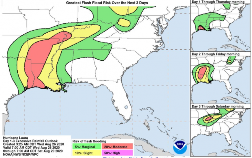
Flash flooding
There will be heavy rains but one saving grace is that this cyclone shifts inland northwards fairly quickly. The storms which linger and just continue to dump huge rainfall along coastal states often result in huge flooding problems even days after landfall.
“From this afternoon through Friday, Laura is expected to produce rainfall totals of 5 to 10 inches, with isolated maximum amounts of 15 inches across portions of the northwestern Gulf Coast from western Louisiana to far eastern Texas, and northward into much of Arkansas.” NHC
Hurricane Laura thread on the Netweather forum
Loading recent activity...