The weather is showing wild mood swings at the moment, which is fairly typical for early Spring. After temperatures soared to 17C on Saturday at many locations across the UK, even in the north, Monday starts chilly with a frost for many and snow over higher parts of northern and western Scotland, as a band of rain arriving across northern and western parts of Britain bumps into the colder air. This rain will move east across most parts today ahead of a deep depression which will whizz northeast just north of Scotland this evening, bringing severe gales or storm force winds to Scotland, N. Ireland and the far north of England Monday night.
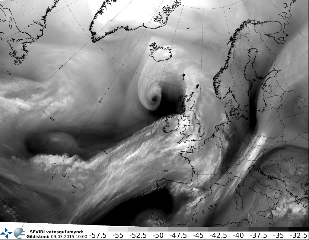
Satellite Airmass image below, courtesy Icelandic Met Office, shows a clear hook on the low, which continues to deepen with strong winds in the clear southern and western flanks near the centre:

The deep low, currently out over the Atlantic NW of Ireland, will be driven NE by a strong belt of southwesterly winds. There are a number of 'jetstreaks' embedded in this strong SWly flow, the low has been in the developmental right entrance of one jet streak this morning but also is now coming under the developmental left exit area of another jet streak moving up from the SW, so another bout of intensification appears likely, maintaining its intense circulation as it arrives close off NW Scotland this evening. Cold conveyor belt winds of 90knts+ (at 925mb) wrapping into the low and descending towards the surface with help of dry air intrusion and rapid pressure rises on the S and SW flank of the low will bring very strong winds to the ground across far north of EIRE, N. Ireland and western Scotland this evening.
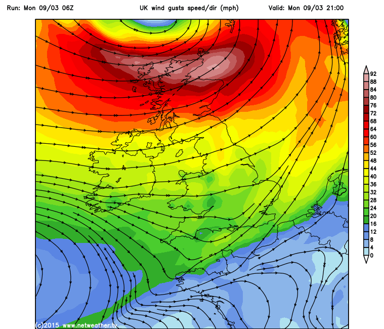
GFS is indicating wind gusts reaching 70-80mph across Donnegal, County Londonderry and County Antrim from early afternoon until early evening. Then northern and western Scotland seeing winds gusting to 80-90mph (perhaps more over mountains and exposed western Islands) between 3pm and midnight before winds subside in the early hours as the low heads off towards Norway. These winds are obviously damaging and will likely cause some travel disruption too. It will be very wind across much of northern Britain, though gales more likely than severe gales or storm force winds away from northern Scotland and N Ireland and far north of EIRE, perhaps gusts of 50-60mph through the central lowlands this evening with a bit of funneling.
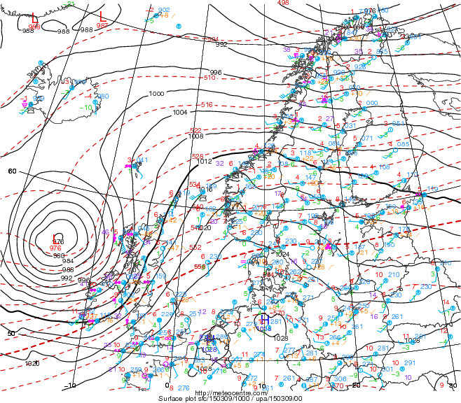
The central pressure of this deep low drops to around 973mb north of Scotland 9pm this evening on ECMWF, 972mb on 00z GFS at the same time. To emphasize these mood swings from the weather at the moment and the rapid rise of pressure as the low passes, the barometric pressure in Thurso, in the far north of Scotland is forecast to drop 987mb at 8pm this evening, while rising to 1027mb at 8pm Tuesday evening - as a ridge of high pressure quickly builds in from the south tomorrow. That's a pressure rise of 40mb in 24hrs!
The rest of the week looks changeable, Tuesday looks mainly dry and sunny as the ridge of high pressure builds in, pressure reaching 1031mb over central England. Turning wet and windy again across the west on Wednesday, as the ridge moves away east, the rain reaching the east by midnight, though winds easing in the south as pressure builds from the south again. Another brief ridge of high pressure building north on Thursday looks to bring a dry and sunny day for most. But wet and windy weather returns across the west Thursday evening before spreading across all parts overnight into Friday morning, as deep low over the Atlantic races NE towards Iceland.
Drier and more settled conditions are indicated from the weekend though, as a strong ridge of high pressure building over Scandinavia and NW Russia joins forces with high pressure ridging up from the SW. This will mean a greater risk of overnight frosts and, although Saturday maybe mild, models indicate a cold and raw SEly or Ely flow developing off the near continent from Sunday and into early next week, which could bring grey skies and some drizzle to eastern areas, perhaps even some wintry precipitation if the air becomes cold enough.
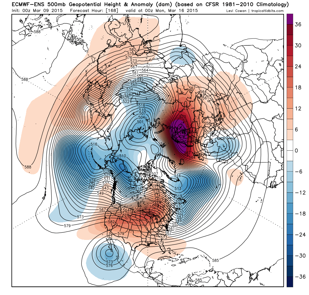
00z EPS mean anomaly chart for day 8, courtesy of Tropicaltidbits.com, shows the ridge close to the east bringing a colder Ely flow.
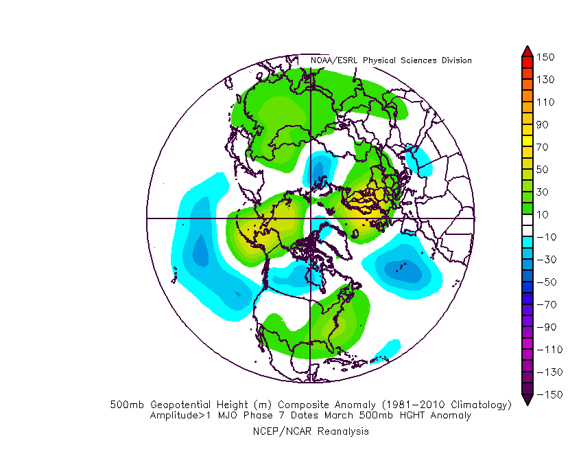
Most model MJO forecasts (Madden Julian Oscillation is a tropical oscillation which can impact weather patterns in temperate latitudes) suggest moving into high amplitude Phase 7 later this week - which supports the idea of pressure rises to our E and NE as the March P7 composite, below suggests: