A few areas of low pressure moving off the Atlantic will bring wind and rain at times with showers in between over the coming week, Monday will see gales over England and Wales, with a risk of drisruption. Turning warmer from mid-week.
Heavy rain and strong winds will affect much of the UK later today and through Monday, as a fairly deep area of low pressure moves off the Atlantic across Scotland early tomorrow. There is a risk of disruption from gales developing from the west overnight and through Monday following the heavy rain pushing east this afternoon and evening, more particularly across England and Wales.
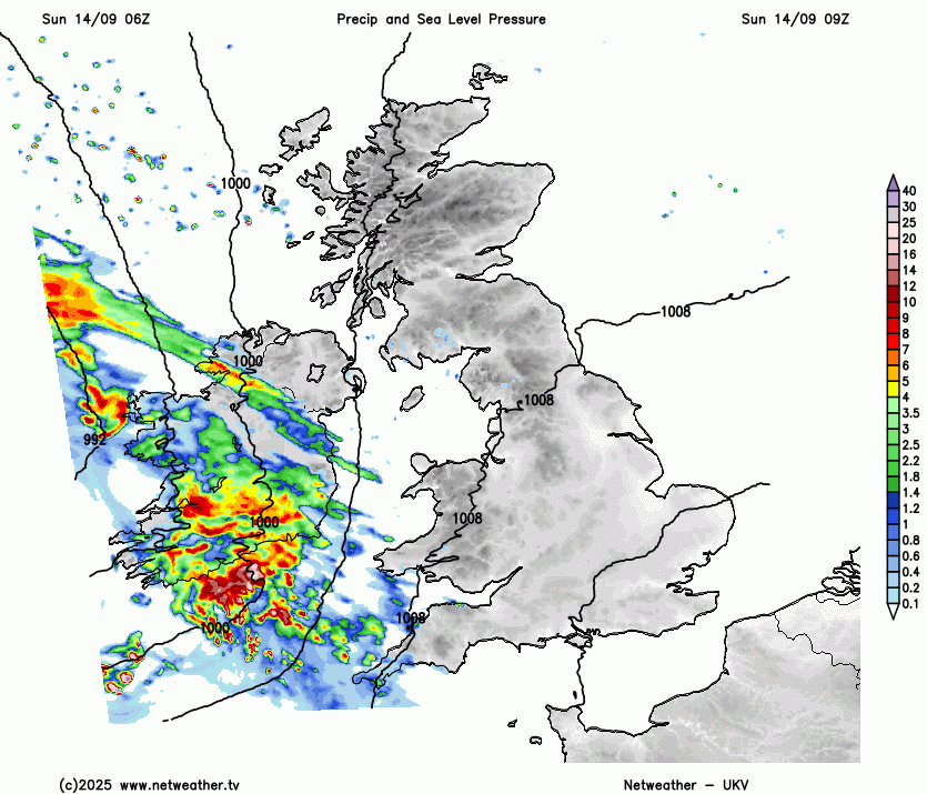
Rain is already pushing in from the west across N. Ireland, Wales and SW England. Through the afternoon rain and increasingly wind conditions spreading north and east across the rest of the UK, after a dry and bright morning, but with cloud increasing from the southwest. Rain will be quite heavy at times, turning squally with gusty winds and perhaps a rumble of thunder before it clears this evening across south Wales, southern England and East Anglia. There is risk of flash-flooding and a low risk of a tornado with this squally rain in the south, as highlighted in the Severe Thunderstorm Watch issued.

More persistent rain arriving this afternoon clearing most areas by late evening, though lingering across northern Scotland, clear spells following overnight, but also scattered heavy showers moving in across western areas of the UK, perhaps with the odd rumble of thunder, mostly dry towards the east. Turning increasingly windy, with gales developing across Ireland, the Irish Sea, Wales and western areas of England, with gusts of 50-60mph around coasts.
Strong winds developing from the west overnight and through Monday
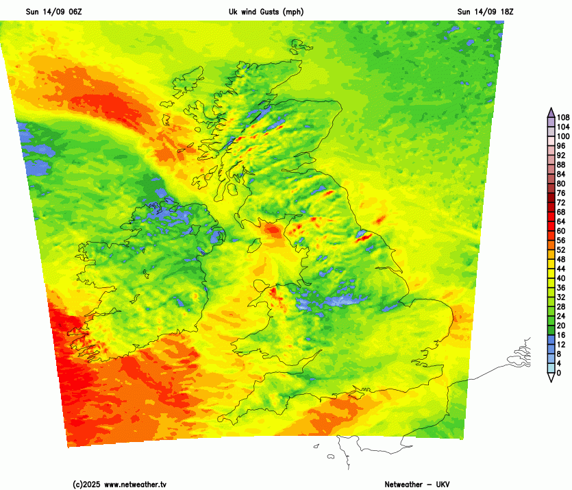
A windy day on Monday, more especially across England and Wales, with gusts of 50-60mph around western coasts and hills, also along English Channel coasts, isolated gusts of 60-70mph possible with exposure along Irish Sea coasts. Inland across England and Wales could see gusts of 40-50mph locally. So potential for travel disruption, with trees or tree limbs brought down, which may affect rail travel, along with delays to ferries and flights. Winds not quite as strong over Scotland, as the centre of the low crosses here. As well as the strong winds, heavy showers will be blown east through the day, most frequent across the north and west - where they may merge into longer spells of rain, but some sharp showers also developing across central, southern and eastern England too, as the sun warms the air in sunny spells. Temperatures reaching 16-19C.
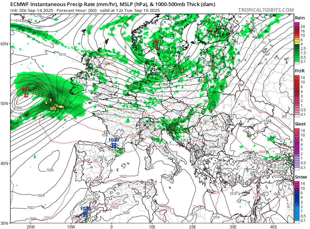
Monday’s low crossing Scotland will move away towards Norway on Tuesday, so winds easing, some showers for a time through northern England and northern Scotland - but these easing through the afternoon. Elsewhere mostly dry and bright or sunny, as a brief ridge of high pressure builds, though a few isolated showers can’t be ruled out. However, cloud will thicken and rain will arrive across the southwest by early evening - heralding the arrival of the next low pressure system moving in for Wednesday.
Some uncertainty from computer models where the low will track exactly, but it looks like a spell of heavy rain will push east across many areas Tuesday night ahead of the low arriving to the northwest. Rain easing eastwards east Wednesday morning, then a cloudy and windy day with further patchy light rain or drizzle.
Another low arrives mid-week, pushing a spell of heavy rain east and turning windy again for a time
It looks to remain rather cloudy at times and breezy with further patchy rain or drizzle from time to time, especially towards the west - where longer spells of rain are possible, on Thursday and Friday. Best chance of sunny spells to the east of high ground across eastern England and eastern Scotland - where it could feel quite warm, with temperatures reaching the low 20s Celsius. Though generally warmer and more humid everywhere after mid-week, with a long-fetch Tropical maritime southwesterly flow, hence western areas may be cloudier and wetter than further east.
Uncertainty for next weekend, but we may see another low pressure system move east off the Atlantic - bringing increasingly windy conditions, a spell of rain followed by showers. As the low clears east by early the following week, turning cooler but drier from the north or northwest for a time, then signs that high pressure may build in from the west that week, bringing drier more settled conditions.
Loading recent activity...