
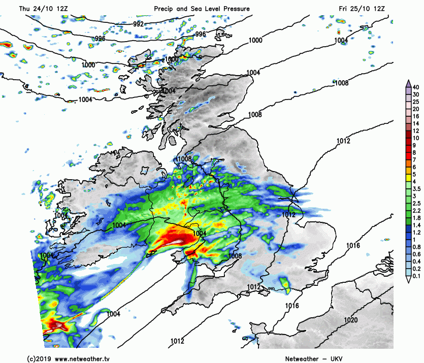
Wales along with northern and western parts of England could see some disruptive rainfall on Friday and Saturday, with Met Office Yellow Warnings out for parts of northern England, West Midlands, Wales and SW England. Prolonged heavy rainfall is expected to develop across these areas Friday morning and linger across these areas into Saturday before eventually clearing away southeastward Saturday afternoon.
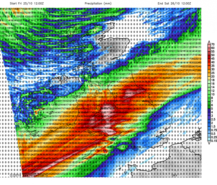
During this spell of rain, 15-40mm of rain can be expected widely in the watch areas, but locally hillier parts of northern England could see 70mm (nearly 3 inches), hillier parts of SW England locally seeing up to 90mm (nearly 4 inches), while higher ground of Wales could see as much as 120mm (nearly 5 inches).
UKV model rainfall totals (mm) between noon Friday and noon Saturday
Such large rainfall totals in 24 hours may lead to watercourses overflowing leading to flooding of properties, standing water leading to difficult driving conditions, with a risk of some roads becoming flooded and cutting off communities.
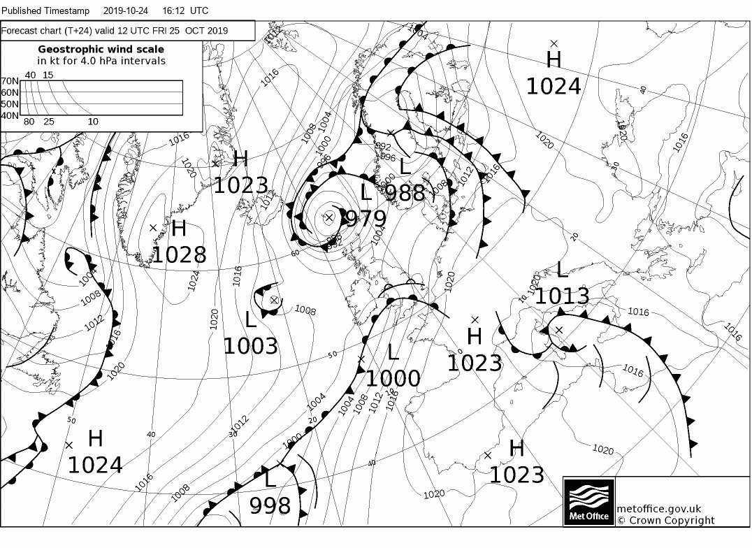
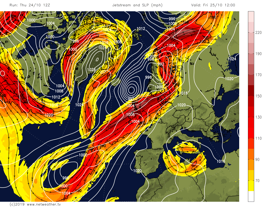
The prolonged and heavy rain arriving tomorrow and lingering over the same areas into Saturday can be attributed to a waving frontal boundary arriving on Friday which by Saturday lunchtime will stretch from Denmark southwestward across central England and Wales then all the way down to the Azores. This frontal boundary separating colder arctic air spreading down from the north between Greenland and Scotland and a conveyor of warm and moist sub-tropical air pumping northeast from south of the Azores all the way up over southern Britain and beyond across the North Sea.
UKMO fax charts for 12z Friday, 00z & 12z Saturday show slow-moving waving frontal boundary bringing the prolonged and heavy rain
 Conveyor of warm and moist tropical air drawn from way to the southwest, south of the Azores, lifted by frontal boundary creating prolonged rainfall
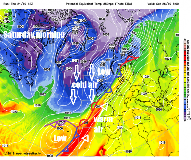
A strong jet stream will run parallel to this frontal boundary, with ripples running northeast along the jet causing waves along the slow-moving frontal boundary below, which will lie across SW and central parts tomorrow and Saturday. Denser cooler and drier air undercutting the slow-moving boundary from the north and the waves moving along the front will create enhanced lift of the warm moist surface flow into cooler air aloft and induce pulses of prolonged heavy rainfall. The heavy rain further enhanced by uplift of western slopes of higher ground in the north of England, Wales and SW England (orographic uplift if you use the meteorological terminology).
Ripples in jet stream parallel to frontal boundary will cause waves along the front, enhancing rainfall
So a good 24 hour deluge seem likely across SW England, Wales, West Midlands and northern England. However, much colder air drier air of arctic origin spreading down across the far north Atlantic will eventually win out over the weekend, pushing the conveyor of warm moist tropical air away southeastward into mainland Europe.
Saturday evening onwards we lose the warm air across the south to be replaced by colder air from the north across all parts into early next week, this means a risk of cold nights with some frosty starts in the mornings. But we will at least see the back of the recent wet weather, with drier and more settled conditions as high pressure builds.
Loading recent activity...