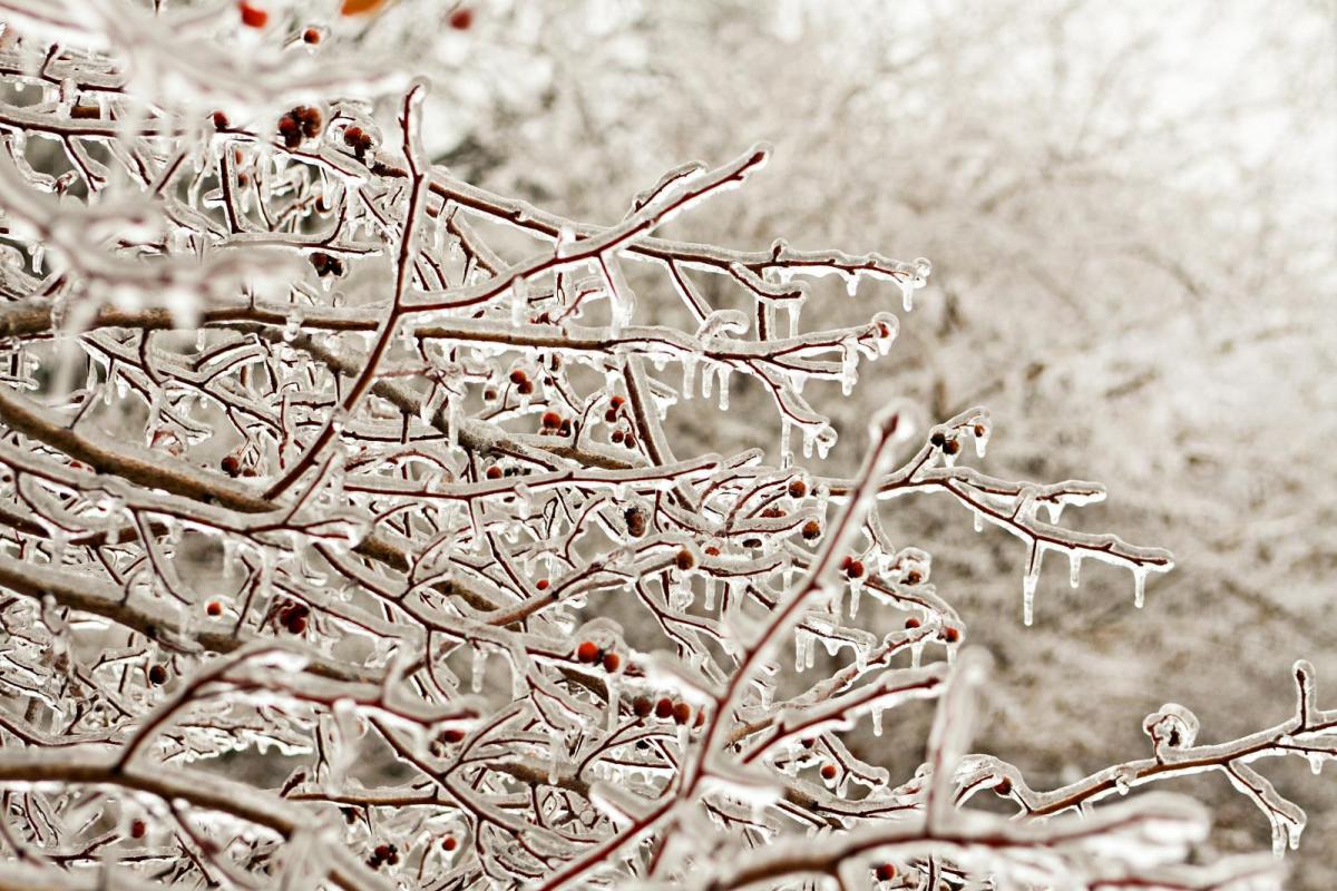
This is not just cold rain, on a miserable day. Freezing rain is an unusual type of precipitation which consists of supercooled droplets which fall from the sky as rain, but when it hits a surface, it freezes instantly. This can be on trees, leaves, cars, power cables and roads or pavements. Conditions become lethal, known as an icestorm in the US.
The conditions for its formation have a definite signature on forecast charts. Cold air aloft to form snow, a thin layer of warmer air, where the snow could melt and then colder air again nearer the surface. The melted liquid, the raindrops falls through the colder air near the surface but doesn't manage to solidify, just becomes supercooled still as a liquid. The instant it hits a cold surface there is a coating of thick black ice. It can bring down power lines with the extra weight, branches look amazing but on the transport network it can bring mayhem.
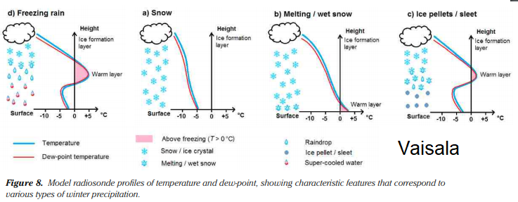
If the air is cold enough, precipitation just falls as snow. If the air is warmer at the surface we may get rain, or a mix of rain and snow often called sleet. You will also notice Ice pellets which form in similar but less pronounced atmospheric conditions. They are not hail, which forms in convective clouds from being stirred up and down in draughts inside. This is from frontal cloud and ice pellets are smaller than 5mm and are spherical or irregular transparent ice particles. They tend to fall from stratiform cloud. There is quite a list of wintry precipitation, it links to what qualifies for a White Christmas
It is not usually widespread here in the UK, it doesn't occur very often here but the setup for Saturday 15th Dec 2018 is causing concerns. Also, people will be travelling in the run-up to Christmas and venturing out for shopping, visits and parties as well as work. There are warnings for Snow, rain and high winds too, it will become a miserable day.
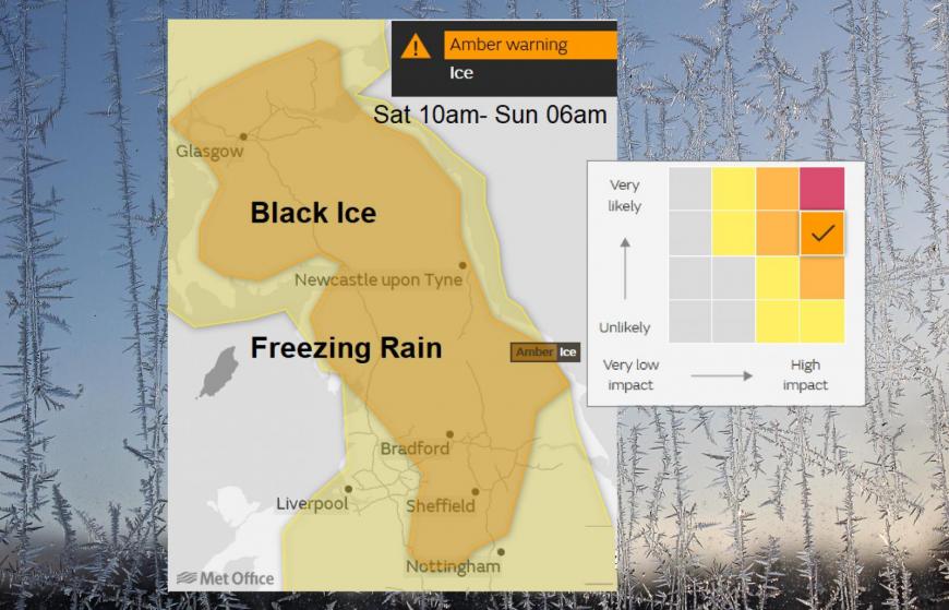
Heavy freezing rain is expected to develop during Saturday. This will result in the rapid formation of widespread ice on roads, pavements, trees and other structures. Freezing rain is rare in the United Kingdom but when it does occur the impacts can be very severe. This is due to the fact that it can form very quickly, it can be difficult to see and is incredibly slippery. Met Office Amber Ice warning.
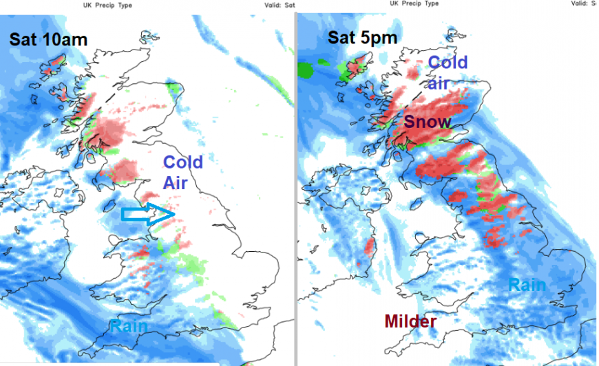
The wet and wintry weather with strong winds will be moving NE during Saturday.
Conditions for Freezing Rain here in the UK can be quite borderline, so within the wide Amber and even yellow warning area, there are concerns for the wintry weather but not an exact location and timing for the freezing rain. The potential is there. If reports do start to appear, then it would be advisable to delay your journey. You may consider yourself a safe driver with winter tyres but there is everyone else out there and when the black ice forms from this it becomes an ice rink.
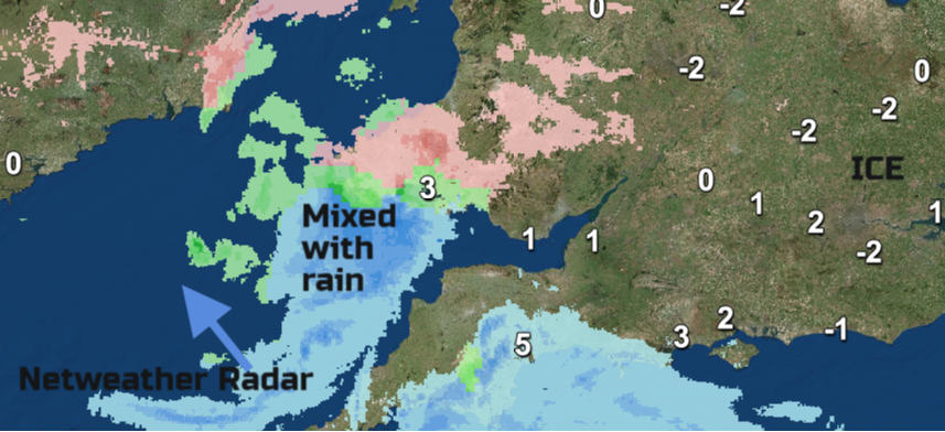
During the Beast from the East when Storm Emma joined in for SW Britain, there were freezing rain warnings. This Netweather Radar image from early March 2018. Click on image to see current progress of rain and snow.
Keep an eye on travel updates, the Netweather Radar which can give an indication of where the precipitation is freezing, but is more of a guide. Don't assume your area is okay, just because the purple/pink returns aren't present. It's an interesting rare phenomenon for us in the UK, but it can create lethal conditions.
Loading recent activity...