High pressure will be over the UK at the weekend with a lot of sunny and dry weather. There will be some early low cloud, mainly near coastal areas, but overall fine. Some parts will remain very warm, others will see a change in the airflow, which has been linked to the heatwave conditions over southern Europe.
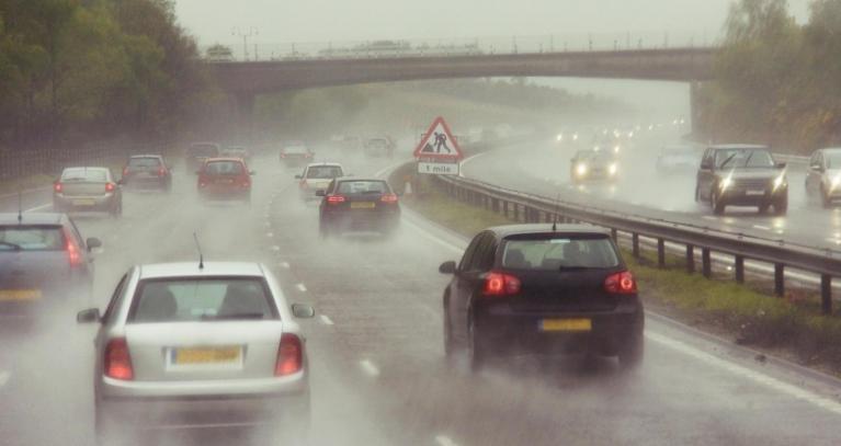
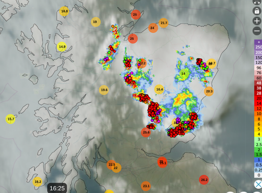
It’s been a different day on Thursday, still very warm or hot but with more cloud for many parts. This is increasing humidity and there has been a small cluster of thunderstorms over the Grampians. It does feel more close and sticky, but without the sunshine, the temperatures aren’t quite as high as yesterday.
Bramham in the Leeds Metropolitan borough reached 33.2C on Wednesday. Nottingham was sweltering 32.2C, Glasgow reached 29.1 as temperatures reached 28.1C at the Giant’s Causeway in County Antrim.
It has been eastern Britain seeing the highest temperatures on Thursday as a slight westerly wind has set in from the Atlantic and is just allowing a shift, to less warm air instead of the southern Europe heat of midweek.
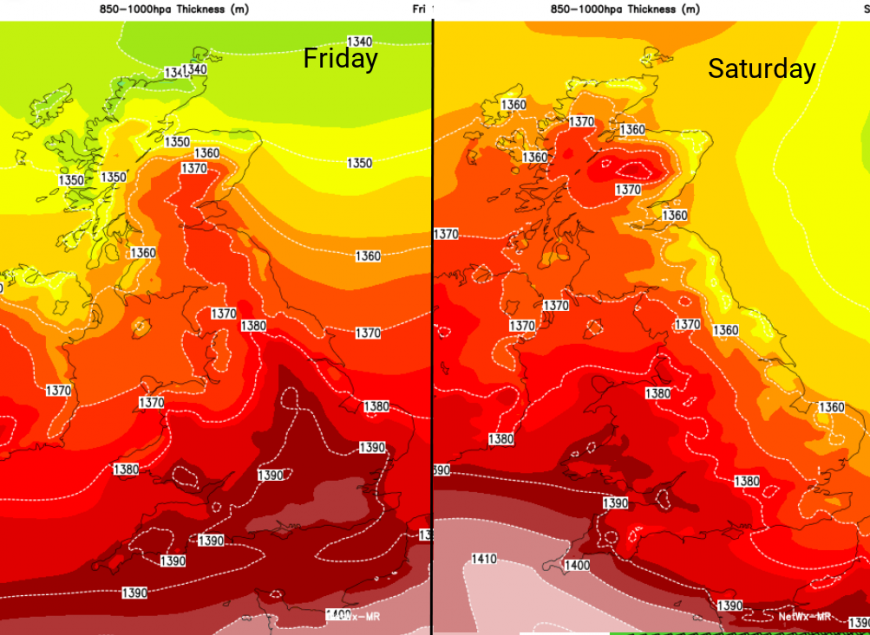
The shift in airmass will continue on Friday, coming into northern Scotland with a light northerly wind. Inverness saw 26C on Thursday and will be nearer 20C on Friday. High pressure will topple over Scotland from the northern Atlantic and around this, there will be fresher air down the North Sea. As an Easterly sets in, eastern Britain won’t be as hot, certainly a difference from Thursday. It will be southwestern Britain that will see the highest temperatures on Saturday from London up to Merseyside and down to the West Country in the region of 25 to 29C
There will be these changes, but it remains warm into next week, with temperatures inland in the mid to high twenties.
Friday
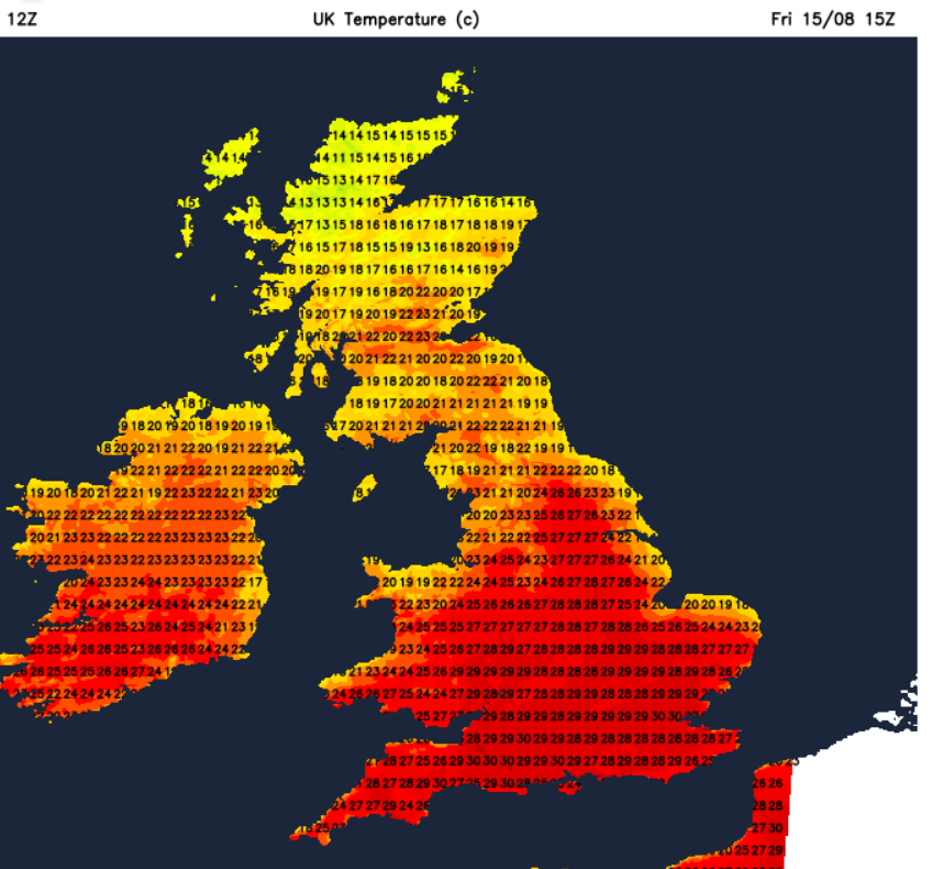
There will still be a few showers on Friday, but not the heavy downpours and thunderstorms that affected Scotland on Thursday. Early showers in the north will fade as Scotland and Northern Ireland see a fair amount of cloud, but brighter in the afternoon. Through the Central Belt temperature should reach 21 to 24C and in Northern Ireland 20 to 22C. For England and Wales, there will be plenty of sunshine and so temperatures will rise, York and Leeds 27C. Birmingham and Southampton 29C and London at 30C and almost calm for southern Britain. Northern Scotland will feel cooler to end the day.
Friday evening will be warm and sultry but with low cloud beginning to drift off the North Sea, particularly for northeastern Britain.
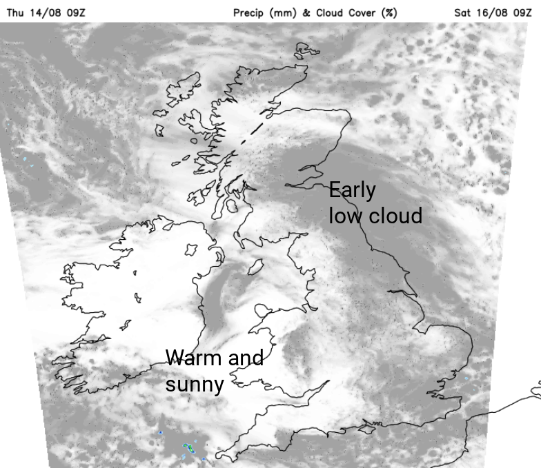
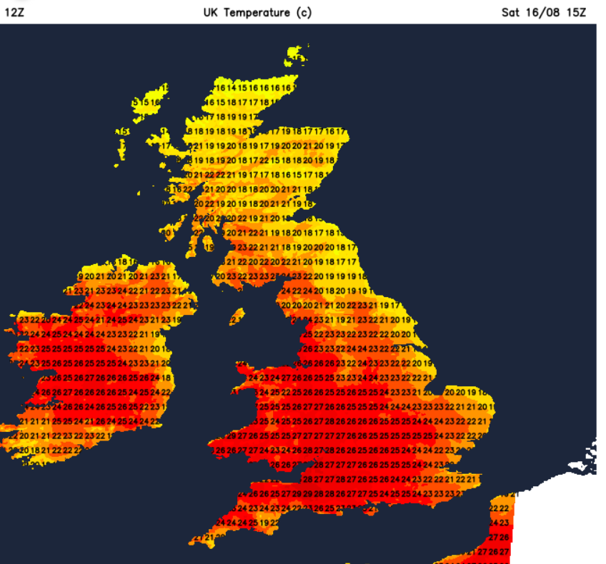
Saturday looks dry and warm across the UK. There will be the early low cloud from the North Sea and a refreshing easterly breeze for East Anglia, Kent and the Thames estuary. Northeastern Britain will be fine, but not as hot. To the south and west, it will still be very warm. Temperatures could reach 30C around the Bristol Channel. Saturday night could feel a bit more comfortable for central and eastern Britain.
Sunday looks similar. Again, some low cloud for North Sea coasts with a fine and sunny day developing. There is a small chance of a shower later in the day reaching Northern Ireland or SW England but overall it is more fine weather on the way and more heat further north than on Saturday.
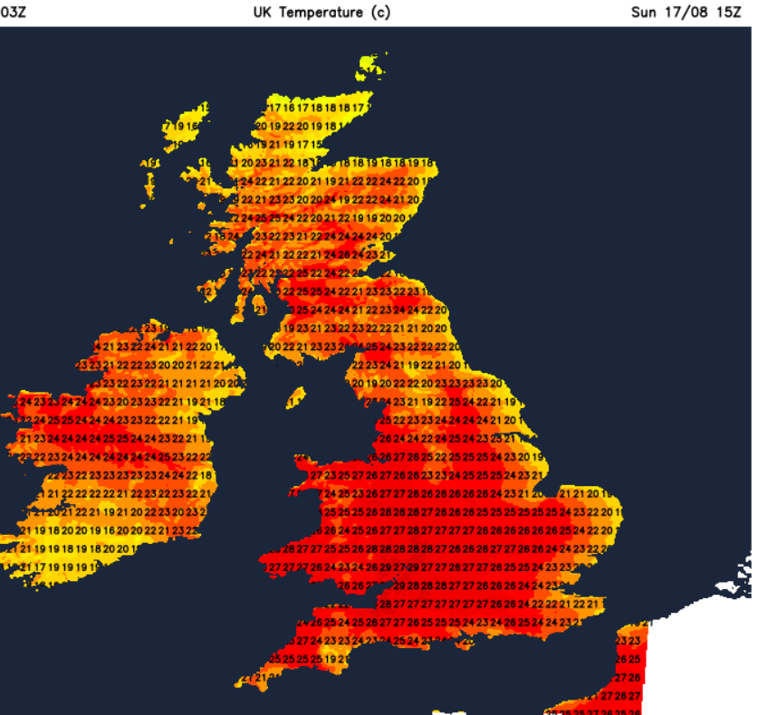
Glasgow could see 26C, as should Manchester. There will still be the refreshing breeze coming onto the coasts of eastern England. Overall, a glorious weekend but it might still be too hot for some people.
Loading recent activity...