Hurricane Leslie to make landfall across Portugal tonight, bringing dangerous winds, surf and heavy rainfall.
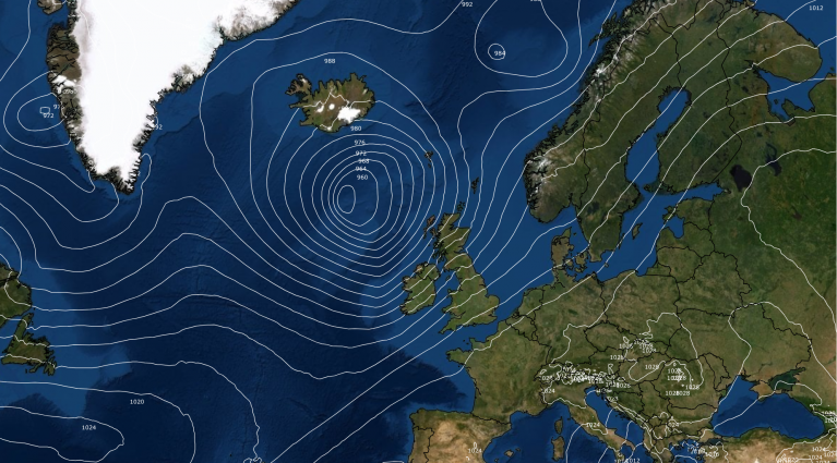
Hurricane Leslie has been wandering around as a tropical storm over the tropical central North Atlantic for the last three weeks since its formation. Over the past few days Leslie has started to move east to the south of the Azores, being caught by a trough in the upper westerlies, and now tracking northeast to make a rare landfall, for a tropical system, across Portugal later this evening.
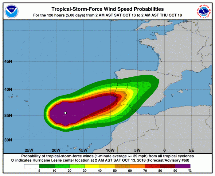
The track of Leslie until today
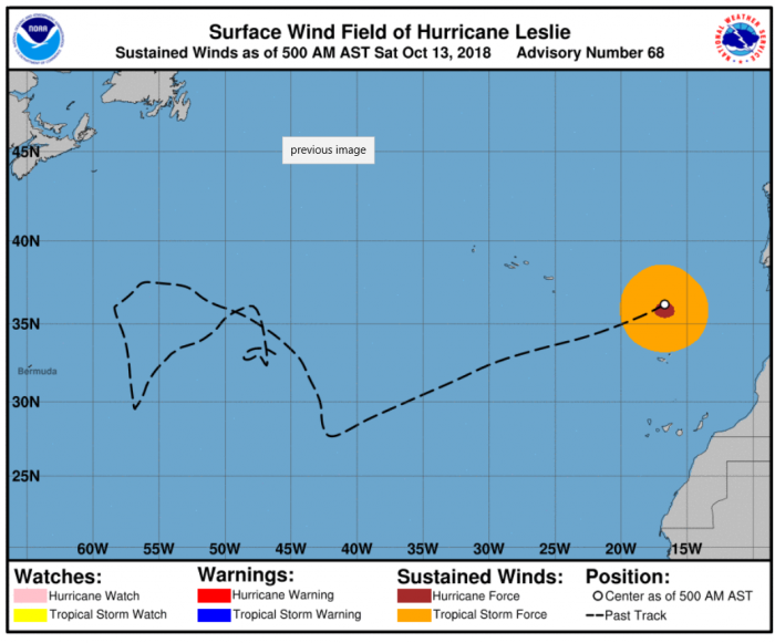
Leslie’s track, until yesterday, was uncertain, as late as some 48 hours out. The hurricane was forecast by the U.S. National Hurricane Center to loop back south then southwest, brushing the Canary Islands, then model guidance started to agree on a track northeast towards Iberia early yesterday. The uncertainty perhaps related to how the hurricane interacted (or not) to the upper westerlies, which now look to engage and push the storm northeast.
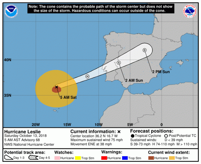
Hurricane Leslie this morning is a category 1 storm with maximum sustained winds of 75mph and a central pressure of 980mb, moving east-northeast at 38mph. Leslie will weaken slightly as it continues ENE toward the Iberian Peninsula today, the centre likely to make landfall across the central coast of Portugal tonight. Dangerous winds with gusts reaching 75mph, perhaps as high as 90mph with exposure, dangerous surf and heavy rainfall (locally over 100mm) will affect Portugal and western Spain tonight and into Sunday before the system weakens as it moves inland.
From the U.S. National Hurricane Center
Key Messages:
1. Leslie is expected to bring near hurricane-force winds to portions of Portugal late today as a powerful post-tropical cyclone. Gale-force winds are also likely to affect portions of western Spain tonight and Sunday.
2. Leslie is expected to produce rainfall amounts of 25 to 75 mm (1 to 3 inches) with isolated amounts as high as 125 mm (5 inches) across portions of Portugal and Spain, which could cause flash flooding.
3. For more information on Leslie, interests in Portugal should refer to products from the Portuguese Institute for Sea and Atmosphere at www.ipma.pt Interests in Spain should refer to products from the State Meteorological Agency at www.aemet.es
Leslie will not technically be a hurricane when it makes landfall across Portugal tonight, as it is currently making its extratropical transition. Leslie is losing its eye while cooler air is entraining into the western and southern side of the circulation, however, winds around Leslie will still maintain at or near hurricane force when it makes landfall tonight, before the system rapidly weakens as it heads inland over Iberia.
It will scupper the holiday plans for some in Portugal and western Spain this weekend and those that have planned a weekend getaway to Lisbon not expecting strong winds and heavy rain! The storm could cause some travel disruption to rail and air across western Iberia this weekend.
Loading recent activity...