Northern Britain will face some unseasonably windy weather over the next 12 to 24 hours, as Storm Hector, named by the Irish Weather Service, swings northeast past the north of Scotland. This depression will deepen over the next 12 hours as it approaches the northwest of Britain. A powerful jet stream crossing the Atlantic and sharpening upper trough behind the depression will work in tandem to intensify Storm Hector, with the isobars tightening on the southern and western flank of the low as its central pressure falls.
Although the storm is unseasonal, is not unusual for deep depressions to visit the UK occasionally in June, as the jet stream can wake up, return to the UK and strengthen after a spell of more settled and blocked weather as such as we’ve seen in May and the start of June.
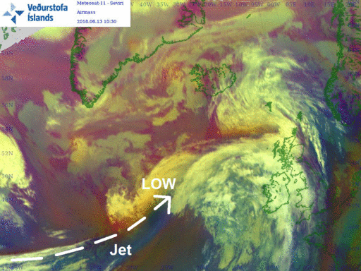
Jet stream and surface level pressure shows Hector, to left of UK and Ireland at the beginining of the loop, deepening and passing the north
The airmass image loop below shows the jet streak intrusion (in blue) overriding the developing ‘cloud head’ of Hector (in white) helping deepen the low.
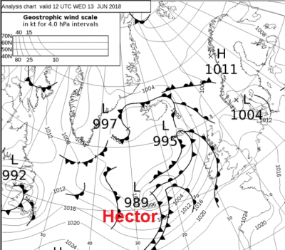
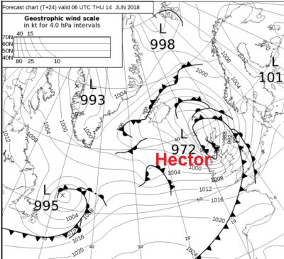
Hector’s centre was around 989mb at noon on Wednesday, tomorrow, the central pressure of the depression is expected to fall to around 972mb.
With the centre of Hector passing somewhere near the Faroe Isles Thursday morning, the strongest winds are likely to develop from late evening and through the early hours of the morning across Ireland and N. Ireland with gusts of 50-60mph likely, locally up to 70mph around northern and western coasts and over hills.
Then as we head through the morning, these strong winds will transfer across Scotland and Northern England, again gusts of 50-60mph likely, perhaps 60-70mph around western coasts and over the hills, with some funnelling of winds through the central belt possible towards mid-morning, as winds veer westerly.
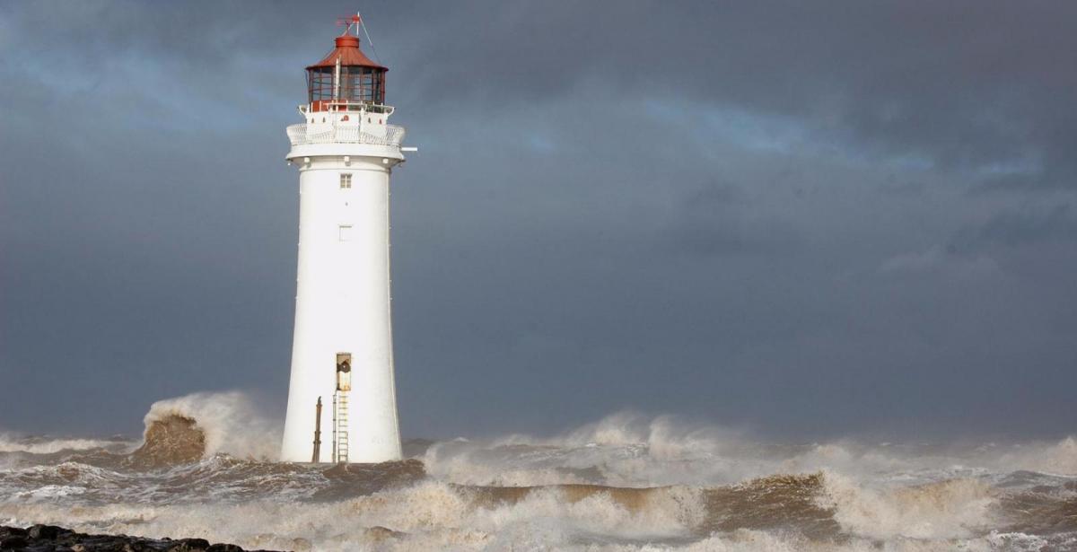
So, we can expect some travel disruption – with bridges closed, air travel disrupted and ferries cancelled. With trees in full leaf now, there is the greater risk, than would be the case in winter with similar wind speeds, of branches or whole trees coming down in the strong gusts. There will also be some persistent and heavy rain this evening, tonight and into tomorrow across parts of northern and western Scotland, particularly windward slopes of higher ground.
The winds will ease from the west as we head into the afternoon, with the worse of the winds gone by mid-afternoon.
Following Hector, the jet strong Atlantic jet stream will continue to flow west to east over the UK to end the week and over the weekend, so it will continue unsettled with further spells of rain or showers and it will be windy at times too, particularly again on Saturday across more southern areas this time, as low moves across central areas, though not as windy as the next 24 hours.
Loading recent activity...