Earlier this week I wrote an article about Where's my sunshine? and I'm still looking at east coast low cloud, haar or sea fret hearing tales of 27C for the west coast. Now it seems "The forecast said rain, they said there would be thunderstorms" is the question being bandied about, with "the forecast was wrong" which upsets people in my profession.
How to get across the weather warning message has long been a conundrum; to make it simple, understandable, serious and not too long-winded. Currently, we can not warn for every person in the UK, their home, school, commute and backyard.
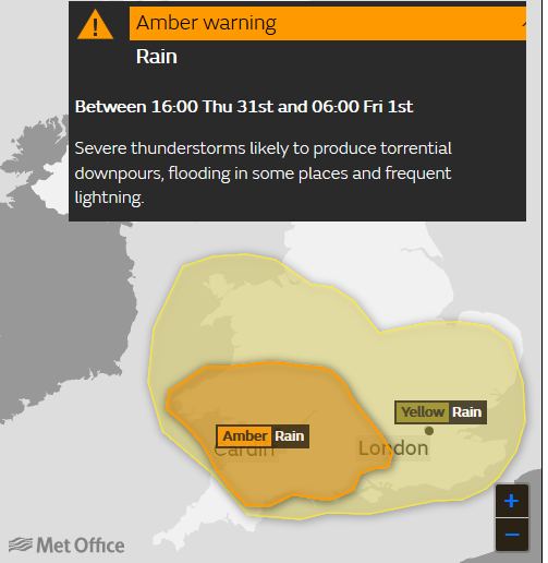
So what does a warning area for rain showers and thunderstorms mean?. These warnings came out from the UK Met Office on Thursday 31st May, one Yellow warning across much of southern England and also Wales and an Amber for some of SW Britain.
And relying on an app won't help in these situations. You may have seen thunderstorm symbols dance about on the forecast, sometimes appearing for a morning then the afternoon then disappearing leaving just cloud symbols, why is this?
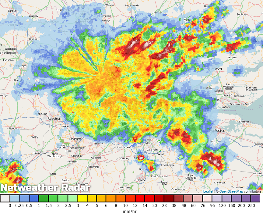
For what actually is happening with the real weather we can look on the Netweather Radar which shows an image of the rainfall (and lightning strikes) every 5 minutes, so a snapshot of real rain data.
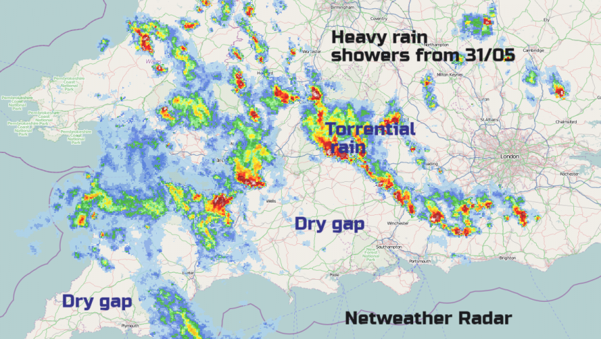
Within the warning areas for showers. the potential is there for heavy rain, but it doesn't guarantee that it will necessarily be on your head. All of this area was under the Amber warning and there were torrential downpours, there was hail and flash flooding which is why the warnings were issued. The difference in colour relates to the likelihood that this type of weather will impact on your day and your plans.
Amber Warning: There is an increased likelihood of impacts from severe weather, which could potentially disrupt your plans. This means there is the possibility of travel delays, road and rail closures, power cuts and the potential risk to life and property. You should think about changing your plans and taking action to protect yourself and your property. You may want to consider the impact of the weather on your family and your community and whether there is anything you need to do ahead of the severe weather to minimise the impact.
Outside of the warning areas there still could be rain showers but there aren't the ingredients to cause heavy, thundery showers. Same for say, a warning of snow, outside the yellow area there could still be snow at times, but disruption isn't expected.
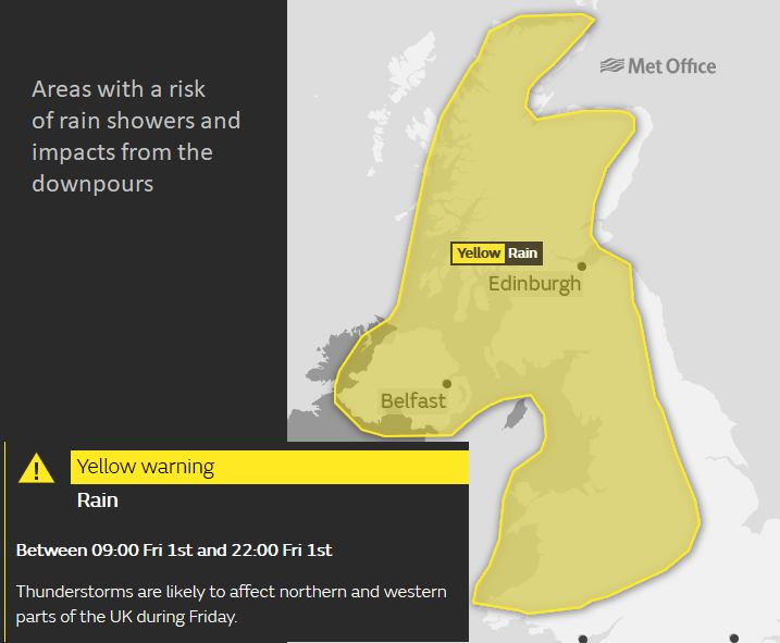
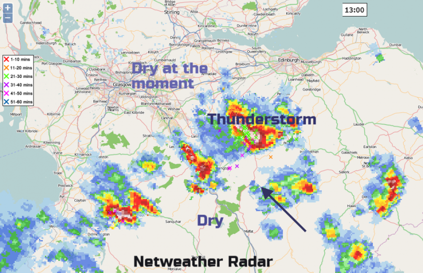
For today (Friday 1st June 2018) Wales, NW England, Northern Ireland and much of Scotland are at risk of downpours from hefty showers and thunderstorms. There could be flash flooding and lightning strikes but as always with showers, there will be gaps in between with fine, bright, even sunny weather and real warmth. If you have an evening event or BBQ will you get a downpour or stay dry, we can't forecast that until nearer the time. Then we use nowcasting, where you watch the radar and see how the storms have developed and are moving. So if a cell has popped up in Kent and is being steered NW on the wind, then it will be heading to London. Depending on its size it will affect maybe just Chelsea or Wimbledon or like the huge cluster earlier this week, nearly everywhere inside the M25.
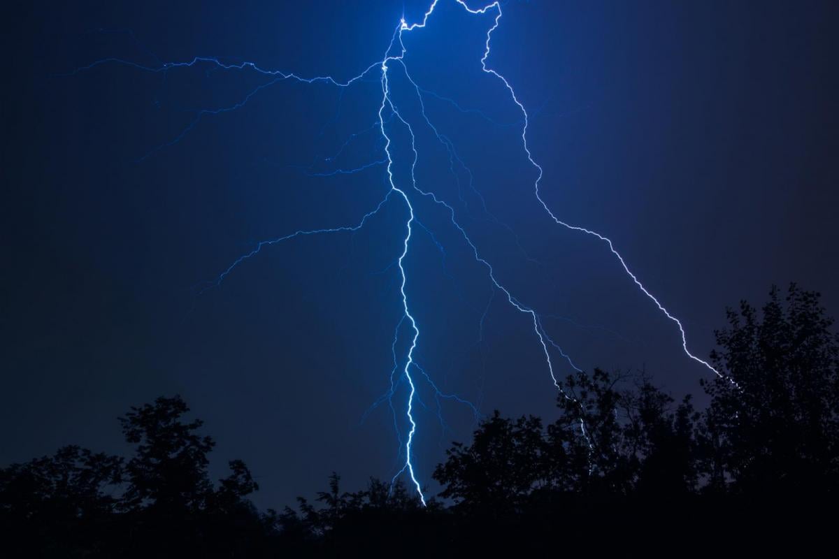
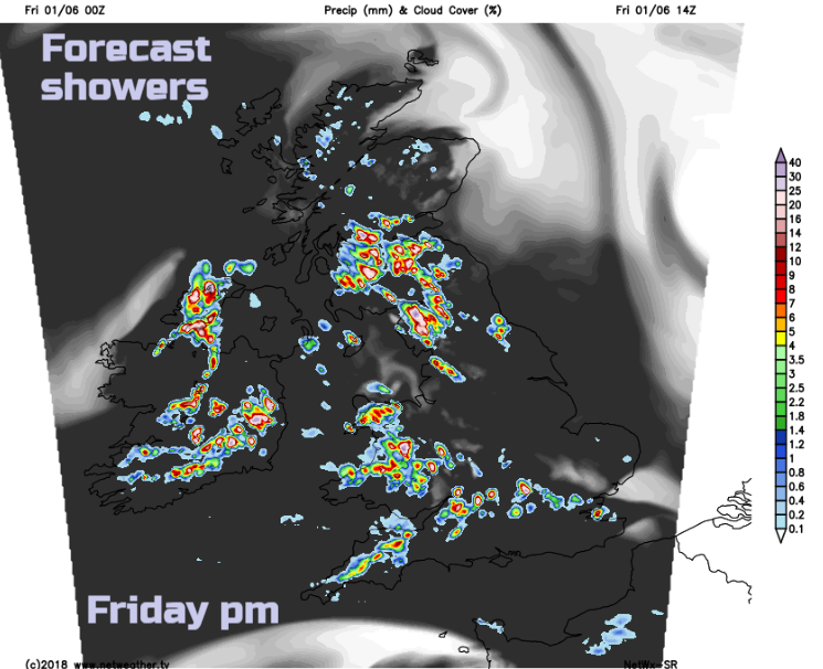
Below is a forecast chart for Friday pm. You can see the scattering of showers, clusters of heavy showers. mostly within the yellow warning area, but not to be taken too literally. They could be in slightly different places, which is why the heavy rain, thunderstorms symbols keep varying on your apps. The potential remains but the actual location on the forecast can vary, with a slightly different breeze or local conditions. If the sunshine gets to work, the air temperature climbs quickly, the air shoots up and we see Cumulus clouds, Cumulonimbus then storms with rain and lightning. There has to be descending air nearby and around the cells there can be areas of fine, dry weather sometimes with a fair amount of cloud though. The warnings still are valid, they are not wrong but they need some understanding, which often doesn't come across in media headlines.
What about the weekend, there have been headlines screeching of torrential rain, awful weather, doom and gloom. Numerous worried people have asked me about events they are attending or running, where they have seen ominous articles, also glanced at the weather warnings and now have the impression that they need waders to venture out of the house.
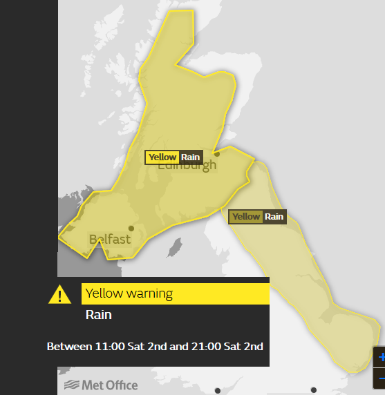
By Saturday, different parts of the UK are at risk, with southern Britain looking more settled, fine and warm. Eastern Britain area will see showers from early morning and the risk continues all day. Later in the morning and for the rest of Saturday there will be thunderstorms and heavy showers for parts of Scotland and Northern Ireland but don't write the day off. They won't be for everyone, there will be some lovely weather in between and if you do get stuck under a line of hefty downpours there is not much you can do about it.
Put the apps away for now, watch the radar and cross your fingers that the rain will be two miles down the road. Remember a warning area is at more risk of impacts from the weather, snow, fog, wind, ice and rain. The current ones are listed as rain by the Met Office, I'm not sure if thunderstorms and lightning are working just yet.
Loading recent activity...