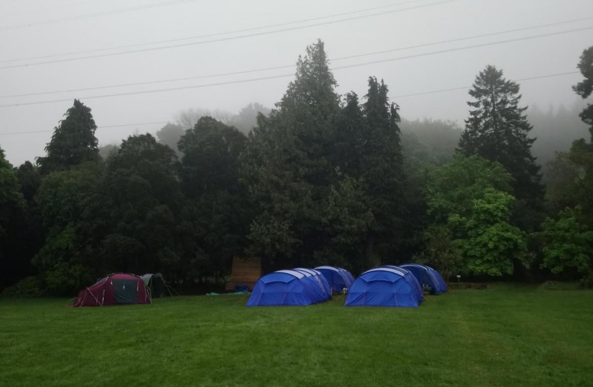
Duke Of Edinburgh award- all levels. Weather forecasts – knowing how, where and when to obtain weather forecasts, relating weather forecasts to observed conditions, looking for signs which will indicate changes in the weather.
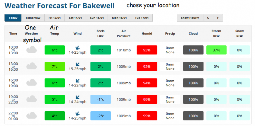
How to obtain - let’s start with weather apps, because most people do go to those first. Weather apps give you raw model data, just a sequence of figures and symbols. No explanation, no confidence or other possibilities, just one forecast answer. Then suddenly it changes, the rain times change the maximum temperature leaps up, any sunshine disappears- you’ve had an update. And if you are sitting next to other people with their different apps, they will all be saying something different, so whose is right?
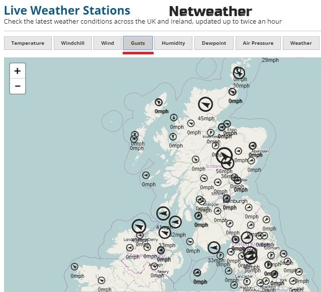
Apps can be good for daily temperatures and usually wind direction. They often fall down on precipitation, so rain, snow, hail or sleet, timings.
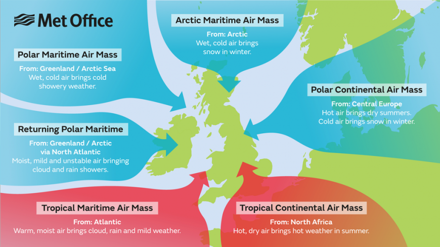
With frontal bands of rain, you may see a sequence of rain, heavy rain, then drier, brighter conditions over a few hours. A front will mark a change in air mass, so the temperatures may change too. Not just the usual daily warming into the afternoon and cooling overnight. If a front stall, or slows down, that can be why a forecast changes. Sometimes the rain won’t reach as far north or east.
Showers
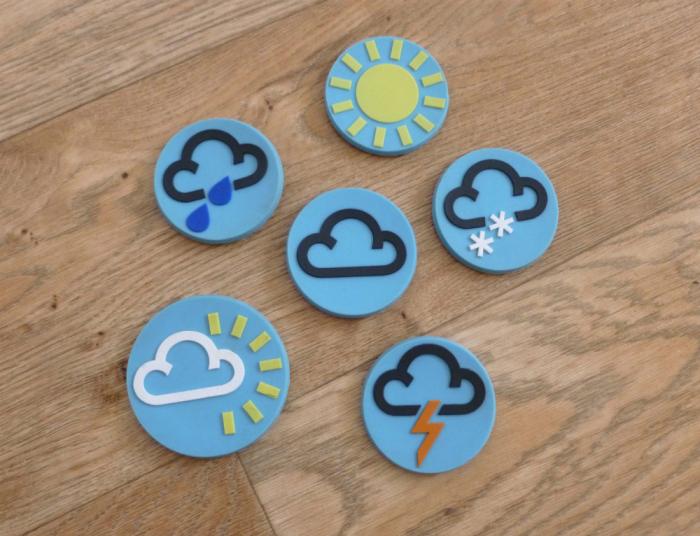
Showers are very tricky to explain on an app. The symbol of dark cloud, sun and rain is supposed to show bright, fine weather interrupted by a downpour. If a day’s forecast is full of shower symbols, that doesn’t mean it will rain all day; it is showing the potential for a shower, or lots of showers over that period. If you see hail or lightning symbols, then you need to note the potential for thunderstorms, heavier showers, strong gusts and more severe weather. However, the shower or storm maybe 1 mile down the trail and not trouble you at all, perhaps you see the dark skies, anvil cloud or downpour in the distance. Or you get utterly soaked, visibility decreases, the wind whips up then 10 minutes later the sun appears.
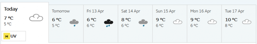
If you are looking at a website display, there may be one symbol per day, often the most significant weather of the 24 hours, with day weighted more than night. Then you can look in more detail at hour by hour or parts of the day.
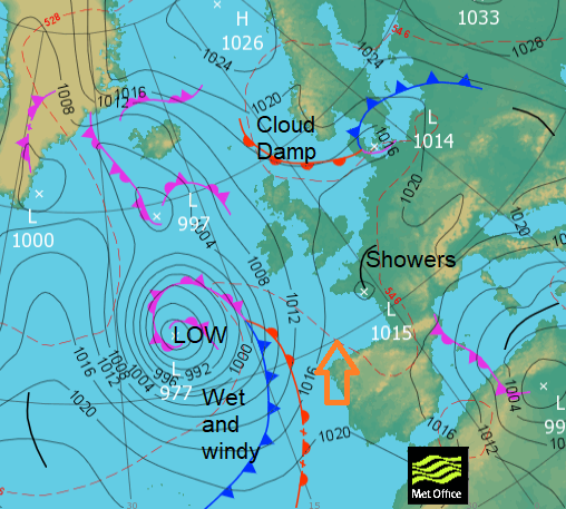
You can look at synoptic pressure charts. If you know what to look for they can give a broad, quick overview of whether it looks wet and windy and unsettled (low pressures) or more settled and dry (high pressure). It’s not quite as simple as that.
Where to obtain
You may have your own forecast source that you are happy with and use anyway. You can get a 5 day ahead forecast here at Netweather for many UK locations or from the Met Office website. The BBC no longer takes the UK Met Office (MO) data or forecasts (a change in Feb 2018) so the BBC weather app is using Meteogroup data now. They do have to broadcast the MO national weather warnings; these appear on television, radio, twitter.
"the UK National Meteorological Service, the Met Office is the official authority in the UK for generating weather forecasts and weather warnings". MO
I would advise you avoid extreme claims on newspaper headlines; there is no - fair with a good deal of cloud and average temperatures weather - in the tabloid world. They do exaggerate. The same can be said for various people/groups on social media.
Flood warnings are issued by the Environment Agency in England and Wales, by SEPA for Scotland and advice is given in Northern Ireland by NI Direct. The Env. Agency does issue a five day ahead guide which links to the Met Office severe rain warnings. The other agencies issue as problems arise.
NHS England issues warnings in times of severe cold or heat and DEFRA give out air quality observations and a MO forecast relating to pollutants and their possible effects on asthmatics and people doing exercise outside. There is also UV and pollen level information.
Television and radio broadcasts. Countryfile forecast on Sundays is a long standing well thought of television broadcast for the week ahead. Farming Today has a lengthy (but early) look at the week ahead Monday at 05:55 on BBC Radio 4
When to obtain
We can’t forecast months ahead. In the UK, you will have to plan for the worst but hope for the best, weather-wise. Occasionally, like with the cold easterly flow of some winters (Beast from the East), there can be strong signals over a week ahead, of severe cold or maybe warmer air heading our way. Usually, stick to 5 days ahead. Within that, you should get a good overview, but still, don’t rely on the fine detail for your exact location. Check the forecast on the day you leave, get the most up-to-date forecast you can.
Early warnings are generally updated in the morning, this can vary from after 9 am for flood guidance, especially Monday morning and Bank holidays seem a bit sluggish. The Met Office has been known to wait until 11 am to update/issue warnings but with an overhaul of their warning system in March 2018 they are now saying they can issue more quickly and be more responsive to changes.
However, more severe warnings, such as amber or Red weather or Flood warnings, can pop up at any time as the weather deteriorates. It would be worth signing up for the alerts for your expedition area, but again don’t rely on that if the mobile coverage is ropey. It is worth having a read of how the warnings are put together and issued, so you are familiar with the process before your actual trip.
Relating forecast to observed conditions
Sometimes the forecast can be a bit out, rain moves further north, thunderstorms sway to the south, forecast snow stays as rain or vice versa. Or cloud/fog doesn't clear and it's grey and cool rather than fine and sunny. Also is the forecast data for sea level? Winds at height will be stronger than surface forecast. Air cools with height as well.
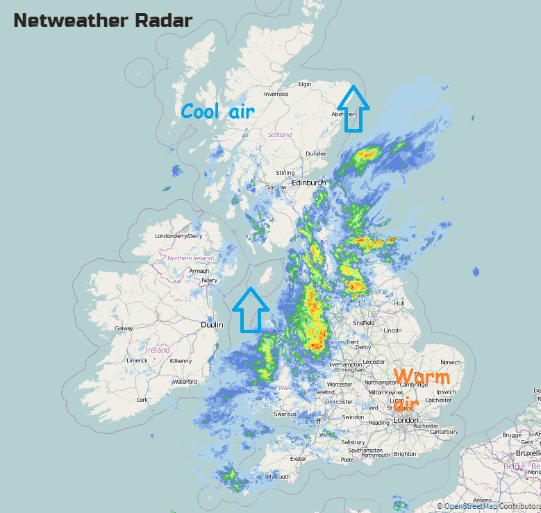
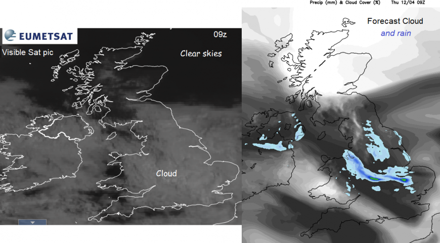
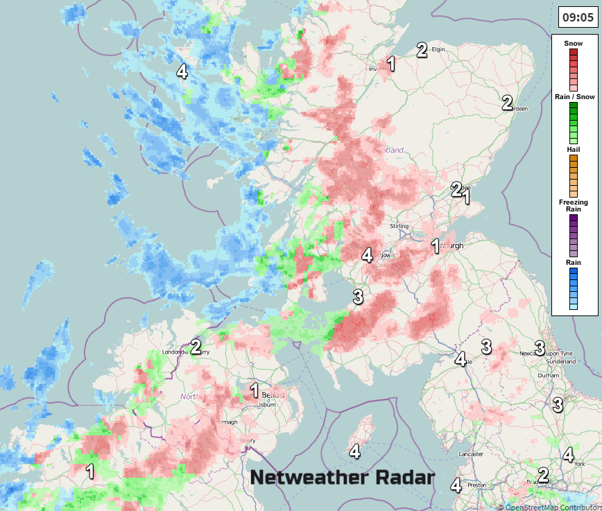
If you have UK map forecast frames for say, the morning you are setting off, you can compare them to real observed data such as Radar/rain and Satellite/clouds. You can see where a frontal rain band actually is. If you have access, there is a UK wide observation network recording hourly data, such as wind, temp, cloud amounts etc. This gives you an overview of how the forecast is going, so far. If the model had rain over Devon by 8am yet on the radar it is barely reaching the Isles of Scilly you could adapt the forecast rain arrival time if you are walking in, say, the Cotswolds this morning,
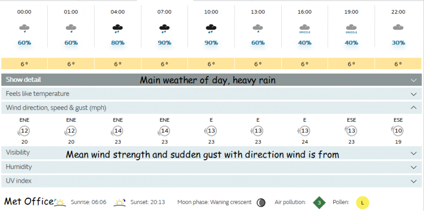
If the forecast mentions gusts up to 35mph, but you can see higher than that in your region, then you know to take care. Funnelling, local topography, the change in altitude all have effects, it may be worth watching the weather for a few days, different situations before you go. For every 100m you climb the temperature will fall by 1° in dry air, in moist air 1° in every 200m. A rule of thumb would suggest that winds at the tops of UK peaks could be two to three times the surface wind strength
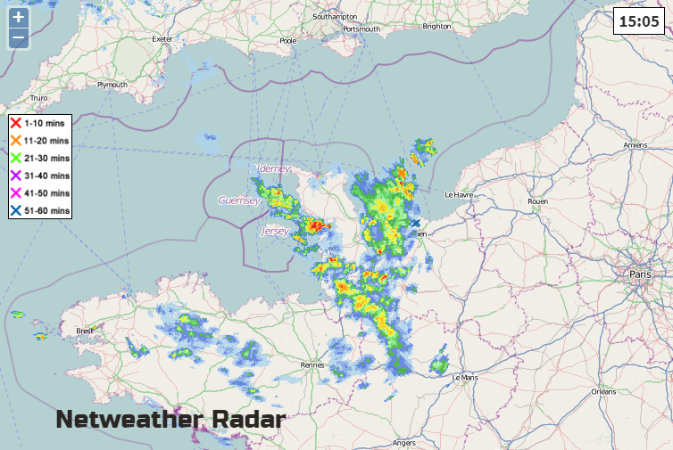
Radar shows precipitation. It does need some interpretation but it is an easy, quick glance way to see where the rain is and which way it is heading. This can show frontal rain bands lumbering across the UK or smaller cells from showers or thunderstorms. You can also turn on lightning strikes, called sferics, marked by a little cross. You can then relate the MO warning areas to areas of heavy rain showers or snow already appearing on the Radar.
And of course, your own observations of the sky around you
Signs that the weather will change
We've all seen the sky darkening in the distance, felt the wind picking up, clouds gathering and maybe a change in the smell of the air, that rain is on its way. Away from I can feel it in my bones or watching animals, sea creatures and insects there are a few more meteorological things to keep an eye on. As a front approaches, high cloud moves in. Blue skies can be invaded by very high thin cirrus and then mid-level clouds before finally the rain arrives. Wispy cirrus with tails show that the winds aloft are changing direction, so the weather is likely to change.
If you have access to a barometer, falling pressure often signals more unsettled conditions are on the way. Steady higher pressure means more of the same.
If you have early fog, it can be very stubborn in winter, in late spring it will soon shift on a morning. Fog needs a breeze to stir it, sun to burn it away, or more cloud to interrupt it.
It is worth having an idea of how certain wind directions affect your local area. If you have been battling a wet and windy expedition start with mild SW winds but the second day you wake up and it's brighter but cooler in a NW wind, you are more likely to see showers come and go. Don’t pack your over trousers or your woolly hat too deep in your rucksack.
There are plenty of weather proverbs. No-one can really decide about the sitting down cows. Mackerel skies show changeable weather is on the way, from the high-level cirrocumulus. Mackerel sky, never long wet, never long dry. It’s the small cells you are looking for, not mid-level altocumulus. Mares' tails and mackerel scales make tall ships take in their sails. The wispy cirrus = mares tails.
For frontal rain, Rain before seven, fine before eleven Is an encouraging one. A frontal band from the west can move across the UK in a few hours, however, there are times when they just stall and setup a conveyor belt of rain which just keeps on feeding in more and more rain, often over Cumbria or other parts of western Britain.
If you are lucky enough to be walking in fine, sunny dry weather that can bring other problems. Michael Fish always says Three fine days then a thunderstorm. If conditions are the same and the previous day has been hot, then the next day will only get hotter, as heat is stored in the earth. Early in the season don't be caught out by sunburn, there are the various pollens throughout the year and just as cold and wet can affect your group, so can sun and heat.
Good luck and remember there is no such thing as bad weather only unsuitable clothing.
Netweather Radar - where is the rain, thunderstorm or snow right now?
Loading recent activity...